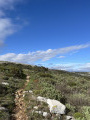
Route du Baou de la Gaude

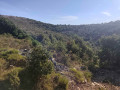
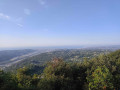
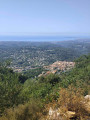
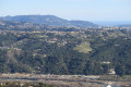
A magnificent route starting from the car park in the village of Saint-Jeannet. Numerous viewpoints overlooking the coastline with sweeping panoramic views.
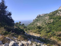
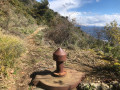
The path is stony, so make sure you wear sturdy shoes that provide good ankle support and take your time to ensure you keep your footing. Be careful not to slip on certain sections.

Details

101337512
Creation:
Last update:
Last review:
  • Walking
    Activity: Walking
  • ↔
    Distance: 4.25 mi
  • ◔
    Average duration: 3h 15 
  • ▲
    Difficulty: Moderate

  • ⚐
    Back to start: Yes
  • ↗
    Ascent: + 1,453 ft
  • ↘
    Descent: - 1,417 ft

  • ▲
    Highest point: 2,753 ft
  • ▼
    Lowest point: 1,352 ft

Photos

Description of the walk

Park in the car park near the Saint-Jeannet Tourist Office.

(S/E) Head due east along the road following the GR®51 and its red and white signposts. Continue to the junction marked by signpost 98.

(1) Leave the road, continue left uphill along the GR®, and reach the junction marked with marker 74.

(2) Leave the GR® here and take the path on the left. Follow a circular loop to the left until you reach a multi-way junction marked by marker 75.

(3) Turn left and, following a virtually level section, reach marker 97.

(4) Continue straight ahead due south, pass the Gros Chêne rest area, and carry on to reach the summit of the Baou de la Gaude.

(5) Retrace your steps along the previous route to return to marker 97.

(4) Turn left, and at marker 96 turn left again to quickly rejoin the GR®51 at marker 95.

(6) Take this path straight ahead, continue the descent and you’ll reach a road at marker 94.

(7) Take this road – it also forms part of the GR® route – and, following the red and white markings, enter Saint-Jeannet, pass the Post Office before reaching the car park near the Saint-Jeannet Tourist Office (S/E).

Waypoints

  1. S/E : mi 0 - alt. 1,352 ft - Car park near the Saint-Jeannet Tourist Office
  2. 1 : mi 0.57 - alt. 1,558 ft - Marker 98
  3. 2 : mi 1.19 - alt. 2,051 ft - Marker 74
  4. 3 : mi 1.89 - alt. 2,687 ft - Marker 75
  5. 4 : mi 2.24 - alt. 2,684 ft - Marker 97
  6. 5 : mi 2.57 - alt. 2,579 ft - Baou de la Gaude - Gros Chêne
  7. 6 : mi 3.38 - alt. 2,060 ft - Marker 95
  8. 7 : mi 3.91 - alt. 1,660 ft - Marker 94
  9. S/E : mi 4.25 - alt. 1,365 ft - Car park near the Saint-Jeannet Tourist Office

Notes

There are no water points along the route; water is only available on arrival in the village of Saint-Jeannet. Dogs must be kept on a lead; you may encounter herds of livestock and other trail runners.

Worth a visit

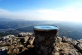
Between (4) and (5): the Gros Chêne and the Baou viewpoint, which offers a superb panoramic view of the coastline.
(5) At the Baou de La Gaude: it’s a small area, so please be careful not to get in each other’s way.

Always be cautious and plan ahead when you're outdoors. Visorando and the author of this route cannot be held responsible for any accidents occurring on this route.

The GR® and PR® markings are the intellectual property of the Fédération Française de Randonnée Pédestre.

Other walks in the area

For more walks, use our search engine .

The GPS track and description are the property of this route's author. Please do not copy them without permission.