Long walk above Vence, from Plan des Noves to the Baous

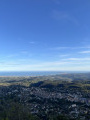
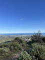
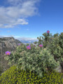
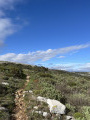
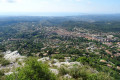
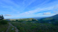
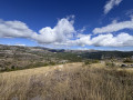
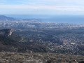
This route allows you to explore a variety of landscapes above Vence, ranging from karstic and stony terrain in the Blaquières to more wooded areas at the Plan des Noves and the Baou des Noirs. It also offers several beautiful views, from the ruins of Le Castellet and the Baou de Saint-Jeannet all the way to the sea, and overlooking Vence from the Baou des Blancs.

Details

66818456
Creation:
Last update:
Last review:
  • Walking
    Activity: Walking
  • ↔
    Distance: 6.76 mi
  • ◔
    Average duration: 4h 25 
  • ▲
    Difficulty: Moderate

  • ⚐
    Back to start: Yes
  • ↗
    Ascent: + 1,463 ft
  • ↘
    Descent: - 1,440 ft

  • ▲
    Highest point: 2,651 ft
  • ▼
    Lowest point: 1,785 ft

Photos

Description of the walk

Park at the side of the M2, near marker 129. 

(S/E) Walk carefully along the roadside until you reach marker 130. 

(1) Take the path on the right towards Mangia Pau. 

(2) When you reach the junction to the right of marker 131, head straight ahead at the pile of stones onto the path that descends steeply towards the Petit Plan des Noves, leaving the marked paths for a short while.

(3) At the Y-junction, turn left to go round the fenced-off meadow, then continue straight on to the next fork. 

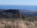
(4) Turn sharply right to follow the path which first crosses the Grand Plan des Noves, then climbs gradually towards Les Blaquières. A stunning landscape unfolds as you climb, with views of the Baou de Saint-Jeannet and as far as the sea. Reachmarker 132. 

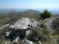
(5) Continue straight on through a more karstic landscape until you reach the summit of Les Blaquières, with its holm oaks and panoramic view.

(6) Follow the path downhill to marker 124.

(7) Turn left towards the Baou des Noirs and its cross, through a landscape that is less arid and more wooded.

(8) At the junction marked by marker 123, leave the path on your left that descends towards Vence via Le Riou and continue towards the summit.

(9) Retrace your steps.

(7) Do not take the path you came down on the way there, but continue straight ahead towards the Baou des Blancs. You will pass marker 125 near a high-voltage power line.

(10) Pass the path on your right that descends towards the M2 road and continue towards the baou until you reach marker 139.

(11) Take the path on your left that climbs towards the Baou des Blancs.Take care if it has rained, as the stones on this section can be slippery. Follow the path, keeping an eye on the signposts and following in the footsteps of hikers who have gone before you: the GPS track can be reassuring. Ignore a path on your right that descends very steeply towards Vence and the M2 road, and carry on to the next junction about a hundred metres further on. 

(12) You’ll see a path branching off to the left; ignore it for now (this is the one to take for the descent from the summit). Continue straight on to the summit, with its cross, bench and orientation table

(13) After admiring the view over Vence, head down a path that branches off to the right and runs slightly beneath the trees, following a large section of sheepfold wall that is still standing, until you reach the junction you passed on the way up.

(12) Head down to the right to follow the route back in the opposite direction to the way out. You’ll come across marker 139.

(11) Continue straight on downhill towards the M2 road and Vence.

(14) At marker 126, ignore a path leading uphill to the right and carry on straight ahead along a wide, fairly stony track until you reach the entrance to a private property: the path continues to the right.

(15) At marker 127, turn right again towards Coste Bérarde; the path climbs slightly once more, running alongside the road until you reach marker 129 (S/E). 

Waypoints

  1. S/E : mi 0 - alt. 1,808 ft - M2, marker 129
  2. 1 : mi 0.26 - alt. 1,909 ft - Marker 130
  3. 2 : mi 0.97 - alt. 2,293 ft - Marker 131
  4. 3 : mi 1.1 - alt. 2,159 ft - Y-junction
  5. 4 : mi 1.37 - alt. 2,139 ft - Junction
  6. 5 : mi 2.38 - alt. 2,516 ft - Marker 132
  7. 6 : mi 2.63 - alt. 2,651 ft - Cime des Blaquières
  8. 7 : mi 3.14 - alt. 2,382 ft - Marker 124
  9. 8 : mi 3.93 - alt. 2,123 ft - Marker 123
  10. 9 : mi 4.07 - alt. 2,188 ft - Baou des Noirs - Baou des Noirs
  11. 10 : mi 5.24 - alt. 2,188 ft - Marker 125
  12. 11 : mi 5.55 - alt. 2,139 ft - Marker 139
  13. 12 : mi 5.72 - alt. 2,133 ft - Path junction
  14. 13 : mi 5.79 - alt. 2,185 ft - Baou des Blancs - Baou des Blancs (673m)
  15. 14 : mi 6.26 - alt. 2,018 ft - Marker 126
  16. 15 : mi 6.52 - alt. 1,818 ft - Marker 127
  17. S/E : mi 6.76 - alt. 1,808 ft - Marker 129

Notes

Hiking boots that provide ankle support are recommended.
There are no water points along the route.

An alternative starting point is available at marker 130: parking spaces are available just before and at the marker itself. 

Reviews and comments

5 / 5
Based on 2 reviews

Reliability of the description
5 / 5
Ease of following the route
5 / 5
Route interest
5 / 5
Pan_bagnat
Pan_bagnat

Overall rating : 5 / 5

Date of your route : Dec 21, 2025
Reliability of the description : ★★★★★ Very good
Ease of following the route : ★★★★★ Very good
Route interest : ★★★★★ Very good
Very busy route : No

Hiking 🥾 is very interesting, especially in autumn. Much of the route is open, and the Noves area offers beautiful scenery with lovely colours at this time of year 🍁 🍂. Be careful ⚠️ if you go after rain, as there are lots of stones and it is very slippery. It doesn't matter what type of soles you have. I loved this balcony on the Côte d'Azur, which is much less crowded than the ever-popular Baou de Saint Jeannet. The trail is perfect. Thank you ☺️

Machine-translated

User 15802986
• Edited:

Overall rating : 5 / 5

Date of your route : Sep 29, 2025
Reliability of the description : ★★★★★ Very good
Ease of following the route : ★★★★★ Very good
Route interest : ★★★★★ Very good
Very busy route : Yes

Very beautiful hike with magnificent views

Machine-translated

Other walks in the area

For more walks, use our search engine .

The GPS track and description are the property of this route's author. Please do not copy them without permission.