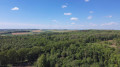
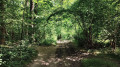
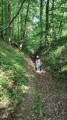
Through the woodland on the hills above Ablin-Saint-Nazaire

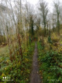
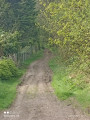
A lovely little walk to enjoy when it’s very hot, as it’s largely shaded but not excessively so. The woodland is magnificent and the place exudes a sense of tranquillity. It’s a little hilly, but again, not excessively so.
However, I wouldn’t recommend doing it during wet weather, as theGR®127can get very muddy.

Details

22056846
Creation:
Last update:
Last review:
  • Walking
    Activity: Walking
  • ↔
    Distance: 3.90 mi
  • ◔
    Average duration: 2h 00 
  • ▲
    Difficulty: Easy

  • ⚐
    Back to start: Yes
  • ↗
    Ascent: + 243 ft
  • ↘
    Descent: - 246 ft

  • ▲
    Highest point: 617 ft
  • ▼
    Lowest point: 331 ft

Photos

Description of the walk

Park at the side of the road near the farms in the Bois de Mont, taking care not to encroach on the road so as not to obstruct farm machinery.

(S/E) With your back to the farms, turn left onto the small path that climbs alongside the plot currently being reforested. Enter the Bois de Mont.

(1) Carry straight on. It might be tempting to turn right, but this is a private track. You’ll come to a crossroads.

(2) Turn left and carry on straight ahead at the next junction to join theGR®127(theGR® route is incorrectly marked on the IGN map).

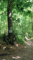
(3) Turn right onto theGR® and continue to a Y-junction overlooked by a magnificent tree with signposts.

(4) Take the path slightly to the right that leads downhill: this is the path directly in front of you. If you turn left, you can still make a short detour to Notre-Dame de Lorette and, why not, pop into the Estaminet de Lorette for a drink.

(5) At the edge of the woods, turn right onto the small path leading downwards. There are two parallel paths; take the narrower one furthest to the right (the other leads to a fence and you’ll have to turn back).

(6) Turn right onto the path that climbs slightly. The one opposite you has been abandoned following the storms of recent years, which have brought down several large trees across it. It’s a shame, as the path, with its ditch dug almost 1.5 metres deep at the side, was very charming. Perhaps it will be restored one day, but that seems unlikely.

(2) Turn left and retrace your steps along the route you took on the way there to return to the car park (S/E).


Waypoints

  1. S/E : mi 0 - alt. 509 ft - Bois de Mont – Roadside verge
  2. 1 : mi 0.37 - alt. 499 ft - Crossroads
  3. 2 : mi 0.74 - alt. 486 ft - Junction of the circular loop
  4. 3 : mi 1.11 - alt. 597 ft - GR°°®°° junction
  5. 4 : mi 1.66 - alt. 591 ft - Y-junction
  6. 5 : mi 2.16 - alt. 331 ft - Edge
  7. 6 : mi 2.74 - alt. 354 ft - Junction
  8. S/E : mi 3.9 - alt. 509 ft - Bois de Mont – Roadside verge

Notes

Best avoided during wet weather
If possible, wear high-top shoes, as some sections may be a bit uneven

Worth a visit

- Estaminet de Lorette.
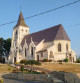
- Notre-Dame de Lorette.
- Claire-Fontaine Ponds (Hersin Coupigny).
- Olhain Park.
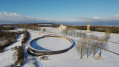
- Louvre Lens (in Lens, of course).

Always be cautious and plan ahead when you're outdoors. Visorando and the author of this route cannot be held responsible for any accidents occurring on this route.

The GR® and PR® markings are the intellectual property of the Fédération Française de Randonnée Pédestre.

Reviews and comments

3.9 / 5
Based on 4 reviews

Reliability of the description
3.8 / 5
Ease of following the route
4.3 / 5
Route interest
3.8 / 5
Denis Bourez
Denis Bourez

Overall rating : 4.7 / 5

Date of your route : Oct 07, 2024
Reliability of the description : ★★★★★ Very good
Ease of following the route : ★★★★☆ Good
Route interest : ★★★★★ Very good
Very busy route : No

A lovely walk in an area I hadn’t been to before

Machine-translated

Azimut71
Azimut71

Overall rating : 3.7 / 5

Date of your route : Sep 15, 2023
Reliability of the description : ★★☆☆☆ Disappointing
Ease of following the route : ★★★★★ Very good
Route interest : ★★★★☆ Good
Very busy route : Yes

It is very difficult to park properly at the designated starting point. However, there is a small car park to the south-east of point 5, near the bus terminus. Of course, in that case you will only be walking the circular route.
At point 5, the recommended narrow path is in very poor condition and overgrown with nettles. It’s better to take the main path, then halfway between points 5 and 6, join the narrow path at the small valley.

Machine-translated

bapfred
bapfred

You're welcome – it's my pleasure. It's true that when you want to head away from the AGGOLs for a walk, some of the starting points can be a bit of a faff to get to.

Machine-translated

Salamand59115
Salamand59115

Overall rating : 4.7 / 5

Date of your route : Jun 20, 2022
Reliability of the description : ★★★★★ Very good
Ease of following the route : ★★★★★ Very good
Route interest : ★★★★☆ Good
Very busy route : No

Once again, we thoroughly enjoyed this walk, which was particularly pleasant last week. There was just one issue, though: be careful with the address of the starting point that we’d entered into our sat-nav. It took us down some rather rough tracks. So we used the ‘Go to Start’ feature in the app, and that worked very well. Thanks again for your suggestions – we really appreciate them!

Machine-translated

bapfred
bapfred

It’s true, the starting point is right in the middle of nowhere. As for the mosquitoes, it obviously depends on the season. But that’s nature for you. The trees fell recently during the last few storms. The original route wasn’t supposed to be this one, but we had to settle for this one (which isn’t too bad, in our opinion) to make do. I hope the paths will be repaired.

Machine-translated

Texas62
Texas62

Overall rating : 2.7 / 5

Date of your route : Jun 18, 2022
Reliability of the description : ★★★☆☆ Average
Ease of following the route : ★★★☆☆ Average
Route interest : ★★☆☆☆ Disappointing
Very busy route : No

It’s not easy to get there by car – 1.5 km of very bumpy road.
There are lots of fallen trees and plenty of sections in direct sunlight; be warned – there are huge numbers of insects and mosquitoes in some places.
Personally, I wouldn’t do it again.

Machine-translated

Other walks in the area

For more walks, use our search engine .

The GPS track and description are the property of this route's author. Please do not copy them without permission.