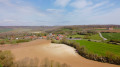
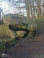
Les têtes d'halaux depuis Servins

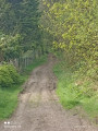
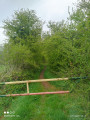
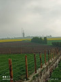
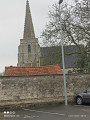
Cette randonnée, dans la plaine de l'Artois, vous verra passer par Bouvignie-Boyeffles, avant de remonter vers Verdrel, pour revenir sur Servins

Details

66910970
Creation:
Last update:
Last review:
  • Walking
    Activity: Walking
  • ↔
    Distance: 8.03 mi
  • ◔
    Average duration: 3h 55 
  • ▲
    Difficulty: Moderate

  • ⚐
    Back to start: Yes
  • ↗
    Ascent: + 269 ft
  • ↘
    Descent: - 292 ft

  • ▲
    Highest point: 627 ft
  • ▼
    Lowest point: 384 ft

Photos

Description of the walk

Start from the car park, Rue de la Mairie.

(S/E) Leave the car park and turn right. Keep to the right again at the junction, walking alongside the cemetery, and take the first street on the left, Chemin du Paradis. At the end, turn left until you reach a side path.

(1) Keep to the right, then turn left towards the aerial masts.

(2) At the junction where the masts meet, take the path leading downhill. At the bottom, keep to the right and cross the D75 with care.

(3) Take the first street on the left, and continue straight on along Chemin de la Claire Fontaine until it ends.

(4) Turn left, pass under a power line, then, at the top, turn right and continue straight on until you reach the D57.

(5) Turn right onto the path running parallel to the road, then cross carefully to take the path on the left, and continue straight on until you reach a Fork in the road.

(6) Turn left onto the D57 and, at the bend, carry on straight ahead until you reach the Fond de Coupigny junction.

(7) Head off to the right and follow the path until you reachthe GR®® de Pays.

(8) Continue to the left, then turn right to follow thePR®® until you reach a road.

(9) Take the hairpin bend onto the first path on the left, then turn left again and, at the end, join the D75, Rue des Quatre Vents.

(10) Turn left onto the street, then, at the end, turn right onto Rue de Villers au Bois, until you reach Chemin Croise on the left.

(11) Follow this path to the end, then turn left onto Rue de la Mairie and head for the car park (S/E).


Waypoints

  1. S/E : mi 0 - alt. 535 ft - Car park, Rue de la Mairie
  2. 1 : mi 0.73 - alt. 568 ft - Junction
  3. 2 : mi 1.3 - alt. 627 ft - Carrefour des Antennes
  4. 3 : mi 1.66 - alt. 469 ft - Junction
  5. 4 : mi 2.44 - alt. 384 ft - Junction
  6. 5 : mi 3.51 - alt. 568 ft - D57
  7. 6 : mi 4.22 - alt. 587 ft - Fork
  8. 7 : mi 4.87 - alt. 551 ft - Fond de Coupigny
  9. 8 : mi 5.41 - alt. 509 ft - GR de Pays
  10. 9 : mi 6.25 - alt. 538 ft - Route
  11. 10 : mi 7.26 - alt. 522 ft - Rue des Quatre Vents
  12. 11 : mi 7.53 - alt. 522 ft - Chemin Croise
  13. S/E : mi 8.03 - alt. 535 ft - Car park on Rue de la Mairie

Notes

Pas de point d'eau

Worth a visit

Always be cautious and plan ahead when you're outdoors. Visorando and the author of this route cannot be held responsible for any accidents occurring on this route.

The GR® and PR® markings are the intellectual property of the Fédération Française de Randonnée Pédestre.

Reviews and comments

4.7 / 5
Based on 1 review

Reliability of the description
5 / 5
Ease of following the route
5 / 5
Route interest
4 / 5
souchez rando
souchez rando

Thank you for your feedback. We’ve tried to offer you as many walks as possible in the Pas-de-Calais and the North.

Machine-translated

Amely's
Amely's

Overall rating : 4.7 / 5

Date of your route : Dec 02, 2024
Reliability of the description : ★★★★★ Very good
Ease of following the route : ★★★★★ Very good
Route interest : ★★★★☆ Good
Very busy route : No

If you fancy a lovely refreshing walk, head straight for this trail – it’s packed with nature

Machine-translated

Other walks in the area

For more walks, use our search engine .

The GPS track and description are the property of this route's author. Please do not copy them without permission.