Country:
 City:


Start from Paifve church.
(S/E) From the church, walk down Rue du Centenaire to its southern end (cross) and take the country lane on the left. This descends gradually to a small railway line, which you cross and follow to the left until you reach a large pasture.
(1) Walk along the pasture to the end and continue straight on between two fields to reach a dirt track at the edge of a wood (cross over the ditch from the edge of the upper field). Take the track to the right, then turn left onto the concrete path.
This track climbs gradually before joining another concrete track (Fond de Couvenaille) on a wide plateau.
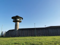
(2) Take this path to the left and follow it to the other end of the plateau (view of the military base on the right and the Paifve water tower slightly to the left).
(3) When you reach the other end of the plateau, at the edge of the valley, head straight down the tarmac road towards the village of Glons. Take the tarmac path on the left before the railway bridge.
At the bottom of the path, turn left onto Rue de la Gare and cross the railway line.
(4) Turn right immediately afterwards onto Rue de la Cour, which runs alongside the railway line.
This path gradually moves away from the railway line and joins another dirt track; take this to the right to pass under the railway line again. Shortly afterwards, it takes a right-angle bend to the right before joining a footpath (cycle path).
(5) Take this path to the left (not the road running parallel to it!). After one kilometre (signs for the village of Sluizen and the province of Limburg), at the junction, turn right towards the village centre, then left.
(6) After about a hundred metres, veer slightly left onto the Kerkedries lane (paved with clinkers), which very quickly turns into a gravel track.
Ignore the footpath that starts straight ahead and continue through the hedgerows until you reach and follow the Geer. The path continues as a street (Tweemolensstraat), which you follow to the end.
(7) At the end of the street, turn left and then immediately right into Neremstraat. This street passes in front of former warehouses that have recently been converted into flats. Continue along Neremstraat to the left, keeping the central reservation and the stream on your right.
(8) Turn left onto Glaaierweg, just before the railway bridge. At the Grotte de la Vierge, carry on straight ahead along the dirt track which climbs slightly. Once at the top, cross the bridge over the railway tracks and continue along the concrete path to the next junction (ignore the first dirt track on the left).
(9) At the junction (meadow with a gate opposite), turn left onto the tree-lined path, which gradually climbs towards the fields. Follow it for about 1.5 km. After passing under the high-voltage power line, walking alongside an orchard and passing the top of the road, you’ll reach a concrete path.
(10) Turn right onto this path, which continues as a stony track; follow it for a further 500 m.
(11) Then turn left onto a grassy dirt track leading towards the water tower. Once you reach the village of Paifve, walk straight through and head for the church (S/E).

 Visorando Member



 Easy