In the Senonch region

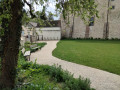
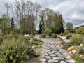
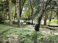
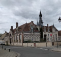
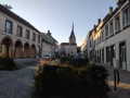
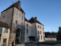
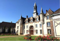
A town of water and greenery, Senonches invites you to explore its winding paths along the forest edge, beside springs, and through narrow streets lined with beautiful ‘grison’ buildings.

Details

22995882
Creation:
Last update:
Last review:
  • Walking
    Activity: Walking
  • ↔
    Distance: 3.16 mi
  • ◔
    Average duration: 1h 30 
  • ▲
    Difficulty: Easy

  • ⚐
    Back to start: Yes
  • ↗
    Ascent: + 66 ft
  • ↘
    Descent: - 66 ft

  • ▲
    Highest point: 732 ft
  • ▼
    Lowest point: 682 ft

Photos

Description of the walk

Park at Rond de Battenberg

(S/E) Rond de Battenberg. With your back to the church, walk left along the shore of Lac Arthur Rémy (picnic area, view of the castle). Pass the Evés wash house and cross the weir. Follow the fitness trail towards the sports hall, cut across Rue de la Tourbière and walk along the second pond on the left.

(1) Cross Avenue de Badouleau and walk along the fence of the stadium opposite.

(2) At the corner, turn left at the edge of the woods and arrive at the Étang de Badouleau and the Huttopia holiday village. Turn left, pass the entrance, and continue straight on along the path under the trees (Source de la Hutte). Cross Route de Pontgouin and take the path opposite. Take the path on the left and Rue du Gibet. Cross Rue de Chartres and follow Rue de l’Étang de l’Isle, the entrance to which is a few metres to the right.

(3) Go through the passage between two houses to reach the grassy path that runs along the embankment of the former Étang de l’Isle (protected wetland). Cross the Passerelle des Esseaux and go down Rue du Vieux Fourneau to the right until you reach the wash house. Retrace your steps and slip through to the right into the grassy passage running alongside the leat. At the roundabout, turn left. At the crossroads, turn right onto Rue des Vallées and follow the Goëtte.

(4) At the fork, go up Rue de la Becquetterie, then down the narrow gravel path on the left. At the bottom, turn right. At the Stop sign, cross the road and head up Rue Flandres-Dunkerque to pass in front of the L’ambiance cinema (listed building).

(5) At the war memorial, turn left towards the town centre. Walk past the town hall. At the post office, turn right onto Rue de la Pyramide (cast-iron statue of Napoleon at the top of the column). Take the start of Avenue de Badouleau on the left, then the footpath on the left which cuts across Rue de la Fontaine du Chemin and leads to Parc du Petit Bossard. Walk around the park.

(6) Where it meets Avenue Poucin, head up towards the church (information plaques), go round it, follow Rue Foucault and cross Rue Michel Cauty. Walk past the two small squares along Rue du Four Banal. At the crossroads, head towards the castle on the right (tourist office). Return to the roundabout and, via Avenue des Evés, head to Rond de Battenberg (S/E).


Waypoints

  1. S/E : mi 0 - alt. 692 ft - Senonches Rond de Battenberg, carrefour Avenue Poucin - Avenue des Evés.
  2. 1 : mi 0.47 - alt. 715 ft - Avenue de Badouleau
  3. 2 : mi 0.68 - alt. 725 ft - Badouleau Pond
  4. 3 : mi 1.29 - alt. 699 ft - Protected wetland. Head towards the stream - Saint-Cyr (cours d'eau) - Affluent de la Blaise
  5. 4 : mi 1.76 - alt. 699 ft - Rue de la Becquetterie
  6. 5 : mi 2.02 - alt. 715 ft - War Memorial
  7. 6 : mi 2.65 - alt. 699 ft - Avenue Poucin
  8. S/E : mi 3.16 - alt. 692 ft - Senonches Rond de Battenberg, carrefour Avenue Poucin - Avenue des Evés.

Notes

Route created in collaboration with the Eure-et-Loir Departmental Hiking Committee.
Follow the yellow markings.

To walk the Orée du Bois Sensory Trail
From the (1), at the corner of the stadium, follow the main path straight ahead, passing behind the Collège la Loge des Bois, until you reach the access path to the route on the left, at the end of Avenue Poucin. Cross Avenue du Général-de-Gaulle and the car park to enter the trail (accessible to people with disabilities, this 600-metre trail offers a better understanding of the woodland environment, linked to the château). Retrace your steps to the corner of the stadium to return, via the right-hand side, to the main route.

Worth a visit

“Senonches” bike hire point

Museum
Senonches Castle - Forest of Stories

Natural site
L'Étang de l'Isle

Reviews and comments

4.8 / 5
Based on 4 reviews

Reliability of the description
5 / 5
Ease of following the route
4.5 / 5
Route interest
4.8 / 5
FARGAS Jean-Claude
FARGAS Jean-Claude
• Edited:

The site of the former Étang de l’Isle is currently being redeveloped. It is best to avoid walking through the area whilst the works are in progress. Temporary signposting has been put in place: When you reach Rue des Laitiers, follow it to the right, then turn left onto Rue Jean Grandon. Cross the bridge, keeping well to the left on the pavement. Turn left onto Rue du Vieux Fourneau. Walk past the wash house, then turn right onto the path alongside the leat, where you will rejoin the PR.

Thank you for your feedback. As I am responsible for maintaining the signposting, could you please specify the reasons why you were unable to follow the route in its entirety? Thank you.

As you emerge from the narrow passage, you’ll reach Rue des Laitiers, which you should follow to the right. Then cross the bridge, turn left again onto Rue du Vieux Fourneau, walk past the wash house to rejoin the route. I’ve placed a few adhesive markers. It’s possible that some may have come loose. Work has now stopped, so you can fairly easily resume the usual route along the embankment. Unfortunately, however, everything has been turned upside down, and the only reason to go that way is to see the remains of the old sluice and the Passerelle des Esseaux, which has recently been restored. We’ll have to be patient; the site is due to be restored, and a discovery trail on pontoons should make it possible to visit it. (See Municipal Bulletin No. 31 on the Town Hall website. (pp. 24–25)

Machine-translated

User 29628749

A lovely route to explore the village and the surrounding countryside! It’s best, however, to use your common sense as you can’t follow the route exactly.
I couldn’t find the signposting to go round the pond, which is currently being developed, but I realised I just had to cross the bridge to rejoin the route.

Machine-translated

FARGAS Jean-Claude
FARGAS Jean-Claude

The site of the former Étang de l’Isle is currently being redeveloped. It is best to avoid walking through the area whilst the works are in progress. Temporary signposting has been put in place: When you reach Rue des Laitiers, follow it to the right, then turn left onto Rue Jean Grandon. Cross the bridge, keeping well to the left on the pavement. Turn left onto Rue du Vieux Fourneau. Walk past the wash house, then turn right onto the path alongside the leat, where you will rejoin the PR trail.

Thank you for your feedback. As I am responsible for maintaining the signposting, could you please specify the reasons why you were unable to follow the route in its entirety? Thank you.

Machine-translated

User 29628749

Overall rating : 4 / 5

Date of your route : Jun 23, 2026
Reliability of the description : ★★★★★ Very good
Ease of following the route : ★★★☆☆ Average
Route interest : ★★★★☆ Good
Very busy route : No

A lovely route to explore the village and the surrounding countryside! It’s best, however, to use your common sense, as you can’t follow the route exactly.

Machine-translated

FARGAS Jean-Claude
FARGAS Jean-Claude

Overall rating : 5 / 5

Date of your route : Apr 10, 2026
Reliability of the description : ★★★★★ Very good
Ease of following the route : ★★★★★ Very good
Route interest : ★★★★★ Very good
Very busy route : No

The site of the former Étang de l'Isle is currently being redeveloped. It is best to avoid crossing it whilst work is in progress. Temporary signage has been put in place: On reaching Rue des Laitiers, follow it to the right, then turn left onto Rue Jean Grandon. Cross the bridge, keeping well to the left on the pavement. Turn left onto Rue du Vieux Fourneau. Walk past the wash house, then turn right onto the path alongside the leat, where you will rejoin the PR.

Machine-translated

FARGAS Jean-Claude
FARGAS Jean-Claude

Overall rating : 5 / 5

Date of your route : Aug 15, 2023
Reliability of the description : ★★★★★ Very good
Ease of following the route : ★★★★★ Very good
Route interest : ★★★★★ Very good
Very busy route : No

A slight change to the route at the end of the walk: at the junction with Rue du Four Banal, turn right onto Place des Halles, then take the narrow lane on the left between the chemist’s and the recently opened and restored market halls, to arrive opposite the castle-museum-tourist office. After visiting this monument, return to the crossroads and turn right onto Avenue des Evés until you reach the Battenberg roundabout.

Machine-translated

FARGAS Jean-Claude
FARGAS Jean-Claude

Overall rating : 5 / 5

Date of your route : Aug 15, 2023
Reliability of the description : ★★★★★ Very good
Ease of following the route : ★★★★★ Very good
Route interest : ★★★★★ Very good
Very busy route : No

Error on the map: between points 1 and 2, go round the stadium: a pleasant walk along the edge of the forest.
At point 2, in season: access to Badouleau Pond via the entrance to the holiday village – refreshment bar – food available 7 days a week – entertainment open to all.

Machine-translated

Other walks in the area

For more walks, use our search engine .

The GPS track and description are the property of this route's author. Please do not copy them without permission.