Country:
 City:


The walk starts at the town hall car park on Rue Paul Vaillant Couturier.
(S/E) Walk through the town hall grounds to Rue Raymond Brau. Turn right and cross the road. Take the Promenade du Ru des Cerceaux path, keeping to the right. Walk past a fenced-off basketball court. This path turns left and leads onto Rue André Carrez; turn right here and follow the road until you reach Avenue du 8 Mai 1945 (D139).
(1) Turn right and continue to the Rond-point de la Solidarité. Go round it on the left, cross the roundabout and take the footpath running alongside the avenue.
(2) Carry on straight ahead, passing alongside a sports ground. At the end of the path, cross Avenue du 8 Mai 1945 at the pedestrian crossing and continue to the left. Pass under a railway bridge and arrive at a roundabout.
(3) Turn right onto Rue Raymond Lefèvre and take the second street on the left, Rue Berlioz, until you reach the Mitry-Mory Regional Forest.
(4) Enter the forest by following the path (further on, on the right, you’ll see an obelisk) until you reach the edge of the woodland.
(5) Take the path on the right which follows the edge of the woodland until you reach an entrance on the right with a gate. Follow this path.
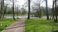
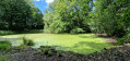
(6) Take the first path on the right, going round the wetland (marsh). Cross the footbridge over the Ru des Cerceaux and turn right to follow the path running alongside this stream on your right until you reach the junction with the main path.
(7) Turn right and continue to the edge of the woods. Ignore the path branching off to the left and carry on straight ahead, passing a water treatment plant and, further on, a sheep and chicken farm on your right. Go under the railway tunnel and carry on straight ahead along Rue du Moulin des Marais.
(8) At the junction, continue along Chemin de l’Abîme. Ignore thefirst street on the right and, at the crossroads, turn right onto Avenue du 8 Mai 1945.
(2) Cross over to join the footpath and head left towards the Rond-point de la Solidarité, then go round it on the right.
(1) Continue straight on for 800 m, passing Rue Gustave Eiffel and Rue de Juilly on your right, go past the town hall on your left and enter the car park (S/E).

 Visorando Member
 Moderate

 Difficult