Circular route between Gressy and Nantouillet

A short walk via Messy and Saint-Mesmes, following the Beuveronne

Details

32579342
Creation:
Last update:
Last review:
  • Walking
    Activity: Walking
  • ↔
    Distance: 10.32 mi
  • ◔
    Average duration: 5h 00 
  • ▲
    Difficulty: Moderate

  • ⚐
    Back to start: Yes
  • ↗
    Ascent: + 305 ft
  • ↘
    Descent: - 279 ft

  • ▲
    Highest point: 381 ft
  • ▼
    Lowest point: 174 ft
  • ⚐ Country: France
  • ⚐ City: Gressy (77410)
  • ⚑
    Start/End: N 48.964403° / E 2.675603°
  • ❏
    IGN map(s): Ref. 2413OT
  • Hour-by-hour weather

Description of the walk

The route starts at the public car park, 19 Rue Saint-Denis in Gressy.

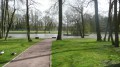
(S/E) At the far end of the car park, take the public passageway between the two school buildings, go through the small gate on this path, reach the park, turn left and cross the bridge over the Beuvronne, then follow the bank of the pond on your right-hand side until you reach the bridge spanning the Beuvronne Canal; turn onto the path on the left

(1) Take the bridge on the left and cross the Beuvronne. At the T-junction, turn left onto Chemin du Bray. Further on, cross the Ru du Gué Poiré. When you reach Rue de Moulignon in Messy, turn left and walk past the entrance to the cemetery.

(2) Turn right onto Chemin du Tour de Ville and cross Rue de Saint-Mesmes. Take the path opposite until you reach Rue des Graviers and follow it to the left until you reach Rue du Gué Brûlé.

(3) Turn left onto Chemin des Cerisiers, which joins Route de Charny; follow it to the right until you reach the path on the left.

(4) Turn left onto this track, then right and left towards Vinantes. Follow the road, and at the multi-way junction, take the Chemin de Saint-Mesmes opposite and continue to a four-way junction.

(5) Turn left towards Nantouillet.

(6) At the Nantouillet cemetery, go straight on along Rue de Meaux, then turn left onto Rue de la Fontaine, until you reach the 16th–17th-century church.

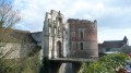
(7) Cross the Grande Rue to visit the Renaissance-style Château de Nantouillet, dating from 1520, and return to Rue de Meaux. Continue left until you reach the cemetery.

(6) Turn right and follow this path, ignoring the path on the left. Cross the Ru Fossé de Richebourg and arrive at Rue de Vineuil.

(8) Turn right and take thefirst street on the right, Ruelle aux Prêtres. At the end, pass the Fossé de Richebourg on your left and, a little further on, turn right onto the Chemin des Buttes.

(9) Continue to the right until you reach Grande Rue.

(10) Cross at the pedestrian crossing, walk past the church and take Rue du Four. Join Rue Royale.

(11) Follow it straight on, continuing along a west-south-west-facing path.

(12) Cross the Beuvronne and walk alongside an active peat bog on your right. When the path turns right, take a path on the left. Further on, follow the edge of the woods on your left and pass a cemetery on your right.

(13) Continue along the Chemin de Cybèle; at the end, turn left onto Rue Saint-Denis, past the 12th-century church and the town hall, then arrive at the Gressy car park (S/E).

Waypoints

  1. S/E : mi 0 - alt. 187 ft - Car park - Château de Gressy
  2. 1 : mi 0.32 - alt. 177 ft - Pont Rouge (Gressy)
  3. 2 : mi 1.47 - alt. 233 ft - Tour de Ville path
  4. 3 : mi 2.03 - alt. 266 ft - Chemin des Cerisiers
  5. 4 : mi 3.14 - alt. 299 ft - Tarmac road towards Vineuil
  6. 5 : mi 4.61 - alt. 381 ft - Junction towards Nantouillet
  7. 6 : mi 5.46 - alt. 249 ft - Cemetery
  8. 7 : mi 5.85 - alt. 249 ft - Église Saint-Denis (Nantouillet)
  9. 8 : mi 7.24 - alt. 259 ft - Rue de Vineuil
  10. 9 : mi 7.83 - alt. 269 ft - Chemin des Buttes
  11. 10 : mi 8.01 - alt. 266 ft - Église Saint-Maxime (Saint-Mesmes)
  12. 11 : mi 8.2 - alt. 292 ft - Rue Royale
  13. 12 : mi 9.22 - alt. 200 ft - Bridge over the - Beuvronne (rivière) - Affluent de la Marne
  14. 13 : mi 9.92 - alt. 210 ft - Cemetery
  15. S/E : mi 10.32 - alt. 187 ft - Gressy car park

Notes

Several villages to pass through, with shops.

Worth a visit

The 12th-century church at Gressy.
Gressy Manor (formerly the Frémont farm).
Gressy Park.
The church and castle at Nantouillet.
The church at Saint-Mesmes.
Condé Mill.

Reviews and comments

4.1 / 5
Based on 3 reviews

Reliability of the description
4 / 5
Ease of following the route
4.7 / 5
Route interest
3.7 / 5
Piou1203
Piou1203

Overall rating : 4.7 / 5

Date of your route : Nov 19, 2024
Reliability of the description : ★★★★★ Very good
Ease of following the route : ★★★★★ Very good
Route interest : ★★★★☆ Good
Very busy route : Yes

Machine-translated

Sèverine Berger
Sèverine Berger

Overall rating : 3.3 / 5

Date of your route : Oct 08, 2023
Reliability of the description : ★★★☆☆ Average
Ease of following the route : ★★★★☆ Good
Route interest : ★★★☆☆ Average
Very busy route : No

Around three-quarters of the route involves walking through beetroot fields, along dusty dirt tracks or tarmac roads, without so much as a patch of shade.
The circular route through the village of Nantouillet (point 7 on the route) is well worth a visit for its castle and church.
It’s worth noting that Roissy Airport’s runways are on the outskirts, with a plane taking off roughly every minute depending on the time of day (or every five minutes). The deafening noise spoils the pleasure of the surrounding countryside’s tranquillity… As the walk took place on a Sunday between 12 noon and 5 pm, there may be fewer planes on weekdays and at other times of day.

Machine-translated

Yannick Barbeau
Yannick Barbeau

Overall rating : 4.3 / 5

Date of your route : Jun 13, 2023
Reliability of the description : ★★★★☆ Good
Ease of following the route : ★★★★★ Very good
Route interest : ★★★★☆ Good
Very busy route : No

The first part of the route is a bit monotonous. Long straight stretches across the fields in the sweltering heat. The second part is much more interesting and varied, particularly Nantouillet and its 16th-century castle, which is half in ruins.

Machine-translated

Other walks in the area

For more walks, use our search engine .

The GPS track and description are the property of this route's author. Please do not copy them without permission.