Country:
 City:


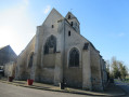
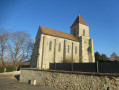
Park in the car park at Saint-Mesmes Town Hall.
(S/E) With your back to the town hall, follow Rue de Charny to the traffic lights. Turn right and head down towards the church.
(1) Turn left onto Rue du Four and immediately right onto the path leading down towards the industrial estate. When you come out onto a road, turn right, then left.
(2) Cross the Beuvronne and, at the crossroads, carry on straight ahead, passing under a high-voltage power line, then over the railway line. Ignore two turn-offs to the left near a mobile phone mast and continue towards Thieux until you reach Rue des Trois Villes (D9).
(3) Turn right, then immediately left onto Chemin du Tour du Parc. This path first turns right then left and continues straight on to reach a junction at a place called La Croix Antoine.
(4) Turn right. Ignore a turn-off to the right and take a short first turn right then left at the next junction. Pass under two high-voltage power lines, ignore a turn-off to the left, then one to the right, and reach the Clos de Saint-Mard housing estate.
(5) Turn right onto Chemin des Peupliers. At the junction, continue straight on along Rue Parmentier. At the next junction, continue straight on along Rue Victor Hugo. Then cross Rue Gambetta and continue straight on along the grassy path uphill past the barrier.
Red and white markings forthe GR®1
(6) Cross Rue Pasteur with care to cross the railway line onto Chemin du Fond du Bois. Ignore a turn-off to the right, then turn right onto the next path. Pass under the high-voltage power line and walk alongside a woodland on your right.
(7) Cross the Ru de la Maquerelle, then walk alongside the woodland on your left before entering it. On emerging, continue walking alongside the woodland on your left until you reach a horse paddock.
No signposting
(8) At this point, leave theGR® by taking the path that branches off to the right towards the south. Ignore two paths branching off to the left. The path passes a wayside cross on your right, then under a high-voltage power line.
(9) Cross the D9 with care and continue straight ahead towards Vinantes.
(10) At the wash house, turn left towards the church. Turn right immediately after the church onto the Grande Rue. Ignore the Rue de Longchamp, which branches off to the left.
(11) Turn left onto the street that runs past the town hall. Carry on straight ahead, ignoring a path on the left. Pass a radio beacon on your right, then the Croix Henriette, hidden in a copse, on your left.
(12) Turn right onto the first path after the cross. At the next junction, turn right heading west. Ignore a path on the right. Pass under the high-voltage power line.
(13) At the next junction, turn left, heading south-west. Ignore a path on the right. Cross the stream.
(14) At the T-junction, turn right, then carry on straight ahead to cross Vineuil. Note the wash house on Ruelle aux Prêtres and continue left along Rue de Richebourg, which leads to Saint-Mesmes town hall and the car park (S/E).

 Visorando Member
 Difficult

 Easy