Country:
 City:
City:


Starts from the Market Square in Villeparisis (Place Jacques Chirac). Parking available nearby.
Accessible via the RER B line, Mitry-Villeparisis station. From there, cross the Canal de l’Ourcq and join the walk from the footbridge over the canal.
(S/E) Head north towards the footbridge spanning the Canal de l’Ourcq in the direction of Mitry-Villeparisis station.
(1) Just before the footbridge, turn right and head for the canal bank. Pass under a road bridge and walk along the canal on your left. Pass under a second road bridge and continue along the canal.
(2) Just before a high-voltage power line, take a path on the right. Then turn right into Rue Jean Monnet, then into Rue Denis Papin, which passes in front of a biscuit factory.
(3) At the end, turn left twice, take a path and walk alongside a large building on your left. You’ll come out onto Avenue du Poitou; follow it to the left. When the road bends to the right, turn left onto the path that joins Rue des Entrepreneurs.
(4) Take the path opposite, which soon turns right. This joins Rue d’Auvergne; follow it as it continues. Carry on along Avenue des Noyers and, when it turns right, turn left onto a path. Walk past Collège Marthe Simard on your right, then Collège Gérard Philippe on your left.
(5) At the roundabout on the corner of the school, turn left onto Rue Jean Monnet. Cross the road carefully (be careful – there is no pedestrian crossing here!) and follow it to the left.
(6) After a few dozen metres, turn right onto the road towards Morfondé. You’ll pass under a series of high-voltage power lines, the A104 (Francilienne) and then more high-voltage power lines. At the entrance to the Domaine de Morfondé, carry on straight ahead, following the N3.
(7) Take the footbridge over the N3. At the other end, turn right onto Allée des Lilas. At the roundabout, carry on straight ahead. At the next junction, turn left onto Allée des Chrysanthèmes. Then cross Chemin de Chelles and continue into the woods via Chemin de Villeparisis. Ignore a turn-off on the left, then turn left with the path.
(8) At the junction just after the bend, turn right and then right again to head up a path along the edge of the woods. Turn left with the path and ignore a turn-off on the left. Pass a ruin on the left and, at the Fork in the road, veer right and uphill. This will take you to the open area of the Dhuys underground aqueduct.
(9) Turn right to follow theGR®14Aalong the open area (red and white markings). Cross the D105 with care, then pass under a high-voltage power line.
(10) Turn left and continue along the GR®. Pass under the A104 again. As you emerge from this section, first turn right then left. Walk for a long stretch along the embankment of the aqueduct and stay on the GR®.
(11) Cross the D84 with care and continue straight ahead on the embankment, following the GR®°.
(12) At a barrier, take the path leading down to the left (let the GR®°°° continue straight ahead). Ignore a path branching off to the left, then walk through the middle of the horse pastures. Pass under a high-voltage power line and, further on, turn right. At the next junction (elevation 78), carry on straight ahead along a signposted path. Walk past the vineyards of Clos de Bréon, ignore a path branching off to the left and continue straight on until you reach the road.
(13) Head downhill to the left and walk past Coubron cemetery. At the roundabout, follow Rue Roger Salengro straight ahead. At the end, take thesecond right onto Rue Jean Jaurès.
(14) At the top of the street, turn left into the car park and turn left towards the Acrobranche. Pass on the left and follow the path downhill. In the woods, walk alongside a fence.
(15) Turn right immediately after this fence and continue along this path downhill. Pass a small pond on your right. At the corner of the pond, turn right. Then go round a larger pond on the left, veer right, walk alongside athird pond and reach the Fontaine de Frère Jean.
(16) Then turn left. Cross the Allée des Princes and carry on straight ahead until you reach the wall covered in graffiti near a pond.
(17) Turn slightly to the right and walk alongside the pond on your right-hand side. Join the embankment of the Dhuys Aqueduct and follow it to the right. Stay on the embankment and ignore all side paths until you reach the edge of the park.
(18) Cross the D136 with care and continue straight ahead on the aqueduct embankment, following theGRP® Ceinture Verte d’Île-de-France (red and yellow markings). Pass under a high-voltage power line and continue along the GRP®.
(19) You’ll come to a road; follow it to the left. At the roundabout, head straight ahead.
(20) Just before the Résidence du Renard, take a small street on the left, then immediately a path on the left, keeping the buildings on your right. Head down into a woodland and then walk alongside the Vaujours cemetery. Turn right onto Rue de Livry, which passes under the church.
(21) Then turn left into Rue de l’Église. At the bottom, turn left into Rue Alexandre Boucher, which passes in front of the town hall. Cross over the N3 and reach a junction with Rue de Meaux (post office).
(22) Turn left and walk past the Collège Henri IV. Turn right into Rue Eugène Burlot. Enter the Parc Forestier de Sevran. At the toilets, turn right into the main path.
(23) Turn left into the first path. You’ll come to a tarmac path (EV3); follow it to the right (take care – cycle path).
(24) Turn left and follow the path through the park gates. Head down towards the Canal de l’Ourcq.
(25) Turn right and go under the road bridge. Follow a track and walk alongside the canal on your left. Go under several bridges or footbridges. After about 2.5 km, veer right to head uphill towards a bridge.
(1) Turn right to return to the starting point (S/E).
To return to Villeparisis-Mitry-le-Neuf RER station, turn left and cross the bridge.

 . I couldn’t find the access to the path at point 20, so I took a detour along the road to point 21.
 Visorando Member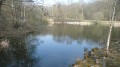
 Moderate
 Easy
Easy