Country:

 City:


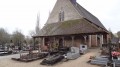
Park in the car park near the church in Neung-sur-Beuvron.
(S/E) Turn right onto the main road, Rue Henry de Geoffre (D925), heading north-west. Cross the Tharonne. At the junction, continue along Rue des Colonels Marais, then turn right at the Fork in the road onto Rue du 8 Mai 1945, heading towards La Marolle-en-Sologne.
(1) Just past the police station, leave the tarmac and take a track on the left signposted “CR de Beaumont No. 3 – 2540 m”, the entrance to which is partially blocked by a huge clay pot. At the crossroads, stay on the Beaumont track, which is again signposted “CR de Beaumont No. 3”. The tarmac section quickly gives way to a wide track
(2) Turn left at the crossroads onto the Chemin de Mon Idée, signposted “CR de Mon Idée No. 6”, which is tarmac.
(3) At the junction, leave the tarmac and take the track on the left signposted “CR des Meuniers No. 1”. Ignore the private track towards “Mon Idée” and the one leading to the Beauregard farm, and continue straight ahead along the gravel track.
(4) At the junction with the Chemin de Maison Neuve on your left, stay on the Chemin des Meuniers for a round trip that will bring you back to this junction. Turn right at the junction with the Allée Royale, which runs across. Stay on the Allée Royale, ignoring the side turnings, until you reach a crossroads.
(5) Continue along the main path, keeping to the right towards the Étang de Beaumont. As you approach the Étang du Ragot, the tarmac gives way to a wide path.
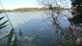
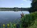
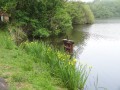
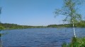
(6) At the three-way junction, shortly after Étang du Ragot, continue northwards along the path signposted ‘Étang de Beaumont’ and marked with the ‘La Sologne à vélo’ pictogram. Various paths leading off to the right towards the lake are closed off to protect the natural environment. However, you can still access it via a footbridge leading to a viewing point. To get there, head right onto the wide path just after the Point du Jour.
(7) Turn back. Once back on the footpath, turn left to retrace your steps at the three-way junction.
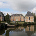
(6) To reach Château Villemorant via the forest tracks, turn right onto the hard-surfaced track signposted ‘Allée Royale No. 2’. At the junction, turn left onto the hard-surfaced track leading to the château after passing through the gate marked ‘Emergency Entrance’, which is open from 8.00 am to 5.30 pm.
(8) At Château Villemorant, retrace your steps until you reach the three-way junction near the Étang du Ragot. Château Villemorant is 1 km from this junction.
(6) On the way back, turn right onto the lane you took on the way there. It runs alongside the Étang du Ragot at first, before leading to a crossroads.
(5) Stay on the tarmac road, veering slightly to the left, until you reach a crossroads. Turn left onto the path signposted “CR des Meuniers No. 1”.
(4) At the crossroads, turn right onto the path signposted “CR de Maison Neuve No. 5 1300 m”. This straight path joins a small road which leads onto a side street, the Chemin du Plessis.
(9) Turn right onto this path signposted “la Sologne à vélo”. This leads onto Rue des Colonels Marais, which you took on the way out. Turn left onto it to return to the church at Neung-sur-Beuvron, the starting point of the walk (S/E).


 Visorando Member
 Difficult

 Easy