Country:

 City:
City:


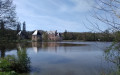
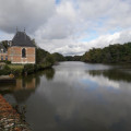
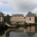
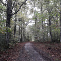
Start from the car park at the church in La Marolle-en-Sologne
(S/E) With your back to the church, turn right onto the main street and, after 150m, keep right at the Fork in the road onto Rue des Chenelles. Follow this narrow street until it gives way to a gravelled track at a junction.
(1) At the junction, do not continue along the gravel track straight ahead but turn right. Ignoring the side tracks, the new gravel track eventually crosses the D104.
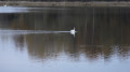
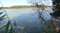
(2) Opposite, leave the gravel track by keeping to the left at the Fork in the road and take a grassy track instead. This crosses a large wooded area, running alongside a pond before reaching the Château de la Noue.
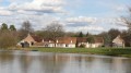
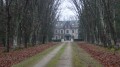
(3) At La Noue, the grassy path is followed by a stabilised track. Pass the turn-offs to the right and then to the left so that you walk alongside the château on your right-hand side.
(4) Just after Le Tertre, at the junction, take the most clearly marked track furthest to the left until you cross a stabilised track running across.
Yellow-red markings (SologneGRP® )
(5) Turn right at the junction onto the stabilised track. Pass La Brosse and then La Coulardière.
No signposting
(6) At La Garenne, turn right onto the narrow street heading towards Château de Villebourgeon.
(7) Once past the château, turn right at the Fork in the road towards La Marolle-en-Sologne. After 125m, leave the tarmac and take the grassy track on the right, then turn immediately left at the ‘Bienvenue en Sologne’ sign.
(8) The grassy track is followed by a compacted track. Ignore the turn-off to the left and stay on the busier track. Keep to the left at the Fork in the road at the entrance to the woods (the junction does not appear on the IGN map). After Bordebure, at La Meule, ignore the private track leading to the hamlet and continue along a grassy path.
(9) Turn left at the sign for La Bergerie (ignore the private track leading to La Bergerie, which is not shown on the IGN map) and stay on the busiest track until you reach a Fork in the road.
(10) At the fork in the road, take the well-marked grassy track on the left. Turn right at the junction with a grassy cross-track, then immediately left, until you reach a fork.
Yellow-red markings (GRP® de Sologne)
(11) Turn right at the Fork in the road, then keep to the busiest path. This crosses a hard-surfaced track. At Le Chavant, turn right onto a hard-surfaced track.
(12) After a few dozen metres, turn left at the Fork in the road. The busiest track eventually joins the road to Yvoy-le-Marron, which you take to the left. After 150 metres, turn right onto a compacted track that runs alongside a pond.
(13) As soon as you’ve passed Le Plessis, keep left at the Fork in the road onto a grassy track. At La Bouteillerie, this track eventually crosses the compacted track you took on the way there, onto which you’ll head left.
No signposting
(1) Turn left at the crossroads onto the small road which joins the main street, Rue de Beaugency, before reaching the church, the starting point of the walk (S/E).



 Visorando Member

 Easy
Easy 
 Difficult