Country:

 City:
City:


Start from the car park at the church or the town hall in Montrieux-en-Sologne.
(S/E) From the church, turn left onto the D104 or Rue Lancelot du Lac.
(1) As you leave the village, turn left onto the Route des Moulins, signposted ‘Sologne à vélo’. Pass the gravel track leading to La Motte on your right.
(2) At the next three-way junction, leave the tarmac and take the right-hand track. The gravel track leads to the hamlet of Morêt. Follow it until you reach a Fork in the road, where you should keep left.
(3) Leave the gravel track when it bends sharply to the right towards La Maison Neuve, taking the forest track about a hundred metres before the farm. Ignore the side tracks and stay on the best-defined track until you reach a junction with a gravel track.
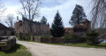
(4) Turn right onto the gravel track. This gives way to a forest track, the CR32, which leads to the Château du Mesnil, followed by another gravel track.
(5) Turn left onto a forest track, the VC11, 300 metres after Château du Mesnil. Ignore any side tracks until you reach a bend in a compacted track.
(6) Turn left onto the gravel track, the CR28. After 150 metres, leave the gravel track as it heads towards La Belle Fontaine, continuing along the forest track at the edge of the woodland (with the woodland on your left).
(7) Keep to the left at the junction, still following the edge of the woodland. The track soon leads into the woodland until it crosses a transverse track, onto which you turn right. Pass the Étang du Verger, cross a narrow road and continue straight ahead along the stabilised track, the VC14.
(8) Turn right at the crossroads. The grassy track leads to the hamlet of Robinson. Continue along the hard-surfaced track until you reach a junction.
(9) Turn left at the hairpin bend at the junction and stay on the gravel track until you reach another junction, just past an aerial.
(10) Continue along the narrow road, leaving the gravel track on your left. Turn right at the junction with the D22 (Les Ouches). Leave the gravel track on your left, signposted ‘Hameaux des Ouches’.
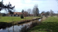
(11) Turn onto the next track, 80 metres after the hamlet of ‘Les Fourneaux’. Turn left at the junction with a narrow road. Ignore the side tracks. Just after Le Pavillon, the path passes through a ground-level gate designed to prevent animals from crossing, then runs alongside the Étang Viez before leading onto a cross-path, opposite Courbanton Castle, which is hidden by a hedge.
(12) Turn left onto the hard-surfaced track. The château comes into view shortly after you have passed the hedge. The hard-surfaced track gives way to a forest track at a place called La Sarmonnière, passes through another ground-level gate, and is followed by another hard-surfaced track. This track leads to Les Robardières, bending sharply, and then crosses the D22.
(13) Turn right onto the D22, then keep left at the Fork in the road after 350 metres.
(14) Turn left at the crossroads to rejoin Rue Lancelot du Lac, then head towards Montrieux Church (S/E)



 Visorando Member
 Easy
Easy 

 Moderate