Circular walk starting from Gergueil

Discover a little-known natural wonder from Gergueil: the Roche Chèvre cave.

Details

61052453
Creation:
Last update:
Last review:
  • Walking
    Activity: Walking
  • ↔
    Distance: 8.43 mi
  • ◔
    Average duration: 4h 30 
  • ▲
    Difficulty: Moderate

  • ⚐
    Back to start: Yes
  • ↗
    Ascent: + 741 ft
  • ↘
    Descent: - 741 ft

  • ▲
    Highest point: 1,936 ft
  • ▼
    Lowest point: 1,368 ft
  • ⚐ Country: France
  • ⚐ City: Gergueil (21410)
  • ⚑
    Start/End: N 47.238613° / E 4.819916°
  • ❏
    IGN map(s): Ref. 3023OT
  • Hour-by-hour weather

Description of the walk

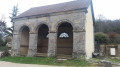
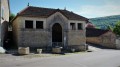
Head to Gergueil, a small village perched in the Hautes Côtes. There is parking for a few cars around the washhouse and the village hall, or otherwise in the village streets.

(S/E) From the large washhouse in Gergueil, a little below the village, head up towards the church along Rue de la Fontaine. Pass a few water collection points on the rocks to your left. Opposite the church, turn left into Rue Haute. At the next Y-junction, turn right onto a wide path.

(1) Keep to the left, staying on the same path. You’ll reach the edge of the woodland.

(2) Enter the woodland and continue along this wide path. Cross the Combe aux Grives, then reach a multi-way junction in the Combe des Larreys de Grand Mont.

(3) Take the dirt track on the left to climb up through the forest. Follow it all the way up the valley, occasionally passing through sections of scree or rocky ground above the valley. Look out for the numerous stone markers that line this section. Reach a viewpoint above the Grande Combe.

(4) Continue gently uphill to reach the junction with a grassy path.

(5) Take this path to the left: it is lined on the left by conifers and on the right by deciduous trees. Climb, without any real difficulty, until you reach the main track: the Croix Bielle forest road. Follow it to the left for about 150 m, then turn right to reach the Grotte de Roche Chèvre.

(6) After visiting the cave, return to the forest track and follow it to the right. Continue along a long, completely straight stretch until you reach a multi-way junction at a place called La Croix Bielle.

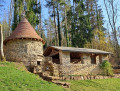
(7) Turn right, passing the old Grand Taïaut hunting lodge, of which only an abandoned-looking hut remains. Cross the D104 with care, continue straight ahead and, a few steps further on, you’ll come to a crossroads.

(8) Then turn left onto this wide dirt track running through the valley floor. You’ll reach a wide cart track.

(9) Leave this to your right and continue straight ahead downhill; you’ll cross a wide track coming from the right – ignore it and carry on straight on. Continue downhill until you reach a crossroads at the lowest point, directly beneath the power lines.

(10) Turn left to head back up into the Combe aux Renards: the path is marked in white here. At a junction, stay on the correct path on the left: please note, the paths have been altered since the IGN map was published. At the top, you’ll come to a wide white path; follow it to the right to return to Gergueil and reach the car park by the wash house (S/E).


Waypoints

  1. S/E : mi 0 - alt. 1,644 ft - Car park at the large Gergueil washhouse
  2. 1 : mi 0.4 - alt. 1,634 ft - Junction with a cart track on the right
  3. 2 : mi 1.06 - alt. 1,558 ft - Edge of the woodland
  4. 3 : mi 1.79 - alt. 1,476 ft - Combe des Larreys de Grand Mont
  5. 4 : mi 2.58 - alt. 1,719 ft - Viewpoint over the Grand Combe
  6. 5 : mi 3.5 - alt. 1,847 ft - Grassy path
  7. 6 : mi 3.84 - alt. 1,936 ft - Roche Chèvre Cave
  8. 7 : mi 5.1 - alt. 1,860 ft - Croix Bielle
  9. 8 : mi 5.51 - alt. 1,690 ft - Crossroads after the D104
  10. 9 : mi 6.14 - alt. 1,637 ft - Sommière crossroads
  11. 10 : mi 7.61 - alt. 1,368 ft - Bottom of the Combe aux Renards
  12. S/E : mi 8.43 - alt. 1,644 ft - Car park at the large Gergueil washhouse

Notes

(S/E) Plenty of drinking water is available at the Gergueil washhouse, where you can have a picnic on the table provided.
(6) You can take shelter at La Roche Chèvre; be careful, though, as it is very cool inside the cave.
A pleasant route to follow in summer, as you walk mostly in the shade of the trees.

Worth a visit

At (4), there is a beautiful section overhanging the valley; take care in wet weather.

Between (3) and (5), you’ll pass numerous stone markers; these mark the path above the valley.

(6) A very beautiful and vast cavern at the Grotte de Roche Chèvre; the entrance forms a ledge in the rock, behind which lie several chambers, which are quite spacious and easily accessible. Don’t forget to bring a torch to better admire this site.

Between (7) and (8) The ‘Relais du Grand Taïaut’ shown on the map is a hunting lodge in the woods to the left of the large ridge. It is in a poor state of repair.

Reviews and comments

4.6 / 5
Based on 3 reviews

Reliability of the description
5 / 5
Ease of following the route
5 / 5
Route interest
3.7 / 5
MichelRando21
MichelRando21

Hello,
Thank you for hiking this route. It's true that it's very peaceful and you don't come across many people!
I chose forest roads because it's easy to get lost in these large woods without any landmarks...

Machine-translated

User 21463276

Overall rating : 4.3 / 5

Date of your route : Mar 09, 2026
Reliability of the description : ★★★★★ Very good
Ease of following the route : ★★★★★ Very good
Route interest : ★★★☆☆ Average
Very busy route : No

Hiking without meeting anyone.
For my taste, too many roads or forest tracks.
Lack of more untamed nature.

Machine-translated

Chabanis
Chabanis

Overall rating : 4.7 / 5

Date of your route : Aug 19, 2025
Reliability of the description : ★★★★★ Very good
Ease of following the route : ★★★★★ Very good
Route interest : ★★★★☆ Good
Very busy route : No

This hike could be great, if it weren't for the very unpleasant section between 3 and 4. The single track, which is over a kilometre long, is littered with brambles (wear thick trousers, which we didn't have).
Because of this really awful section, we won't be doing it again. It's a shame because the rest of the hike is quite nice, all through the forest. Unless the author can find another route to avoid this section through the brambles..

Machine-translated

pascal21850
pascal21850
• Edited:

Overall rating : 4.7 / 5

Date of your route : Feb 24, 2025
Reliability of the description : ★★★★★ Very good
Ease of following the route : ★★★★★ Very good
Route interest : ★★★★☆ Good
Very busy route : No

A lovely walk through the woods in the Burgundian hinterland. It’s peaceful and doesn’t take you through any built-up areas. Not too difficult, apart from the final climb before reaching the Gergueil washhouse, after 13 km! The path is well-marked and there’s no risk of getting lost. The estimated time is quite generous: it took us 3 hours 30 minutes out of the 4 hours, and we’re not exactly fitness enthusiasts!

Machine-translated

Other walks in the area

For more walks, use our search engine .

The GPS track and description are the property of this route's author. Please do not copy them without permission.