Following the River Fischbach from Gries

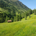
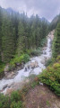
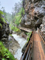
A pleasant stroll along the River Fischbach, offering views over the Otzlater Ache valley at the Brand crossing. Continue on to cross the superb Himalayan footbridge spanning the valley before reaching Burgstein.

Details

n°650075
Creation:
Last update:
Last review:
  • Walking
    Activity: Walking
  • ↔
    Distance: 7.08 mi
  • ◔
    Average duration: 4h 50 
  • ▲
    Difficulty: Moderate

  • ⚐
    Back to start: Yes
  • ↗
    Ascent: + 1,824 ft
  • ↘
    Descent: - 1,854 ft

  • ▲
    Highest point: 5,190 ft
  • ▼
    Lowest point: 4,462 ft

Description of the walk

Park in the car park on the left, near Gries Church.

(S/E) Head south-east along Grieser Straße, turn right off it at Haus Claudia, and continue to the footbridge over the River Fischbach.

(1) Cross the river and turn right onto the wide path on the left bank. Continue until you reach a junction with another footbridge on the right.

(2) Continue along the wide track, still on the left bank. Stay on this track, following the yellow signs for Langenfeld. You’ll reach a crossroads.

(3) Turn left onto the wooden steps towards Brand. Begin a short climb, followed by an easy descent. You’ll reach the village of Brand via a new track.

(4) Leave the track on your left and turn right down the marked path (signposted ‘Brand’). Continue down a short descent followed by another climb, which ends at the Himalayan footbridge.

(5) Cross the valley via this remarkable footbridge to reach, further on, a picnic area above the village of Burgstein.

(6) Head downhill to the village of Burgstein for a quick visit to the chapel.

(7) Follow the route you took on the way there to return to the junction by the second footbridge.

(2) Turn left, cross the river and you’ll easily find your way back to the car park where you started (S/E).

Waypoints

  1. S/E : mi 0 - alt. 5,154 ft - Car park at Gries church
  2. 1 : mi 0.17 - alt. 5,167 ft - First footbridge
  3. 2 : mi 0.42 - alt. 5,135 ft - Second footbridge
  4. 3 : mi 2.34 - alt. 4,619 ft - Brand crossroads
  5. 4 : mi 2.84 - alt. 4,511 ft - Burgstein crossroads
  6. 5 : mi 3.16 - alt. 4,662 ft - Himalayan footbridge
  7. 6 : mi 3.34 - alt. 4,770 ft - Picnic area
  8. 7 : mi 3.69 - alt. 4,685 ft - Burgstein
  9. S/E : mi 7.08 - alt. 5,154 ft - Car park at Gries church

Notes

There are no water points along this route.
Between (2) and (3) A wooden hut is accessible at the side of the path.
There are benches along the entire route.

Worth a visit

(5) A superb 82-metre-long Himalayan-style footbridge spanning a very wild valley.
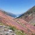
Stunning views of the Otzlater Ache glacial valley.

Reviews and comments

3.5 / 5
Based on 2 reviews

Reliability of the description
4 / 5
Ease of following the route
3.5 / 5
Route interest
3 / 5
Cancale
Cancale

Overall rating : 2.7 / 5

Date of your route : Jul 06, 2026
Reliability of the description : ★★★☆☆ Average
Ease of following the route : ★★☆☆☆ Disappointing
Route interest : ★★★☆☆ Average
Very busy route : No

This walk is currently closed: setting off from Gries, you come across a sign marked ‘forest track’. Nothing to worry about at first glance, but after an hour you come across a scree slope caused by a landslide from the top of the mountain…
It’s quite difficult to get across, and then you come across two more of the same sort.

Just as you’re about to leave this track to turn left, you come across the same barrier as in Gries, bearing the notice: ‘Track closed, no entry!’

Machine-translated

LeLorrain
LeLorrain

Overall rating : 4.3 / 5

Date of your route : Jul 31, 2024
Reliability of the description : ★★★★★ Very good
Ease of following the route : ★★★★★ Very good
Route interest : ★★★☆☆ Average
Very busy route : No

The scenery is pretty (river nearby, views over two valleys) but most of the walk is on a wide, uninteresting track. The paths become really pleasant from points 3 to 7.
The hike would probably benefit from being done in the other direction to get the climb at the start.
To sum up, it's pretty but there are better things to do in the region...

Machine-translated

Other walks in the area

For more walks, use our search engine .

The GPS track and description are the property of this route's author. Please do not copy them without permission.