Country:
 City:
City:


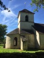
The starting point is on the church square in Mavilly.
(S/E) With your back to the church, turn left onto the Route de Meloisey. Continue until you reach a junction with a path on the left.
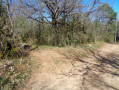
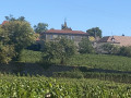
(1) Take this path running between two fields. On your left, enjoy the view of the village of Mavilly. At the next junction, turn left.
(2) At the junction with theGR®7, ignore the markings and continue straight on along the path into the woodland.
(3) Carry on straight ahead and follow the botanical trail which descends along the Montagne de Défens to Nantoux (yellow markings). At the bend, head to the right. At the end of the wooded strip, turn left to rejoin the path on the right. Continue the descent towards Nantoux.
(4) Turn right onto Rue de la Mairie. Turn left onto Rue Léonard. At the end of this street, turn right, then right again onto Rue de la Gare until you reach Grande Rue. On leaving the village of Nantoux, the road splits into a Y-junction.
Carry on along the path on the left. Follow the track, enjoy the view over Nantoux, and take the first left to continue straight on until you reach a cross-road.
(5) Turn left onto a side track.
(6) Turn right and follow the path until you come out onto a road where there is a cross.
(7) Leave the cross on your left and carry on straight ahead. At the next junction, the road splits again into a Y-shape; take the path on the left. Pass the two turnings on the left, keeping to the right.
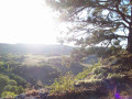
(8) Take the stony path on the right, stop for a moment to admire the view, go round the cross and head down towards Meloisey. Pass the church on your left to reach Route de Pommard.
(9) Turn slightly to the right, then quickly turn left onto Rue des Glacis. At the junction with Rue du Grand Puits, take the latter. Continue along Rue des Chaumaillots on the left, then turn sharply right onto Chemin de Mavilly.
Join the D111, follow it to the left and head back towards Mavilly.
(1) Continue along the D111 to reach Place de l’Église (S/E).

 Visorando Member
 Moderate