


 Country:
 City:


When arriving at Bouze-lès-Beaune from Beaune, there is a car park on the right-hand side of the D970.
(S/E) Follow the D970 north-west, passing through part of the village for about 100 metres, then turn left onto the C3 towards Mandelot. Ignore two streets on the left.
(1) At the fork in the road with a very narrow road, take the one on the left, following the yellow signposting, and head up through the vineyards. You’ll reach the ‘Les Corvées’ signpost.
(2) Follow the signs for Meloisez to the right. At the junction of the small roads, turn left and you’ll reach the ‘Le Châtelet’ signpost.
(3) Head right towards La Bâche. You are now on a section of the GR®7. At the junction with a small road, turn left, leaving the GR®.
(4) Please note: about 200 m further on, make sure you don’t miss the inconspicuous path branching off to the left into the woodland.
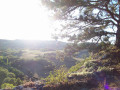
(5) The path passes a viewpoint overlooking the Ruisseau de la Combe valley, then continues to rejoin the signposted GR® path. Follow this path to the left and you’ll come across the ‘Le Châtelet’ signpost.
(3) Follow the signs for Bouze-lès-Beaune, and taking the reverse route of the outward journey, turn right 100 metres further on and you’ll come to the ‘Les Corvées’ signpost.
(2) Turn right, ignoring the signposted directions. Keep to the right at a Fork in the road.
(6) At the junction of three paths, turn left.
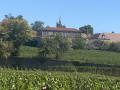
(7) As you approach the village, ignore a path on the left. You’ll come to a road; follow it to the left. Note the church at Bouze on your left. Join the D970 and follow it to the right to reach the car park (S/E).
 Visorando Member

 Moderate

