Country:
 City:


Park in the car park accessible from Rue Paul Maldant, in the centre of Savigny.
(S/E) Leave the car park via the exit marked ‘no entry’ for vehicles, and follow the road to the right; you’ll see a fountain (not running) on the left. Turn left onto Chemin des Guettottes. This small road climbs uphill. Follow the yellow signposts, ignoring any side paths.
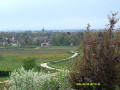
(1) It is at this bend in the road on the right that you’ll enjoy the best view of the village. Continue along the small road. At the ‘Bois de Chenove’ signpost, follow the path straight ahead marked PR®5. At the next junction, turn right and then immediately right again, following the yellow and GR® red and white markings. This path leads down to a small road at the ‘Aux Guettes’ signpost.
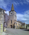
(2) The viewpoint indicated here by IGN no longer overlooks the village but offers views of the vineyards and the valley. Carry on to the right along the PR®5. Back in the village, at the junction with Rue Manson Maldant, go straight on along Rue Pejot to reach the church; walk round it to the left until you reach its forecourt (cross).
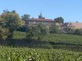
(3) Inside, there are a few murals and polychrome statues of shepherdesses. On leaving, head straight on along Rue Boulanger and Vallée. You’ll come to a square with a fountain. Turn left towards the château’s outbuilding, a wine-tasting cellar, whose façade is adorned with the perforated limestone typical of the region. Carry on left along Rue Général Leclerc until you reach the entrance to the château. Visit the château or carry on straight ahead along Rue Général Leclerc. Turn right onto Rue Sœur Goby. On your left, you’ll see the Manoir de Nicolay.
(4) When the street bends to the left, take the path opposite, marked in yellow. It skirts round the château grounds. Further on, it joins a path running alongside sports fields. Carry on until you reach a street.
(5) Follow it to the right, keeping the château grounds on your right. Turn right onto Rue de Guy de Vaulchier, then keep left onto Rue Richard. At the end of the street, turn left, then turn right onto Rue Paul Maldant and you’ll find the car park on your right (S/E).
 Visorando Member

 Moderate