Country:
 City:




Starts from the Place de l’Abbaye, at the foot of the abbey church of Saint-Benoît-sur-Loire (free car park).
Red and white markings
(S/E) With your back to the church’s porch tower, turn right and head back towards the village centre.
No signposting
Cross Rue Orléanaise and follow Rue François Ier opposite. At the end, turn left into Rue du Dr Ulysse Persillade. Just past the second street lamp, take a path on the right. Cross a river, turn left immediately and follow the river on your left.
(1) You’ll come out onto a street (Rue des Flandres Dunkerque on the map) and follow it to the right. Cross Rue des Grives on the right-hand side. At a T-junction, turn left onto Route du Point du Jour and walk through a housing estate.
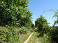
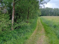
(2) Cross Rue du Carfaton on your left, carry on straight ahead and leave Saint-Benoît-sur-Loire. Walk alongside a market garden on your left and continue along the road between the fields. Pass a poplar grove on your right and follow the winding country lane.
(3) At the corner by a clump of trees, turn left. Immediately ignore another road on the left and carry on straight ahead. Enter the hamlet of La Prieurée and you’ll soon come to a crossroads.
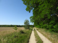
(4) Then follow the Chemin du Pont Chalumeau to the left. After house number 65, the tarmac gives way to a well-graded track. Carry on straight ahead, heading west-north-west.
(5) You’ll come out onto a small road; follow it to the left. After about 200 m, when the road veers to the left, take a gravel track on the right.
(6) At the end, you’ll come to a small road; follow it to the left and enter Germigny-des-Prés. At the Stop sign, go straight on. Cross Rue des Ruets on the left-hand side and reach a junction near the town hall.
(7) Turn right, pass the town hall and you’ll soon reach the church in Germigny-des-Prés.
(8) Retrace your steps back to the crossroads.
Red and white crossed markings
(7) Continue straight on towards Saint-Benoît-sur-Loire, using the right-hand verge of the D60. At a junction, go straight on, pass a pond and cross the Ancienne Bonnée. Immediately turn right onto a small road towards Le Mesnil and Les Marois.
Unmarked
(9) At the Fork in the road immediately ahead, take the right-hand road towards Le Mesnil. At the T-junction, turn right. At the next junction, a triangular one, turn right again.
(10) Then take the first left onto Rue Creuse. Pass the Chemin des Varannes on your left and carry on straight ahead (south-west).
(11) Cross the track onto the embankment (with metal barriers on either side) and carry on straight ahead. The tarmac soon gives way to a hard-packed track which leads into a woodland.
Red and white markings
(12) At the T-junction, turn left onto theGR®3Bthrough a landscape alternating between woodland and broom heath. The Loire is on your right but only becomes visible after several hundred metres. Further on, the track veers away from the river and rejoins the embankment.
(13) Follow the path to the right along the embankment. Stay on this wide, stabilised path towards Saint-Benoît, skirting the Loire below on the right and ignoring all turn-offs to the left. Pass through a metal barrier and emerge onto the D60 (Stop).
(14) Cross the road carefully and take a cycle path towards Saint-Benoît. The path runs parallel to the road situated higher up on the right. At the Stop sign, follow a small road to the left and walk past an equestrian centre.
(15) At a fork in the road, keep to the right. You’ll cross the Chemin des Boutrons on the right, then the Chemin de Tuboeuf on the left.
(16) Just before a Stop sign, turn left onto a cycle path which runs parallel to the D60. At a Fork in the road, follow the cycle path to the right.
(17) At the Stop sign, cross the D60 with care and continue along the cycle path. At the next Stop sign, turn left onto a small road on the embankment and follow the Loire again. At the next Stop sign, continue straight ahead, then ignore the turn-off to the left for the hamlet of La Pointe (a pretty cluster of buildings).
(18) At the next junction, turn right into Rue du Port and stay as close to the river as possible. Pass through the hamlet of Le Port.
(19) At the end, just before the entrance to a campsite, turn left. Ignore a road coming from the right and you’ll soon reach a junction.
(20) Turn right here and head downhill. At the bottom, turn right and follow a small tarmac path, keeping the Abbey of Saint-Benoît in sight. Wind your way along the path, ignoring the dirt tracks on either side. Cross a footbridge and continue straight on until you reach the square at the foot of the abbey church (S/E).


 Visorando Member
 Easy