


Refine your search for walks in Église Saint-Vincent (Ax-les-Thermes)
Église Saint-Vincent (Ax-les-Thermes) walks


 Visorando Member
 Moderate
 Walks near Église Saint-Vincent (Ax-les-Thermes)
 From Ax-les-Thermes to La Tour de Carol
 45.50 mi
 +13,317 ft
 -11,549 ft
 5 days
 Difficult
 Departure from Ax-les-Thermes (Ariège)
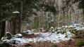
This beautiful Pyrenean hike takes five days; it is intended for hikers accustomed to high-altitude mountain terrain and confident in navigating. It does not present any major difficulties – the route is straightforward – but you do need to be comfortable in high-altitude mountain terrain.
The idea behind this hike is to set off from one railway station and head to another, thus completing a circular route easily without needing a car.
From Ax-les-Thermes to the Prat Redoun refuge
9.35 mi
+3,701 ft
-115 ft
7h 30
Difficult
Departure from Ax-les-Thermes (Ariège)
This hike forms the first stage of a five-day route between Ax-les-Thermes and La Tour-de-Carol. This first stage presents no difficulty unless weather conditions are poor. The start is at Ax railway station, where you follow the road and then a very pretty path that climbs up into the mountains to reach an unstaffed but very comfortable refuge.
This walk is only suitable for hikers accustomed to high-altitude mountain terrain and confident in navigating.
Ax-les-Thermes - Mérens via the Chemin de Llatta
 8.43 mi
+3,563 ft
-2,087 ft
7h 00
Difficult
Departure from Ax-les-Thermes (Ariège)
8.43 mi
+3,563 ft
-2,087 ft
7h 00
Difficult
Departure from Ax-les-Thermes (Ariège)
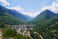
A challenging first stage of exploration in an unspoilt environment.A basic understanding of map reading and navigation is required.The GPX track on Visorando or on a GPS is very useful from the start and at the numerous junctions.It is entirely possible to shorten the route if necessary: see practical information.
From Ax Trois Domaines/Le Saquet to Castelet via the Refuge de Rhule
17.68 mi
+3,251 ft
-7,635 ft
2 days
Difficult
Departure from Ax-les-Thermes (Ariège)
A long hike in Haute Ariège to admire the lakes, ridges and magical landscapes with a stop at the ideally located Refuge de Rulhe, an opportunity to taste the local rataf'. On the second day, you can admire the whole area from the ridges.
Ax 3 Domaines Plateau du Saquet - Rulhe Refuge
6.69 mi
+2,293 ft
-1,677 ft
5h 05
Difficult
Departure from Ax-les-Thermes (Ariège)
This is a magnificent hike that starts from the Plateau du Saquet, and therefore the Ax 3 Domaines ski slopes, and ends at the Refuge de Rulhe, where a good local rataf will do you good. Once you reach the top of the resort, long desert plateaus await you before you descend into the austere scree slopes at the foot of Rulhe and finish sliding down to the Refuge de Rulhe. This first stage is wild and challenging, in the scree slopes. Be careful on the descent from the Col de Lhasse, which is very steep (but the GR® is well marked).
From Mérens-les-Vals to Étang de Pédourrés via Étang de Couard
 6.55 mi
+4,052 ft
-400 ft
6h 35
Difficult
Departure from Mérens-les-Vals (Ariège)
6.55 mi
+4,052 ft
-400 ft
6h 35
Difficult
Departure from Mérens-les-Vals (Ariège)
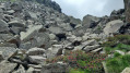
The first stage of the journey! We leave the village of Mérens-les-Vals to reach Étang de Pédourès via the rugged slopes of the Ariège mountains; the scenery is magnificent and very wild. The main difficulty lies between the Étang de Comte and the Étang de Couard, where the well-marked path follows a very long and at times arduous scree slope; once you reach the Étang de Couard, the beauty of the scenery makes up for the hard work.
Forges d'Orlu - Refuge d'en Beys via Naguille and La Couillade d'en Beys
 7.48 mi
+4,964 ft
-1,509 ft
7 hrs
7.48 mi
+4,964 ft
-1,509 ft
7 hrs
 Very difficult
Departure from Orlu (Ariège)
Very difficult
Departure from Orlu (Ariège)
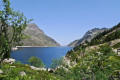
Significant elevation gain over a relatively short distance. Magnificent landscapes in a very wild mountain setting. Numerous ponds along the way. A magnificent view from the Couillade d'en Beys. The effort is rewarded throughout the day.
⚠️ Stay on the marked trails: GRP® Tour de la Montagne d'Ax, as you are on the edge of or within the National Reserve.
Mérens – L’Hospitalet-près-l’Andorre via the Bésines refuge
 9.54 mi
+4,160 ft
-3,225 ft
8h 00
Difficult
Departure from Mérens-les-Vals (Ariège)
9.54 mi
+4,160 ft
-3,225 ft
8h 00
Difficult
Departure from Mérens-les-Vals (Ariège)
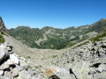
A challenging second stage with a steep gradient on the ascent of the Porteille des Bésines.
This day’s walk follows good, well-signposted paths.
Stopping off at the Refuge des Bésines may be useful for drinking water and, possibly, lunch.
The climb to Les Bésines and the descent towards L’Hospitalet are not very busy (as observed on 2 August 2022).
Auberge du Nabre – Refuge des Bésines
 5.69 mi
+4,442 ft
-1,312 ft
6h 30
Difficult
Departure from Mérens-les-Vals (Ariège)
5.69 mi
+4,442 ft
-1,312 ft
6h 30
Difficult
Departure from Mérens-les-Vals (Ariège)
Second stage of the tour of the Orlu nature reserves and the Montagne d’Ax.
A challenging stage due to its 1,350-metre elevation gain. The ascent is, however, steady.
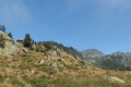
The scenery is magnificent.
This itinerary details the route taking in the magnificent Étang Soula Couloumé.
This stage follows theGR®10, apart from the short detour (5), (6), (7) off the marked trail at the lake.
Ascent to the Refuge du Rulhe from the Cascade des Escaliers (Mérens)
 6.01 mi
+3,727 ft
-1,260 ft
6h 00
Difficult
Departure from Mérens-les-Vals (Ariège)
6.01 mi
+3,727 ft
-1,260 ft
6h 00
Difficult
Departure from Mérens-les-Vals (Ariège)
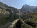
First day’s hike to the Refuge du Rulhe.With a 1,000 m elevation gain over 5.5 km, the average gradient of the climb to the Pyramide de Lherbés is 18%. IBP difficulty rating = 105 (“very difficult” for a hiker of average fitness).Allow 6½ hours with a light rucksack.This day takes place in the high mountains, far from any roads, tracks, etc.The landscapes and environments you’ll pass through are majestic.