


Refine your search for walks in Église Saint-Nicolas (Urbeis)
Église Saint-Nicolas (Urbeis) walks


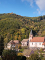
 The Urbeis Heritage Trail and Bilstein Castle
 Visorando Member
 8.59 mi
 +1,398 ft
 -1,385 ft
 5h 10
 Moderate
 Departure from Urbeis (Bas-Rhin)
Circular starting from Urbeis in the Villé valley, following the heritage trail on the theme of the mining past, then passing by the ruins of Bilstein Castle, the village of Climont and the Col d'Urbeis.
Walks near Église Saint-Nicolas (Urbeis)
 Mountain biking in the Vosges, Day 4: Hohwald - Chatenois (Part 1)
7.84 mi
+840 ft
-1,558 ft
2.5 hrs
Moderate
Departure from Le Hohwald (Bas-Rhin)
This route is the first part of thefourth stage of a seven-day tour of the Alsatian side of the Vosges mountains. Most of the route is on forest roads in good condition. The signage is excellent, consisting of signs with an orange or red mountain bike logo and the letters TMV (Traversée du Massif Vosgien).
Schelmenkopf – Col des Bagenelles
 10.60 mi
+1,818 ft
-1,289 ft
6h 25
Moderate
Departure from Ribeauvillé (Haut-Rhin) (Haut-Rhin)
A leisurely second stage, apart perhaps from the total distance. It takes place mainly in the shade on mostly flat paths. You’ll pass beneath the Petit Brézouard and give the Grand Brézouard a wide berth – as it is a wildlife sanctuary – before heading directly to Le Haïcot and then on to the Col des Bagenelles.
Châtenois - Ribeauvillé
 Tourism professional
 12.79 mi
+2,238 ft
-2,028 ft
7h 50
 Difficult
Departure from Châtenois (Bas-Rhin) (Bas-Rhin)
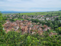
With this superb twelfth stage of the Vosges crossing proposed by Passion Vosges magazine, published by Les Dernières Nouvelles d’Alsace and L’Alsace, the hiker visits a series of castles, starting with the iconic Haut-Koenigsbourg. After a lovely detour into the valley of the mountain village of Thannenkirch, a final climb leads to the steep and spectacular site of the three castles overlooking the charming wine-growing town of Ribeauvillé, the end point of this 20-kilometre route.
Vosges Mountain Biking Day 5: Chatenois – Aubure (Part 1)
9.60 mi
+2,021 ft
-436 ft
4 hrs
Difficult
Departure from Châtenois (Bas-Rhin) (Bas-Rhin)
This route forms the first part of the fifth stage of a 7-day tour on the Alsatian side of the Vosges. The route follows mainly forest tracks in good condition. The signposting, which is excellent, consists of signs bearing an orange or red mountain bike logo accompanied by the letters TMV (Traversée du Massif Vosgien).
Crossing the Southern Vosges from Kintzheim to Willer-sur-Thur
 56.12 mi
+10,161 ft
-9,600 ft
5 days
Difficult
Departure from Kintzheim (Bas-Rhin)
This route takes you across the Vosges in the Haut-Rhin, with moderate daily stages ranging from 15 to 20 km and an elevation gain generally between 800 and 900 m. These stages take between 6 and 7 hours, always ending near a mountain refuge, which must be booked in advance. The route follows paths marked by the Club Vosgien and passes through a wide variety of landscapes.
Kintzheim – Schelmenkopf
 9.38 mi
+2,949 ft
-1,188 ft
6h 55
Moderate
Departure from Kintzheim (Bas-Rhin)
This first stage starts in Kintzheim, passes by Haut-Koenigsbourg Castle, then crosses the pretty village of Thanenkirch before heading up alongside the ‘pagan wall’ with its beautiful rock formations to the Schelmenkopf mountain hut. It is not particularly difficult and is a good way to warm up for the rest of the journey.
Three days around the Val de Senones with bivouacs
 33.33 mi
+5,928 ft
-5,945 ft
3 days
Difficult
Departure from La Broque (Bas-Rhin)
Three days of hiking and camping around the Val de Senones, passing by beautiful viewpoints. Campsites at the Tête du Coquin and the Haute Loge.
From Salm to the Tête du Coquin
10.34 mi
+2,963 ft
-2,349 ft
7h 20
Difficult
Departure from La Broque (Bas-Rhin)
This first stage is probably the hardest day of the route. Beautiful views, pleasant trails and few forest roads. A steep climb at the end of the day explains the "Difficult" rating.
Dambach-la-Ville – Obernai
18.18 mi
+1,450 ft
-1,450 ft
9h 35
 Very difficult
Departure from Dambach-la-Ville (Bas-Rhin)
Vine growing is an integral part of the Alsatian landscape. There is also a route named after it. This route is the fifth stage of the vineyard walk and connects Dambach-la-Ville to Obernai. There are numerous vantage points, indeed they are almost everywhere outside the villages. The villages themselves are very typical, with pretty half-timbered houses and undeniable charm. The region’s heritage is equally well represented.
 Easy