


Refine your search for walks in Eglise romane du Vieux Cherier
Eglise romane du Vieux Cherier walks


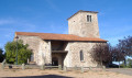
 From Point du Jour to Saint-Haon-le-Châtel
 Association / Club / Walk leader
 14.49 mi
 +1,686 ft
 -3,130 ft
 8h 10
 Difficult
 Departure from Cherier (Loire)
Departure from a high point in the Monts de la Madeleine, in Cherier, at a place called Le Point du Jour (870 m, 14-bed stopover lodge with meals) to descend to the Côte Roannaise, cross its vine-covered hillsides and arrive at the medieval village of Saint-Haon-le-Châtel (14-bed stopover lodge with meals). This route gives priority to small paths with no motor vehicle traffic and beautiful views of the Roanne plain.
Walks near Eglise romane du Vieux Cherier
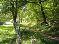
From Cherier (Le Point du Jour) to the campsite at Saint-Just-en-Chevalet
 13.04 mi
+1,788 ft
-2,667 ft
7h 35
Difficult
Departure from Cherier (Loire)
First stage of a 5-day route through the Monts de la Madeleine, the Bois Noirs and the northern Livradois. Most of the day is spent on the lovely paths of the commune of Cherier, offering a range of views from the tops of its hills, amidst unspoilt countryside. At the end of the route, the path descends to Saint-Just-en-Chevalet, after passing through the charming hamlet of Fonthieur.
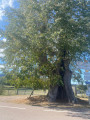
Saint-Just-en-Saltire – Laprugne
 11.35 mi
+1,594 ft
-1,296 ft
6h 35
 Moderate
Departure from Saint-Just-en-Chevalet (Loire)
Second stage of a 5-day horse-riding route across the Monts de la Madeleine, the Bois Noirs and the northern Livradois. A typical mid-mountain route, featuring open countryside used for livestock farming, deciduous forests, lively villages, and quiet, well-maintained paths. The start involves little elevation gain (La Tuilière plateau), but most of the climb comes towards the end, after crossing into the Allier.
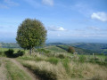
From the Loge des Gardes to Point du Jour
 11.96 mi
+1,368 ft
-2,044 ft
6h 40
Moderate
Departure from Laprugne (Allier)
Departure from the Loge des Gardes sports centre. Start the day in the beautiful beech undergrowth of the Assise State Forest, above 1,000 metres altitude, before descending to the more open plateaus of La Tuilière and Cherier, with beautiful views. End at the Refuge du Point du Jour lodge (overnight stay and meals made with farm produce) (altitude 870 metres).
From Saint-Haòn-le-Châtel to leat
10.63 mi
+2,461 ft
-1,348 ft
7h 00
Difficult
Departure from Saint-Haon-le-Châtel (Loire)
Morning: crossing the northern part of the Roanne coast vineyards, with little elevation gain, and two beautiful historic villages: Saint-Haon-le-Châtel and Ambierle, with a rich heritage open to visitors. The afternoon is more challenging with the climb to leat (altitude 765 m) through meadows and forest. Most of the route is on dirt tracks with no traffic.
Laprugne – Saint-Victor-Montvianeix
 12.93 mi
+2,195 ft
-2,169 ft
7h 50
Difficult
Departure from Laprugne (Allier)
Third stage of the Rez de Sol circular route, straddling the Monts de la Madeleine, the Bois Noirs and the northern Livradois. There is a stark contrast as you cross from the Allier into the Puy-de-Dôme: from pretty mid-mountain hamlets as far as Lavoine, then a landscape dominated by forests cascading down deep gorges from which a few hilltop villages emerge, seeming timeless, towards St-Victor-Montvianeix (a very extensive commune covering 4,500 ha). An optional detour takes you to the Rez de Sol (1.6 km). Omitting this route reduces the length of the stage by the same distance.
From leats to Loge des Gardes
12.97 mi
+2,382 ft
-1,342 ft
8h 00
Difficult
Departure from Saint-Bonnet-des-Quarts (Loire)
This stage crosses the highest villages in the Monts de la Madeleine, at an altitude of around 1,000 metres, and allows you to visit two major tourist attractions in St-Nicolas-des-Leat (03): the Allée des Géants and the Pierre Châtel. Most of the route is through deciduous forest, home to mushrooms. The stage ends at the Loge des Gardes sports resort, where accommodation is available (hotel-restaurant).
Arconsat – Cherier
 13.12 mi
+2,336 ft
-2,041 ft
8h 05
Difficult
Departure from Arconsat (Puy-de-Dôme)
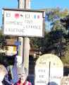
The fifth stage of the Boucle du Rez de Sol route, where you leave the Auvergne to return to the Loire region by crossing the Col Saint-Thomas, famous for its sign reading “Here ends France, here begins the Auvergne”. You leave the Bois Noirs to pass through the pretty hamlets of Chausseterre and then Saint-Just-en-Chevalet. A long climb leads up to the Pras plateau at an altitude of 1,000 metres (in the commune of Cherier), involving a 400-metre ascent in the second half of the day, along lovely little shaded paths well maintained by the Urfé Community of Communes. Discover numerous isolated houses, beautifully restored by those who love solitude.