


Refine your search for walks in Eglise du XVème siècle
Eglise du XVème siècle walks


 Around Lucéram: Col de l'Orme, Col de l'Ablé, Grand Braus and Mont Auri
 Visorando Member
 6.79 mi
 +2,575 ft
 -2,559 ft
 5h 20
5h 20
 Moderate
 Departure from Lucéram (Alpes-Maritimes)
This is a hike to enjoy during the Christmas period, starting from Lucéram, a magical medieval village famous for its 500 nativity scenes. The route crosses the Turini road several times, then passes through the Col de l'Orme before reaching the summit of Mont l'Ablé, where you can enjoy breathtaking views of the coastline and, with a little luck, Corsica, the Grassoises Pre-Alps and part of the Mercantour massif. From the summit of Mont Auri, the aerial view of the village of Lucéram is exceptional. The return journey takes you through the Ibac forest and behind the village.
Walks near Eglise du XVème siècle
Sospel - Menton
 10.24 mi
+3,691 ft
-4,767 ft
7h 55
10.24 mi
+3,691 ft
-4,767 ft
7h 55
 Difficult
Departure from Sospel (Alpes-Maritimes)
Difficult
Departure from Sospel (Alpes-Maritimes)
This is the last stage ofthe GR® 52. It is certainly not the highest in altitude, but it is difficult due to its distance and the passage of certain passes with steep ascents and descents. The Mediterranean views are splendid, especially those from the Col du Razet and Col du Berceau, which rises to 1,100 metres above the town of Menton, the end point of theGR®. You walk along the Italian border throughout the route.
Be warned, in summer this stage is very challenging due to the heat, especially the descent from the Col du Berceau.
Sospel – Menton
 12.54 mi
+3,671 ft
-4,816 ft
7 hrs
12.54 mi
+3,671 ft
-4,816 ft
7 hrs
 Very difficult
Departure from Sospel (Alpes-Maritimes)
Very difficult
Departure from Sospel (Alpes-Maritimes)
This route leaves theGR® 52 to head for Grammondo and cross over to the Italian side.
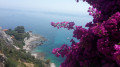
On the descent, there are almost constant views of the sea, ending in the very pretty town of Grimaldi.
From Utelle to Nice Ville railway station
 21.50 mi
+3,806 ft
-6,385 ft
13h 10
Difficult
Departure from Utelle (Alpes-Maritimes)
21.50 mi
+3,806 ft
-6,385 ft
13h 10
Difficult
Departure from Utelle (Alpes-Maritimes)
This twenty-first stage, once you have crossed the Vésubie, takes place in the Nice Pre-Alps and brings the GTA (Grande Traversée des Alpes) to a close by the sea. From the Place de la Fontaine in Utelle, the GR®5 heads west, then south, crossing a few small valleys to reach the hamlet of Cros d’Utelle. It crosses the Vésubie valley, climbs the opposite slope after the town of Levens, ascends through woodland to Colla Partida, passes beneath Mont Cima and descends to the beautiful circular fortified village of Aspremont. The path climbs the western flank of Mont Chauve d’Aspremont without reaching the summit. It descends the Crête de Graus until it reaches Château Renard and then La Bauma. The path enters a valley, which it follows eastwards, then due south towards La Fontaine Sainte, and crosses the bridge over the Autoroute de la Provençale. It enters the city of Nice, which it crosses from north to south to reach Nice Ville railway station.
Utelle - Levens
7.41 mi
+1,870 ft
-2,680 ft
5h 00
Moderate
Departure from Utelle (Alpes-Maritimes)
Etape de la traversée des Alpes d'Utelle jusqu'à Levens. Randonnée entre la vallée de la Vésubie et les derniers reliefs alpins.
From Castillon-village to Monti via Mont Mulacié
 9.66 mi
+3,589 ft
-4,764 ft
7h 35
Difficult
Departure from Castillon (Alpes-Maritimes)
9.66 mi
+3,589 ft
-4,764 ft
7h 35
Difficult
Departure from Castillon (Alpes-Maritimes)
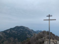
A cross-country hike through the Menton region along a little-used route, passing through wild and unspoilt areas where traces of human habitation still remain.
The route also provides access to the summit of Mont Mulacié, the second-highest peak in the Menton region, which is very little visited as it lies off the official marked trails. The view from this summit is interesting, although less spectacular than that from its neighbour, the Grammondo.
Levens - Nice
13.55 mi
+2,077 ft
-3,734 ft
8h 00
Difficult
Departure from Alpes-Maritimes
Étape de la traversée des Alpes de Levens jusqu'à Nice. Randonnée permettant de traverser la bande littorale typiquement méditerranéenne et arriver à la Mer Méditerranée à Nice.
The steep path on the western flank of Mont Arpasse
 6.19 mi
+1,424 ft
-2,136 ft
4h 05
Difficult
Departure from Alpes-Maritimes
6.19 mi
+1,424 ft
-2,136 ft
4h 05
Difficult
Departure from Alpes-Maritimes
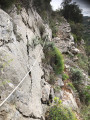
This unique one-way hike (allow for two vehicles) takes you up Mont Arpasse via the little-used south-eastern route. The final stretch is a path nearly 3 km long, sometimes carved into the cliff face, steep and vertiginous, clinging to the mountainous western flank of Mont Arpasse. It was built by the constructors of the Vésubie Canal in the 1870s and offers views of the Var throughout.
The section between marker 296 and the finish is reserved for experienced walkers.
La Baisse de Camp d'Argent – Sospel
 13.53 mi
+1,670 ft
-6,289 ft
10 hrs
Very difficult
Departure from La Bollène-Vésubie (Alpes-Maritimes)
13.53 mi
+1,670 ft
-6,289 ft
10 hrs
Very difficult
Departure from La Bollène-Vésubie (Alpes-Maritimes)
The sixth stage ofthe GR®52, where the landscapes change dramatically. Due to its length and significant descent of nearly 2,000 metres, the stage is very difficult. The descent to Sospel, which makes up two-thirds of the route, puts a real strain on the knees and ankles. Please note, it gets very hot in summer on this section.
Breil – Sospel via La Baisse de Levens
 9.50 mi
+3,100 ft
-2,930 ft
7h 05
Difficult
Departure from Breil-sur-Roya (Alpes-Maritimes)
9.50 mi
+3,100 ft
-2,930 ft
7h 05
Difficult
Departure from Breil-sur-Roya (Alpes-Maritimes)
A lovely route linking the Bévéra Valley with the Roya Valley. Along the way, the Col de Brouis marks the boundary between these two valleys. If you set off early enough, you can have lunch on the terrace of one of the restaurants in this pretty village, where life flows as peacefully as the River Bévéra. The return journey is then by the Train des Merveilles, which connects the two stations in 15 minutes.
Torri Superiore - Ventimiglia
 9.70 mi
+1,657 ft
-1,929 ft
5h 55
Moderate
Departure from Ventimiglia (Imperia)
9.70 mi
+1,657 ft
-1,929 ft
5h 55
Moderate
Departure from Ventimiglia (Imperia)
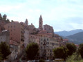
This fifth stage will take you from Torri Superiore to the Mediterranean coast at Ventimiglia. Upon arriving in Bevera, you will find yourself at the confluence of the Bévera and Roya rivers. A final climb through the Ventimiglia hinterland will lead you to the Riviera dei Fiori and the town of Ventimiglia.