Du Rifugio Granero au Refuge du Viso

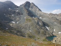
Troisième étape, qui vous fait revenir en France, par un col à 2834 m d'altitude. Avec un peu de chance, vous pouvez observer dans la montée des chamois ou, à défaut, des marmottes, autour du Refuge du Viso.

This walk is part of a multi-day hike: Cross-border between the Queyras and Alta Pellice

Details

n°59135495
Creation:
Last update:
Last review:
  • Walking
    Activity: Walking
  • ↔
    Distance: 2.75 mi
  • ◔
    Average duration: 2h 35 
  • ▲
    Difficulty: Difficult

  • ⚐
    Back to start: No
  • ↗
    Ascent: + 1,519 ft
  • ↘
    Descent: - 1,230 ft

  • ▲
    Highest point: 9,272 ft
  • ▼
    Lowest point: 7,743 ft

Description of the walk

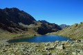
(S) Du Refuge de Granero, prendre le sentier qui mène au Lac Long.

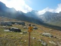
(1) Après avoir traversé le torrent qui sort du Lago Lungo, suivre la direction Col Sellière et Refuge du Viso. Cent mètres plus loin, prendre à droite, toujours en direction du Col Sellière et du Refuge du Viso. Suivre le sentier qui monte fortement et, parfois, traverse des névés.

(2) Au Col Sellière, entamer la descente vers le Refuge du Viso.

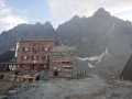
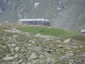
(3) Peu après avoir dépassé les ruines de la Bergerie du Grand Vallon, au croisement, suivre Refuge du Viso. Cent mètres plus loin, prendre à gauche, toujours en direction du refuge. Continuer le chemin jusqu'à arriver au refuge (E).

Waypoints

  1. S : mi 0 - alt. 7,795 ft - Refuge Granero
  2. 1 : mi 0.13 - alt. 7,746 ft - Lago lungo
  3. 2 : mi 1.13 - alt. 9,272 ft - Col Sellierino
  4. 3 : mi 2.12 - alt. 8,087 ft - Croisement proche de la Bergerie du Grand Vallon
  5. E : mi 2.75 - alt. 8,091 ft - Refuge du Viso

Notes

La vallée qui monte au Col Sellière en venant du Refuge Granero est orientée au Nord et les névés peuvent persister jusqu'en juillet. Si vous faites cette randonnée plus tôt en saison, équipez-vous en conséquence (crampons, piolet, ...)

Refuge du Viso

This route passes through a protected area, which may be subject to special regulations:

Reviews and comments

3.3 / 5
Based on 2 reviews

Reliability of the description
3 / 5
Ease of following the route
3 / 5
Route interest
4 / 5
JPC07
JPC07

Overall rating : 3.3 / 5

Date of your route : Aug 15, 2026
Reliability of the description : ★★★☆☆ Average
Ease of following the route : ★★★☆☆ Average
Route interest : ★★★★☆ Good
Very busy route : No

In the morning, we mistakenly climbed up to the Manzal Pass, but didn’t regret it; then, at around 10 o’clock, we tackled the very gruelling climb up to the Selliere Pass, carefully following the signposting which led us into scree 300 metres to the left of the official pass, which we reached with difficulty amid the ‘nebbia’ and a light drizzle. We arrived at the Viso mountain hut at around 2.30 pm – a hut that won’t leave us with any lasting memories.

Machine-translated

JPC07
JPC07

Overall rating : 3.3 / 5

Date of your route : Aug 15, 2026
Reliability of the description : ★★★☆☆ Average
Ease of following the route : ★★★☆☆ Average
Route interest : ★★★★☆ Good
Very busy route : No

That morning, we mistakenly climbed up to the Manzal Pass, but we didn’t regret it; then, at around 10 o’clock, we tackled the very gruelling climb up to the Selliere Pass, carefully following the signposting which led us straight into a scree slope 300 metres to the left

Machine-translated

Other walks in the area

For more walks, use our search engine .

The GPS track and description are the property of this route's author. Please do not copy them without permission.