Country:

 City:
City:



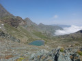
The route starts from the Granero refuge.
(S/E) Head due south towards Lago Lungo; you’ll very quickly come to the start of the trails (signposted).
(1) Turn left towards Colle Manzol. Be careful, as you may come across Lanza salamanders on the path: keep an eye out and take care not to crush them. Keep heading east and climb steadily.
(2) At a fork in the road, carry on straight ahead and leave the path leading to Lago Nero on your right. Climb the switchbacks up to the pass. Please note that the pass is not at the first overhang on the other side. You must continue left along the ridge to reach it!
(3) Descend on the other side via a very steep path that heads north and soon turns east.
(4) At a fork in the road (large cairn), turn right towards Colle Armoine (path 114). Head uphill and you’ll soon reach a small lake (Lago Arbancie).
(5) Carry on straight ahead (ignore a path branching off to the left) and climb, heading south-east, to another lake (Lago Piena Sia).
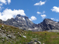
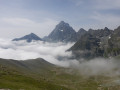
(6) Go round the lake on the left and continue climbing. The path turns south-west and reaches Colle Armoine (magnificent view of Monte Viso).
(7) Start descending and very quickly leave the main path to follow the sign for “Buco di Viso / Traversette”, painted in red on a fallen boulder. This path allows you to cross without losing too much altitude. After a narrow section, the path reaches a fork at the foot of large boulders.
(8) Take the path that continues straight ahead, descending gently in a series of zigzags to rejoin the classic route near Pian Mait.
(9) Turn slightly to the right and head north-west uphill to some old bunkers.
(10) Continue left along the V16 path towards Buco di Viso (2,880 m). This will take you to the entrance to the Traversette tunnel.
(11) Enter the tunnel and go straight ahead. You’ll need a light: a head torch or, if you don’t have one, your mobile phone’s torch.
(12) At the tunnel exit (you are now in France), turn right and head down a short descent, first north-west then west. This will take you to the signpost “Sous le Col Seillierino – alt. 2,780 m”.
(13) Turn right towards the Col Seillierino. The path is not always clearly marked. Don’t hesitate to veer slightly to the left, whilst always keeping the pass in sight. Reach the pass.
(14) Return to Italy. Descend on the other side, heading due north. Ignore a few paths branching off to the right and head north-west (numerous cairns and some paint markings). Reach Lago Lungo and go round it on the left.
(1) Turn left and head straight back to the starting hut (S/E).
 Visorando Member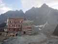

 Association / Club / Walk leader
 Very difficult
 Easy
Easy