


Tour du Mont Viso en 7 jours

Details
Creation:
Last update:
-
 Activity: Walking
 -
 Distance: 56.46 mi
 -
 Average duration: 7 days
 -
 Difficulty: Difficult
 -
-
 Back to start: No
 -
 Ascent: + 20,256 ft
 -
 Descent: - 20,741 ft
 -
-
 Highest point: 9,843 ft
 -
 Lowest point: 5,069 ft
 Country:

 City:
City:


Stages of the route
This route needs several days, find the details below:
This route passes through a protected area, which may be subject to special regulations:
Other walks in the area
The circular of the Praroussin
 Visorando Member
 5.10 mi
+3,196 ft
-3,186 ft
5h 10
Difficult
5.10 mi
+3,196 ft
-3,186 ft
5h 10
Difficult
 Departure from Ristolas (Hautes-Alpes)
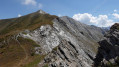
A lovely viewpoint over Mount Viso, the Italian peaks and the Queyras, with the return journey made all the more enjoyable by an easy descent along a very beautiful ridge.As navigation is not straightforward, I recommend supplementing the route description with the Visorando app.
Trek around Monte Viso in 5 days, stage 1
 Association / Club / Walk leader
 4.08 mi
+2,192 ft
-2,051 ft
3h 45
Difficult
Departure from Ristolas (Hautes-Alpes)
4.08 mi
+2,192 ft
-2,051 ft
3h 45
Difficult
Departure from Ristolas (Hautes-Alpes)
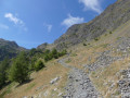
This first stage is a warm-up for the rest. It's a medium mountain trek starting through larch trees before reaching alpine pastures surrounding the pass. A beautiful view over Pellice valley during the hike down.
Trek around Monte Viso in 5 days
37.23 mi
+14,711 ft
-14,688 ft
5 days
Difficult
Departure from Ristolas (Hautes-Alpes)
Trek around Monte Viso in 5 stages.
A beautiful high mountain hike.
Hike over a 5 day period.
An exquisite high mountain trek.
Trak around Monte Viso day 1: L'Echalp - Refuge Granero
 7.26 mi
+4,121 ft
-1,929 ft
6h 55
Difficult
Departure from Ristolas (Hautes-Alpes)
7.26 mi
+4,121 ft
-1,929 ft
6h 55
Difficult
Departure from Ristolas (Hautes-Alpes)
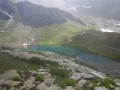
First stage starting at Queyras National Park (Parc National du Queyras) passing through Col Lacroix, then a beautiful Italian valley and ending up at a shelter near a lake where the real trek around Monte Viso will start the next day.
Lakes Égorgéou and Baricle from Échalp
 7.13 mi
+2,579 ft
-2,582 ft
5h 30
7.13 mi
+2,579 ft
-2,582 ft
5h 30
 Moderate
Departure from Ristolas (Hautes-Alpes)
Moderate
Departure from Ristolas (Hautes-Alpes)
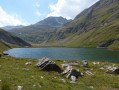
Deep in the Queyras, at the end of the road that climbs up the Guil, you can easily walk up to these beautiful lakes, set in this glacial valley, with Égorgéou flanked by its little brother Baricle.
Col Lacroix loop starting from Échalp
 5.33 mi
+2,064 ft
-2,087 ft
4h 15
Moderate
Departure from Ristolas (Hautes-Alpes)
5.33 mi
+2,064 ft
-2,087 ft
4h 15
Moderate
Departure from Ristolas (Hautes-Alpes)
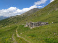
This easily accessible border pass also offers a very pleasant loop through the mountain pastures and forests overlooking the right bank of the Guil.
 Very difficult
For more walks, use our search engine .
The GPS track and description are the property of this route's author. Please do not copy them without permission.

