From the Col de la Portette to the Tubanet refuge

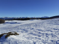
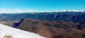
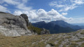
The first day is relatively easy as it follows fairly busy forest tracks that wind gently through the snow-covered fir trees of the three forests. The arrival on the Ambel plateau offers superb views on a clear day. A comfortable night at the Tubanet refuge before setting off on the return journey.

Details

n°18531
Creation:
Last update:
Last review:
  • Snowshoeing
    Activity: Snowshoeing
  • ↔
    Distance: 4.95 mi
  • ◔
    Duration according to the author: 5 hrs 
  • ▲
    Difficulty: Moderate

  • ⚐
    Back to start: No
  • ↗
    Ascent: + 883 ft
  • ↘
    Descent: - 108 ft

  • ▲
    Highest point: 4,462 ft
  • ▼
    Lowest point: 3,566 ft

Photos

Description of the walk

Park at the start of the Col de la Bataille road (D199), which is closed, just before the Col de la Portette when coming from Bouvante-le-Bas.

(S) Put on your snowshoes depending on snow conditions and cross the ‘wall’ of snow left by the DDTE snowplough. Continue along the departmental road, which climbs gently through the Bouvante Pionnier communal forest. The road is still clearly visible despite the deep snow.

After passing the Route Forestière du Pionnier, which branches off to the right ahead (signs visible even in heavy snow), and leaving the Route Forestière des Esserennes on your left (which lies opposite and heads back uphill)… you’ll reach an inside bend in the road, the ‘carrière’ junction, just before a sharp right-hand bend marks the start of a steep climb.

(1) A wooden sign on the left indicates the start of the first Malatra Forest Road.
Take this forest track. The climb then becomes steeper through the undergrowth. You will soon reach the quarry junction. If there is heavy snow and no other tracks are visible, you may not notice where the two forest tracks cross. The track is narrower and winds its way through the snow-covered fir trees of the Malatra Forest, continuing to climb in a south-south-easterly direction. This route, used by mushers, can be very well-tracked all the way to the Tubanet Refuge. It is also popular with cross-country skiers. Many large animals can be spotted: mouflons, deer, chamois, wild boar, etc.

(2) At a place known as Carrefour du Bout de Malatra, leave a descending road on your right that comes from the Malatra clearing.
You will reach the start of the Tubanet track (labelled as a ‘private track’ on the IGN map), marked by signs explaining the current regulations for this sensitive natural area. Depending on snow conditions, a barrier may no longer be visible.

(3) Take the Tubanet path, which winds its way through the Ambel Forest. You will then come to an unobstructed view of the Ambel plateau, which is a nature reserve.

(4) Then take the path on your right towards the Tubanet Refuge. The path descends and you will soon catch sight, in the distance, of the refuge where you will spend the night (E).

Waypoints

  1. S : mi 0 - alt. 3,579 ft - Car park on the Route du Col de la Bataille (D199)
  2. 1 : mi 2.32 - alt. 4,183 ft - Carrefour de la Carrière
  3. 2 : mi 3.42 - alt. 4,291 ft - Bout de Malatra crossroads
  4. 3 : mi 4.21 - alt. 4,400 ft - Private track or Tubanet track
  5. 4 : mi 4.77 - alt. 4,386 ft - Take the path on your right
  6. E : mi 4.95 - alt. 4,354 ft - Refuge de Tubanet

Notes

This route can be done on cross-country skis.

Frequent fog and potentially heavy snowfall mean that this two-day winter walk must be undertaken with a hiker who knows the area or a guide, otherwise you risk getting lost.

CAUTION if you are going for a walk on the Ambel plateau. Snow accumulation creates snow cornices which may give way under your weight and send you tumbling off the cliffs. Admire the view of the Dois mountains from a safe distance from the edge.

There is no running water at the refuge. Make sure you bring enough with you.
Dogs are only permitted from 11 October to 31 March. Outside this period, you risk being fined. Park rangers are very active in the area and can provide you with information.

Worth a visit

The Bear Monument, provided it isn’t buried under the snow, on theGR®93towards the Montagne d’Ambel (towards Fond d’Urle).

The Ambel plateau.

Always be cautious and plan ahead when you're outdoors. Visorando and the author of this route cannot be held responsible for any accidents occurring on this route.

The GR® and PR® markings are the intellectual property of the Fédération Française de Randonnée Pédestre.

Reviews and comments

4.3 / 5
Based on 1 review

Reliability of the description
5 / 5
Ease of following the route
4 / 5
Route interest
4 / 5
ultima ratio
ultima ratio

Overall rating : 4.3 / 5

Date of your route : Aug 26, 2019
Reliability of the description : ★★★★★ Very good
Ease of following the route : ★★★★☆ Good
Route interest : ★★★★☆ Good

A lovely walk in brilliant weather, so the visibility was perfect and clear. It was absolutely heaving on the GR – but then again, it is August after all!!:
Kind regards
PJB
P.S.: Map, compass (the old-fashioned sort!) but also a GPS (you’ve got to move with the times!)

Machine-translated

Other walks in the area

For more walks, use our search engine .

The GPS track and description are the property of this route's author. Please do not copy them without permission.