Col de Côte Plaine

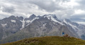
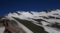
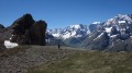
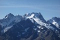
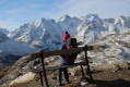
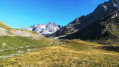
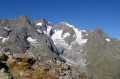
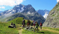
A short hike with a section off the beaten track towards a ridge offering one of the most beautiful panoramic views of the Meije massif.

Details

286360
Creation:
Last update:
Last review:
  • Walking
    Activity: Walking
  • ↔
    Distance: 2.02 mi
  • ◔
    Average duration: 1h 50 
  • ▲
    Difficulty: Moderate

  • ⚐
    Back to start: Yes
  • ↗
    Ascent: + 1,033 ft
  • ↘
    Descent: - 1,033 ft

  • ▲
    Highest point: 8,714 ft
  • ▼
    Lowest point: 7,680 ft

Photos

Description of the walk

From Le Monêtier-les-Bains, take the Route des Grandes Alpes to the Col du Lautaret and then on towards the Col du Galibier. Just before the third hairpin bend, at an altitude of 2,349 metres, park in the small car park on the right-hand side of the road.

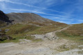
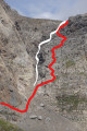
(S/E) From the car park, take the path that starts at the hairpin bend to the north-west. Follow this path up through the valley, following the course of the Torrent de Roche Noire and then its left-hand branch heading west.

(1) At the end of the path, continue for about a hundred metres in the same westerly direction, following the course
of the left-hand branch of the torrent until it turns right towards the north.

(2) Then leave the torrent and climb as the terrain dictates towards the south-west towards the pass (cairns).
This pass is easy to spot as it lies to the right of a rocky outcrop.

(3) Follow the ridge to the right, heading north-west, to the large cairn at the summit (an ideal spot for a picnic and to take in the views).

(4) Return along the same route in the opposite direction to the car park (S/E).

Waypoints

  1. S/E : mi 0 - alt. 7,680 ft - Car park
  2. 1 : mi 0.67 - alt. 8,219 ft - End of the trail
  3. 2 : mi 0.73 - alt. 8,268 ft - Change of course
  4. 3 : mi 0.93 - alt. 8,635 ft - Col de Côte Plaine
  5. 4 : mi 1.01 - alt. 8,714 ft - Large cairn
  6. S/E : mi 2.02 - alt. 7,680 ft - Car park

Notes

I’ve made a video showing the route and the atmosphere of the walk.

Although this route is very short, it does require a basic understanding of navigation.

The best time to go is generally from early to mid-July, though depending on the remaining snowfields, it can be as late as the end of September.

Reviews and comments

4.2 / 5
Based on 3 reviews

Reliability of the description
4 / 5
Ease of following the route
4 / 5
Route interest
4.7 / 5
BG38
BG38

Overall rating : 3.7 / 5

Date of your route : Jul 06, 2020
Reliability of the description : ★★★☆☆ Average
Ease of following the route : ★★★☆☆ Average
Route interest : ★★★★★ Very good
Very busy route : No

The walk leads to a magnificent viewpoint, and it’s well worth the effort.
There were two of us on the hike – not exactly seasoned hikers, but used to walking nonetheless – and the final stretch is, to be honest, very, very steep. But it was well worth it, I promise!

We only had a paper map and had no way of knowing whether we were on the right track towards the end. But then again, following a ridge isn’t exactly complicated ;-)

Not a soul in sight, just some rather unafraid marmots and flowers galore. A real treat!

Machine-translated

pitre
pitre

Overall rating : 4.3 / 5

Date of your route : Aug 05, 2019
Reliability of the description : ★★★★★ Very good
Ease of following the route : ★★★★☆ Good
Route interest : ★★★★☆ Good

A short, easy walk with some lovely views

Machine-translated

throm1
throm1

Overall rating : 4.7 / 5

Date of your route : Aug 15, 2017
Reliability of the description : ★★★★☆ Good
Ease of following the route : ★★★★★ Very good
Route interest : ★★★★★ Very good

A lovely little walk with magnificent views on both sides of the pass.

Machine-translated

Other walks in the area

For more walks, use our search engine .

The GPS track and description are the property of this route's author. Please do not copy them without permission.