


unasic

 Association / Club / Walk leader
PRO  Premium user
Premium user Sign up:
Published route(s)
 From the village of Le Saix to Lake Peyssier via the Col de Combe Escure
 6.66 mi
 +2,320 ft
 -719 ft
 5h 05
5h 05
 Difficult
 Departure from Le Saix (Hautes-Alpes)
Setting off from the village of Le Saix is an alternative to starting from Veynes station. This stage leads to Lake Peyssier and continues the trek.
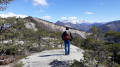
It offers a variety of attractions: a ridge walk, a bird’s-eye view of the Gouravour Gorge, unique views of the Buëch Valley and the Dévoluy massif, a walk through the former hamlet of La Péguière, a visit to the site of Clausonne Abbey and a walk across the Peyssier plateau.
An easier alternative route to reach Lake Peyssier is via the forest track from the village of Le Saix, passing through the Gouravour Gorge; it takes 1 hour to climb to Clausonne Abbey.
From Col des Guérins to Tallard
12.56 mi
+482 ft
-2,812 ft
6h 10
Difficult
Departure from Sigoyer (Hautes-Alpes) (Hautes-Alpes)
A short, all-downhill stage towards the Durance valley, as far as Tallard. You can make a detour via Sigoyer and rejoin the route via the D19.
This route runs partly through woodland, with the Durance valley and the peaks of the Écrins and Ubaye massifs as a backdrop. A glimpse of Montagne Saint Maurice above Valserres, a stage on the ITAC route.