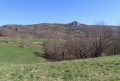
From the Col de Légrillou to the Col des Marrous via the Pech de Therme

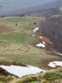
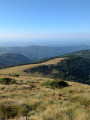
A hike linking the Col de Légrillou to the Col des Marrous via the Sarrat de la Pelade, the Pic de Razels, the Cap du Carmil and the Col d’Uscla. The entire ridge offers magnificent views of the Pyrenees mountain range from Vallier to Soularac.

Details

n°70204640
Creation:
Last update:
Last review:
  • Walking
    Activity: Walking
  • ↔
    Distance: 11.40 mi
  • ◔
    Average duration: 7h 55 
  • ▲
    Difficulty: Difficult

  • ⚐
    Back to start: No
  • ↗
    Ascent: + 3,107 ft
  • ↘
    Descent: - 2,930 ft

  • ▲
    Highest point: 5,312 ft
  • ▼
    Lowest point: 3,087 ft

Photos

Description of the walk

Park at the Col de Légrillou.

(S) Take the path that starts at the foot of the signpost indicating the Route Forestière du Calmil heading south and climb through the Bois de Légrillou. At a Fork in the road, take the path on the right heading south-west. After a hairpin bend to the left and one to the right, you’ll reach a junction.

(1) Turn sharply left. You’ll come out onto a forest track; follow it to the right for about a hundred metres. Take the first path on the left and continue uphill.

(2) Cross a forest track and continue along the path opposite.

(3) At a crossroads, follow the path opposite, heading due south. As you climb, the path gradually turns south-west. You’ll reach the Cabane de Devèze.

(4) Continue climbing south-west to join the GRP® Tour de la Barguillère trail at the foot of the Sarrat de la Pelade.

(5) Take the GRP® to the right (south-west; red and yellow markings). Continue climbing until you reach the ridge.

(6) Follow the ridge to the right, heading due west.

(7) At the junction, carry on straight ahead (do not head down to the left towards the Col de Port) and pass the Roc Blanc. Heading west-north-west then north-west, descend and then climb again to reach the Pic de Razels (beautiful 360° view).

(8) Continue due west. Descend and then climb again to reach the Cap du Carmil (stunning 360° view).

(9) Descend to the right along the GRP®, heading due north, and you’ll soon reach the Pic de Fontfrède.

(10) Continue north along the well-marked path. Descend and go round the Sommet de Cap Long, then the Pic de Jouels on the left.

(11) At the Fork in the road, keep to the right and descend to the Col d’Uscla.

(12) Cross the road and take a path on the right (east; still following the GRP®). Descend to the Col de la Serre.

(13) Continue along the GRP®, which soon turns north-north-west and then north-north-east.

(14) At the Fork in the road, keep to the right on the signposted path and head down to the Col des Marrous (E).

Waypoints

  1. S : mi 0 - alt. 3,087 ft - Col de Légrillou
  2. 1 : mi 0.84 - alt. 3,734 ft - Junction
  3. 2 : mi 1.39 - alt. 4,229 ft - Crossing a forest track
  4. 3 : mi 1.9 - alt. 4,308 ft - Crossroads
  5. 4 : mi 2.74 - alt. 4,938 ft - Devèze Hut
  6. 5 : mi 2.96 - alt. 5,036 ft - Crossroads – GRP junction
  7. 6 : mi 3.44 - alt. 5,262 ft - Crossroads on the ridge
  8. 7 : mi 4.51 - alt. 5,036 ft - Junction - Roc Blanc (1542 m)
  9. 8 : mi 5.8 - alt. 5,240 ft - Pic de Razels (1600 m)
  10. 9 : mi 7.23 - alt. 5,302 ft - Cap du Carmil (1605m)
  11. 10 : mi 7.51 - alt. 5,223 ft - Pic de Fontfrède (1595 m)
  12. 11 : mi 9.07 - alt. 4,367 ft - Fork
  13. 12 : mi 9.49 - alt. 4,127 ft - Col d'Uscla (1258 m)
  14. 13 : mi 10.43 - alt. 3,770 ft - Col de la Serre (1153 m)
  15. 14 : mi 11.01 - alt. 3,494 ft - Fork
  16. E : mi 11.4 - alt. 3,255 ft - Col des Marrous

Notes

N.B. Round-trip walk. Arrange for at least two cars: one parked at the Col de Legrillou (S), the other at the Col des Marrous (E).

No water, no shelter.

Reviews and comments

4.7 / 5
Based on 1 review

Reliability of the description
5 / 5
Ease of following the route
4 / 5
Route interest
5 / 5
BARRABES
BARRABES

Overall rating : 4.7 / 5

Date of your route : Sep 28, 2025
Reliability of the description : ★★★★★ Very good
Ease of following the route : ★★★★☆ Good
Route interest : ★★★★★ Very good
Very busy route : Yes

Hike done in very average weather. We did a circular rather than a round trip. From the start, we followed the yellow markings continuously. We passed through the Col de Mazel to return to the initial route at the Deveze hut. Still following the yellow markings after point 6, follow the signs for PR La Pastorale, pass in front of the Trincade hut and continue following the markings to arrive at a new PR La Pastorale sign, which invites you to turn right to join the Pénitence forest track. This is the track we crossed at the start after point 1. Take the path you took at the start to reach the car park.

Machine-translated

Other walks in the area

For more walks, use our search engine .

The GPS track and description are the property of this route's author. Please do not copy them without permission.