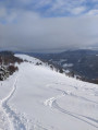
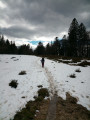
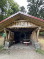
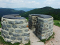
The summit and paragliding launch site at Le Drumont

A short, unpretentious walk offering a superb view from the summit of Drumont and a visit to the nearby paragliding launch site.

Details

n°59476343
Creation:
Last update:
Last review:
  • Walking
    Activity: Walking
  • ↔
    Distance: 0.94 mi
  • ◔
    Average duration: 0h 35 
  • ▲
    Difficulty: Easy

  • ⚐
    Back to start: Yes
  • ↗
    Ascent: + 190 ft
  • ↘
    Descent: - 190 ft

  • ▲
    Highest point: 3,937 ft
  • ▼
    Lowest point: 3,747 ft

Photos

Description of the walk

The route starts from the car park at the end of Route du Drumont, on the left, at the foot of the war memorial and near the farmhouse inn.

(S/E) Head north-east and take the blue-and-white Blue Rectangle and White Rectangle marked path which starts to the left of the telecoms mast. Climb gently until you reach the junction with theGR®531.

(1) Turn right (south-west) towards the summit of Drumont, following theGR® (Blue Rectangle markings). You’ll soon reach the summit (orientation table; 360° panorama).

(2) Descend on the other side (south-southeast), still following the Blue Rectangle markings. You’ll reach the paragliding take-off site (information board from the French Free Flight Federation).

(3) Turn sharply to the right (north-west) and head back down along the Blue and White Rectangle-marked path. Pass the farmhouse inn on your left and the mast on your right, and you’ll soon reach the car park where you started (S/E).

Waypoints

  1. S/E : mi 0 - alt. 3,747 ft - Car park at the end of Route du Drumont
  2. 1 : mi 0.31 - alt. 3,839 ft - Junction with the GR531
  3. 2 : mi 0.47 - alt. 3,937 ft - Le Drumont (1,200 m)
  4. 3 : mi 0.66 - alt. 3,852 ft - Paragliding take-off site
  5. S/E : mi 0.94 - alt. 3,747 ft - Car park at the end of Route du Drumont

Notes

The Drumont farmhouse inn (S/E) serves food and has a few rooms. It is closed on Wednesdays and Thursdays.

Always be cautious and plan ahead when you're outdoors. Visorando and the author of this route cannot be held responsible for any accidents occurring on this route.

The GR® and PR® markings are the intellectual property of the Fédération Française de Randonnée Pédestre.

Reviews and comments

5 / 5
Based on 1 review

Reliability of the description
5 / 5
Ease of following the route
5 / 5
Route interest
5 / 5
louis35
louis35

Overall rating : 5 / 5

Date of your route : Aug 29, 2026
Reliability of the description : ★★★★★ Very good
Ease of following the route : ★★★★★ Very good
Route interest : ★★★★★ Very good
Very busy route : No

This short route starting from the farm offers panoramic views of the peaks; it’s a lovely, easy stroll.

Machine-translated

Other walks in the area

For more walks, use our search engine .

The GPS track and description are the property of this route's author. Please do not copy them without permission.