From Bouscarel to Palsou in Queyssac-les-Vignes

Discover the contrasts of Queyssac-les-Vignes. From the residential areas of Queyssac-bas, to the woodland beneath La Gratade, to the meadows along the Ruisseau du Palsou and Les Cloux, this village never fails to impress visitors.

Details

22529169
Creation:
Last update:
Last review:
  • Walking
    Activity: Walking
  • ↔
    Distance: 3.68 mi
  • ◔
    Average duration: 2h 00 
  • ▲
    Difficulty: Easy

  • ⚐
    Back to start: Yes
  • ↗
    Ascent: + 331 ft
  • ↘
    Descent: - 341 ft

  • ▲
    Highest point: 820 ft
  • ▼
    Lowest point: 472 ft

Description of the walk

Park at the junction of the D12 and the D12E3 on the gravel area reserved for the recycling bin.

(S/E) Follow the D12 towards La Croix du Battut.

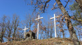
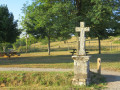
(1) At the Croix du Battut bread oven, turn right onto the stony path.

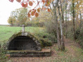
(2) Turn left, then quickly veer right onto a small grassy path leading to the Chapelle Saint-Blaise. Then rejoin the tarmac road and follow it to the right.

(3) Look out for the return path on your right and continue along the road. Pass the buildings at La Gratade, then turn left at the bend onto the path which leads further on to a track suitable for vehicles.

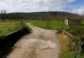
(4) Take the track on the right that runs alongside the Ruisseau du Palsou.

(5) Before reaching the hamlet of Blancou, take the small path on the right leading up towards the village.

(3) Follow the same route as on the way there to Pradel. Turn left to avoid the detour via the Chapelle Saint-Blaise this time.

(2) Carry on straight ahead and return to the car park (S/E).

Waypoints

  1. S/E : mi 0 - alt. 791 ft - Car park at Le Bouscarel – Route D12
  2. 1 : mi 0.28 - alt. 774 ft - Croix du Battut
  3. 2 : mi 0.47 - alt. 797 ft - Lower Queyssac
  4. 3 : mi 0.97 - alt. 794 ft - Junction for the return route
  5. 4 : mi 1.69 - alt. 486 ft - Vehicle-accessible track. Near the - Palsou (rivière) - Affluent de la Dordogne
  6. 5 : mi 2.16 - alt. 512 ft - Blancou
  7. S/E : mi 3.68 - alt. 791 ft - Car park at Le Bouscarel – Route D12

Notes

Head to the village to use the public toilets and picnic tables.
You can also enjoy the panoramic views from the two squares in front of and behind the church.

Worth a visit

Le Pradel: enjoy the panoramic views of the two squares in front of and behind the chapel.

Enter the grounds of the Saint-Blaise Chapel to read the information panel. Saint Blaise is celebrated every year on 3 February.

Reviews and comments

4.8 / 5
Based on 2 reviews

Reliability of the description
4.5 / 5
Ease of following the route
5 / 5
Route interest
5 / 5
Visiorando
Visiorando

Overall rating : 4.7 / 5

Date of your route : Feb 21, 2024
Reliability of the description : ★★★★☆ Good
Ease of following the route : ★★★★★ Very good
Route interest : ★★★★★ Very good
Very busy route : No

The walk was supposed to be 5.9 km. We found that it was actually 8 km. Please could you correct this?

Machine-translated

murielquintin34
murielquintin34

Overall rating : 5 / 5

Date of your route : Dec 05, 2023
Reliability of the description : ★★★★★ Very good
Ease of following the route : ★★★★★ Very good
Route interest : ★★★★★ Very good
Very busy route : Yes

I love hiking. Since my knee operation, my husband and I have been looking for easy walks, so I really like this route 👌😀

Machine-translated

Other walks in the area

For more walks, use our search engine .

The GPS track and description are the property of this route's author. Please do not copy them without permission.