


On the map in the smartphone app: click on the waypoints to see detailed guidance.
The gentle and peaceful Gaume region from Willancourt


Gaume, this beautiful hilly region in southern Belgium, is known for its mild climate. However, I have no idea if the area is popular with hikers... There are hiking markers all along the route. It is possible that you will encounter few or no people.
Details
Creation:
Last update:
Last review:
–
–
-
 Activity: Walking
 -
 Distance: 11.16 mi
 -
 Average duration: 6h 00
 -
 Difficulty: Moderate
 -
-
 Back to start: Yes
 -
 Ascent: + 974 ft
 -
 Descent: - 974 ft
 -
-
 Highest point: 1,148 ft
 -
 Lowest point: 797 ft
-
 Country:
Belgium
Country:
Belgium
-
 Area: Massif des Ardennes
 -
 City:
Aubange
City:
Aubange -
 Start/End: N 49.57916° / E 5.700788°
 -
 IGN map(s): Ref. 3210E
 -


 Hour-by-hour weather
Photos

Description of the walk
Waypoints
- S/E : mi 0 - alt. 837 ft - Willancourt communal playground
- 1 : mi 0.9 - alt. 1,066 ft - Intersection
- 2 : mi 1.52 - alt. 988 ft - Grassy path
- 3 : mi 1.76 - alt. 988 ft - Cross
- 4 : mi 2.57 - alt. 850 ft - Gennevaux
- 5 : mi 3.43 - alt. 974 ft - Route
- 6 : mi 3.65 - alt. 994 ft - Path
- 7 : mi 4.24 - alt. 1,047 ft - Bois de Pertot
- 8 : mi 4.92 - alt. 863 ft - La Grande Fin
- 9 : mi 5.32 - alt. 817 ft - Cycle path
- 10 : mi 6.4 - alt. 856 ft - Bench
- 11 : mi 7.59 - alt. 1,083 ft - GR trail
- 12 : mi 8.26 - alt. 1,125 ft - Intersection
- 13 : mi 8.6 - alt. 1,112 ft - Crossroads
- 14 : mi 9.25 - alt. 902 ft - Rachecourt Cemetery
- 15 : mi 9.45 - alt. 889 ft - Rue Bizeury
- 16 : mi 10.17 - alt. 1,093 ft - La Brûlure
- 17 : mi 10.93 - alt. 991 ft - Trail through the woods
- S/E : mi 11.16 - alt. 837 ft - Willancourt communal playground
Notes
Easy and free parking is available near the church or the Willancourt municipal playground.
There are several benches and picnic tables along the route. However, there are no shops or water points.
Other walks in the area
Gaume circular between Rachecourt and Battincourt
 Visorando Member
 8.87 mi
+961 ft
-984 ft
4h 55
Moderate
8.87 mi
+961 ft
-984 ft
4h 55
Moderate
 Departure from Aubange (Province de Luxembourg)
A pleasant walk in Gaume, even in gloomy weather, through countryside and forests.The route begins by climbing up to the plateau overlooking Rachecourt before descending into the depths of the Batte valley.After the small reed pond, the route crosses the country ridge before descending to Battincourt, where the playground offers a few benches and a welcome picnic table.In Battincourt, the walk follows the marked "Les Sept Sources" trail in the opposite direction until just beyond the Battincourt ponds.On the way back, the route passes through a lovely arboretum!Please note that some sections, such as the Bois de Pertot, can be very muddy.
In the footsteps of the iron miners
 11.60 mi
+1,585 ft
-1,568 ft
6h 45
Moderate
Departure from Musson (Province de Luxembourg)
11.60 mi
+1,585 ft
-1,568 ft
6h 45
Moderate
Departure from Musson (Province de Luxembourg)
This very natural route takes you on a journey of discovery through the wooded hills on the border between the Batte (Belgium) and Coulmy (France) valleys.Anyone with even a passing interest in the region's industrial history will also discover its mining and steel-making past, highlighted by the Transfrontier Iron Mines Trail and a number of information panels along the route.The trail passes by some of the iron mines that brought prosperity to the region in the 19th and 20th centuries, as well as the Musson slag heap, which over time collected all the slag from the mines on the Musson and Halanzy sides. Now cleaned up, it has been turned into a nature reserve managed by the DNF (Nature and Forestry Division).
Halanzy – Habay-la-Neuve
 14.09 mi
+991 ft
-568 ft
7h 20
14.09 mi
+991 ft
-568 ft
7h 20
 Difficult
Departure from Aubange (Province de Luxembourg)
Difficult
Departure from Aubange (Province de Luxembourg)
As the weather is set to be rainy with thunderstorms all day, I’m sticking to the main roads – even the major routes – to get to my destination for the day, Habay-la-Neuve, as quickly as possible. I’m staying in a hotel in the town. The stop (E) is therefore at my discretion.
Le Trou du Beau Bois
6.48 mi
+397 ft
-390 ft
3h 20
Moderate
Departure from Aubange (Province de Luxembourg)
This route straddles a linguistic border, the one that divides Belgian Lorraine into two cultural zones.
To the west lies the Gaume, characterised by Gaumais, a Lorraine dialect of Latin origin.
To the east, the Pays d’Arlon is characterised by a Germanic dialect, Moselle Franconian.
The place-names, sometimes Latin and sometimes Germanic, allow you to trace the course of this cultural boundary.
In the Gaume Natural Park
 7.17 mi
+568 ft
-581 ft
3h 50
Moderate
Departure from Saint-Léger (Belgique) (Province de Luxembourg)
7.17 mi
+568 ft
-581 ft
3h 50
Moderate
Departure from Saint-Léger (Belgique) (Province de Luxembourg)
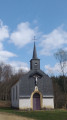
Start at the Ermitage de Saint-Léger, continue towards the Trou du Pérou and its waterfall, pass by the Étang du Fourneau David, then the Source Pétrifiante, and finish by crossing the Bois de Saint-Léger.
Along the Chiers between Lexy and Cons-la-Grandville
 6.30 mi
+433 ft
-456 ft
3h 15
Moderate
Departure from Lexy (Meurthe-et-Moselle)
6.30 mi
+433 ft
-456 ft
3h 15
Moderate
Departure from Lexy (Meurthe-et-Moselle)
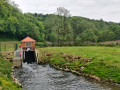
A walk along the Chiers, on a mainly tarmac-surfaced and easily accessible route. This walk takes you close to former industrial and production sites that are now disused. In the tranquillity of the forest, imagine the hum of activity from days gone by still echoing amongst the trees and the remnants of the past.
Mining heritage in Lasauvage and Fond-de-Gras
 13.12 mi
+1,142 ft
-1,135 ft
7h 00
Difficult
Departure from Differdange (Luxembourg (Country))
13.12 mi
+1,142 ft
-1,135 ft
7h 00
Difficult
Departure from Differdange (Luxembourg (Country))
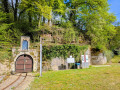
Lasauvage and Fond-de-Gras are must-see sites for understanding the mining history of this cross-border region.The railway line between Fond-de-Gras and Pétange was built in the 19th century to facilitate the transport of iron ore from the hills to the steelworks and foundries located on the plain.The narrow-gauge network, which can be seen in both Lasauvage and Fond-de-Gras, was used to transport the ore from the underground mine galleries to the transfer points.Fond-de-Gras, formerly known as the Lamadelaine industrial station, has now become a living museum of the region’s mining and industrial past and houses magnificent relics from days gone by. It is also the home of the ‘Train 1900’ and ‘Minièresbunn’ (underground) tourist trains, which operate mainly at weekends and on public holidays from May to September.
The Montauban Spring and Fourneau Marchand
 9.70 mi
+709 ft
-725 ft
5h 05
Moderate
Departure from Etalle (Belgique) (Province de Luxembourg)
9.70 mi
+709 ft
-725 ft
5h 05
Moderate
Departure from Etalle (Belgique) (Province de Luxembourg)
A pleasant walk passing through Montauban, the Fourneau Marchand fish market and crossing the old railway line. In summer, you can enjoy a drink on the terrace at the Fourneau Marchand!
For more walks, use our search engine .
The GPS track and description are the property of this route's author. Please do not copy them without permission.

