Country:

 City:


Approximately 1 km after the Pic de Nore, the starting point is at the junction of the D87 with a forest track branching off to the right.
(S/E) There is no marked path for the first 200 metres. You need to head into the undergrowth and make your way down the slope. The stream bed, although dry, is easily discernible. The first drops of the Clamoux soon come into view.
(1) Follow the unmarked path along the stream, which appears on the right bank
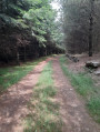
(2) You’ll soon come to a forest track on the right which leads away from the stream. This is the Route Forestière de Peyremaux, which you should follow uphill to the right.
(3) You’ll cross a stream at a bend. A path plunges down the slope on the right-hand bank: follow it past the Ruins of La Goutine and then some other ruins a little further down. The path then descends more steeply, offering two options:
- stay on an old path between two dry-stone walls,
- or take the more recent path which winds a few metres away from it.
When you reach the Pont des Cloutels, you’ll find a stone slab spanning the stream of the same name
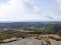
(4) Follow the path marked with yellow lines, an orange dot, and yellow and green lines as it continues along the hillside. You’ll reach La Pompidoira, where the woodland landscape suddenly opens up to reveal a lovely view of the Gorges de la Clamoux and a few surrounding hamlets.
(5) Continue along the path heading south-west to reach the entrance to the village of Laviale, the main hamlet in the commune of Castans.
(6) Walk down to the bottom of the hamlet, following the signposts, and continue the descent. The slope becomes steeper.
Just before rejoining the Clamoux at the Moulin de Bru, the path crosses a grassy track. In a few minutes, you’ll reach the Moulin de Bru, the Clamoux and a small hydroelectric power station with an information board (E).
(E) 2 hours 35 minutes after setting off, you’ll reach the D189, which marks the end of the walk.


 Visorando Member
 Association / Club / Walk leader