Country:

 City:


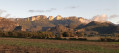
Start from Place du Riousset in Rochefort-Samson.
(S/E) From the car park, head towards the village centre via Rue des Fontaines and join the D125 (Route de Chabeuil), turning left onto it, until you reach the next junction.
(1) Turn left onto Chemin des Blaches, heading towards Les Blaches, La Chapelle and Les Artailles, until you reach a four-way junction at the top (with a fire hydrant on your right).
(2) Ignore Les Blaches and Les Artailles, and head due south along the ridge (Chemin de Barbières). At the next junction, carry on straight ahead (Côte de Bellevue), skirt the cemetery and reach the Grande Rue in the centre of Barbières.
(3) Turn left, walk past the church and carry on until you reach the cliffs and a junction. Turn right to cross a small bridge and head along the Route des Chovets until you reach a multi-way junction.
(4) Turn left onto theD119A, towards Saint-Vincent-la-Commanderie, and carry on straight ahead. Ride through the village, keeping towards Peyrus, then continue on the D102, towards Chabeuil, until you reach the next junction.
(5) Head straight ahead towards Peyrus centre and, at the church, turn sharp right onto the D262 towards Châteaudouble. Drive through the village, passing the town hall and the church, until you reach a three-way junction with a wayside cross.
(6) Take the D262 towards Combovin and follow it to a four-way junction, just after crossing a small bridge
(7) Turn right onto the D154 towards Barcelonne, then 350 m further on, leave the Chabeuil road and take the D401 uphill to the left, towards Barcelonne. Continue to the junction with the D188.
(8) Ignore the sign for Chabeuil and turn left towards Barcelonne. Drive straight through the village and continue until you reach a road on the right.
(9) Follow this road towards Montvendre and head for the village centre.
(10) Turn right, passing the school and then the church. At the bend, head north-west along Chemin des Sables and follow the sign for the Tour de la Petite Raye cycle route no. 3.
(11) At the junction in the hamlet of Claveton, first turn left then right to stay on the same path. Continue straight on at the next junction, passing the sand quarries – hence the road’s name – and arrive opposite the Chabeuil cultural centre.
(12) Turn left onto Chemin du Pré des Dames and follow the green space until you reach the swimming pool and the church.
(13) Turn left onto Rue des Remparts, heading towards the town centre.
(14) In front of the fortified gate, cross the bridge over the Véore, then turn immediately right towards the market area and the post office. Then join the cycle path; to the left of this is Avenue Georges Abel. Carry on straight ahead, continuing along Avenue Marcel Courthial, and leave the town.
(15) Cross the Route du Vercors (D68), then continue straight ahead onto Chemin de la Jeanette. At Bourbourées, continue straight ahead along Chemin de la Limacole until you reach the junction with the D119.
(16) Carry on straight ahead towards Charpey, passing the Valence-Saint-Didier golf course, then enter the village of Saint-Didier and reach a four-way junction just after No. 65.
(17) Carry on straight ahead along Route du Tram, cross the bridge towards Bésayes, then, at the three-way junction that follows, keep left and pass to the left of the car repair garage.
(18) At the Stop sign, turn left onto the D102, towards Bésayes. At the entrance to the village, turn right onto Chemin de Saint-Flour. Road cyclists take note: this section of road is unpaved as far as the junction by the care home.
(19) Continue straight on towards Marches, and stay on this road until you reach a four-way junction within sight of the village.
(20) Turn right onto Route de Fiancey, then, 750 m further on, turn due north onto Route de la Barberolle. At the next junction, carry on straight ahead and continue to the next Fork in the road.
(21) Turn right, cross a road (D149) and take the road opposite, Route de Samsonnes, until you reach a three-way junction.
(22) Turn right, towards Les Pivats, facing the mountain. In the hamlet, stay on Route de Samsonnes, keeping to the right. 500 m further on, after a steep but short climb, turn left towards Fleurs (carpentry firm). Continue until you reach a steep descent and, after crossing a stream, climb back up to the Favons district. Carry on until you reach a Stop sign at the end of Chemin des Favons.
(23) Turn right (D124) then, at the give-way sign, turn right again onto the D125 towards Rochefort-Samson and head for the Place du Riousset (S/E).

 Visorando Member
 Easy

 Moderate