From the heights of the Buène to the Alze and Fon valleys
With its focus on the woodland, this walk will take you along the valley floor, beside streams, and proves particularly pleasant when you’re looking for a bit of cool relief.
(S/E) Take the road on the right. At the junction, follow the D595 to the right for 100 metres. At the bend, take the farm track opposite and turn immediately right onto a grassy track to reach the valley and follow the streams of La Fon and L’Alze.
(1) Follow the stream downstream, keeping to the right bank, until you reach the Route de l’Iraldie.
(2) Turn right. At the first bend, carry straight on to leave the road and take a grassy track alongside a field hedge to reach Bel Air Farm (remember to close any gates if necessary).
(3) At the road, turn right and head towards the Poultrasses junction.
(4) Leave Poultrasses on your left and follow the farm track to the right. Continue straight on until you reach the Route de Puech Redon.
(5) Take the road on the right to reach the Notre-Dame de Buenne Chapel (S/E).
Waypoints
S/E : mi 0 - alt. 2,415 ft - Notre-Dame de Buenne Chapel
4 : mi 3.52 - alt. 2,142 ft - Crossroads towards Poultrasses
5 : mi 4.48 - alt. 2,365 ft - Route de Puech Redon
S/E : mi 4.64 - alt. 2,415 ft - Notre-Dame de Buenne Chapel
Notes
Practical information
Toilets and drinking fountains are available in the square by Saint-Amans Church, at the Goutrens village hall and near the community hall at Puech de Cassagnes-Comtaux
Picnic tables: Puech de Cassagnes, the Croix de Bel viewpoint and the Borie de Cassagnes drystone shelter
Recommendations
- Wear suitable footwear. - Bring some food and drink. - Walkers follow the route at their own risk. They remain responsible for any accidents they may suffer and for any damage they may cause to others (forest fires, vandalism, pollution, etc.). - Stick to the marked paths and do not take shortcuts. If the route has been altered, follow the new signposting. - Keep a low profile. We are not the only ones using the paths; be considerate of others. - Take your rubbish away with you. Leave no trace of your visit; do not throw anything on the ground; carry a rubbish bag with you. - Keep your dog on a lead, particularly near homes or livestock. - Close gates and fences behind you, and walk around crops. We should respect the work of those who shape and preserve our environment. - Observe the rules in certain areas. - Do not light fires. Areas with dense vegetation (forests) or those that are too exposed (scrubland, dry heathland, etc.) can catch fire very quickly. - Do not drink water from streams. Clear water does not necessarily mean it is safe to drink. - Check hunting seasons; some routes may be dangerous.
·Marcillac vineyards; Domaine du Cros (sales and tastings)
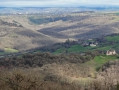
·Panoramic views over the Marcillac vineyards, the Clairvaux valley and Bruéjouls
Viewpoints
·La Croix de Bel with an orientation table: panoramic views over the Glassac valley and the Aubrac and Cantal mountains
·The drystone shelter at Cassagnes with an orientation table: panoramic views of Vieux Cassagnes and the wine-growing valley of Clairvaux and Bruéjouls
·Le Puech de Cassagnes: panoramic views of the Clairvaux and Bruéjouls wine-growing valley
Reviews and comments
5 / 5
Based on 1 review
Reliability of the description 5 / 5
Ease of following the route 5 / 5
Route interest 5 / 5
User 21322327
Overall rating :
5 / 5
Date of your route : Jul 28, 2026 Reliability of the description : ★★★★★ Very good Ease of following the route : ★★★★★ Very good Route interest : ★★★★★ Very good Very busy route : No
To open this route on your smartphone, you must have the Visorando app installed. If not, got to the Apple Store (iPhone) or Google Play Store (Android) to download the app.



 Country:

 City:



 Tourist office
 Easy