From the Chalets d’Anterne to Lac de Pormenaz

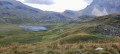
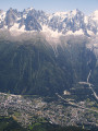
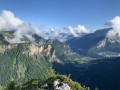
The entire route runs through a nature reserve, beneath the Rochers des Fiz ridge. From the Col d’Anterne, the view opens out onto the Mont Blanc Massif. The setting is magnificent: take your time!

Details

n°1489339
Creation:
Last update:
Last review:
  • Walking
    Activity: Walking
  • ↔
    Distance: 5.25 mi
  • ◔
    Average duration: 4h 00 
  • ▲
    Difficulty: Moderate

  • ⚐
    Back to start: No
  • ↗
    Ascent: + 1,854 ft
  • ↘
    Descent: - 1,371 ft

  • ▲
    Highest point: 7,405 ft
  • ▼
    Lowest point: 5,928 ft

Photos

Description of the walk

Red and white markings

(S) From the Refuge d’Anterne Alfred Wills, head 100 metres towards the Col d’Anterne.

No markings

At the fork in the road, leave theGR® 5, which heads straight on towards Lac d’Anterne, and turn left towards the Petit Col d’Anterne. Climb up through the mountain pasture and head north-east.

(1) At the Petit Col d’Anterne, turn right towards Lac d’Anterne. Climb a grassy ridge heading south-east, then due south. Head west until you reach a flat area.

(2) Continue south-west along a barely defined valley beneath the Frêtes de Willy.

(3) At the Fork in the road, turn right. You’ll arrive above the Lac d’Anterne basin; descend two hairpin bends and reach the junction with theGR® 5.

Red and white markings

Descend slightly southwards to the lake.

(4) Go round the lake to the east and continue towards the Col d’Anterne via the Chemin de Sixt to Chamonix (south). You’ll reach a stream below the Frêtes de Moëde.

(5) After a hairpin bend, the path climbs gently southwards to reach the Col d’Anterne (superb, close-up view of Mont Blanc).

(6) Descend the other side towards the Moëde Anterne refuge via a slightly steep, stony path.

(7) At a junction, turn left along the hillside towards the refuge (east).

(8) At the Moëde Anterne refuge, take the sheep track towards the Chalets de Moëde for 150 metres (south-south-west).

Unmarked

At a junction, leave theGR® 5, which descends to the left along the track, and continue along the ridge on the path towards Lac de Pormenaz (still south-south-west). At the Laouchet crossroads, continue straight ahead. At the Fork in the road, turn right and then reach a junction in a hollow.

(9) Ignore the path leading down to the right towards Les Argentières; take the path on the left and cross a torrent. After a few ascents and descents, you’ll reach a hilltop overlooking Lac de Pormenaz (E).

Waypoints

  1. S : mi 0 - alt. 5,932 ft - Refuge d'Anterne Alfred Wills
  2. 1 : mi 0.9 - alt. 6,683 ft - Petit Col d'Anterne
  3. 2 : mi 1.49 - alt. 6,949 ft - Flat stretch
  4. 3 : mi 1.99 - alt. 7,047 ft - Fork in the road
  5. 4 : mi 2.51 - alt. 6,765 ft - Lac d'Anterne
  6. 5 : mi 2.88 - alt. 6,814 ft - Torrent
  7. 6 : mi 3.54 - alt. 7,405 ft - Col d'Anterne
  8. 7 : mi 4.01 - alt. 6,759 ft - Junction
  9. 8 : mi 4.29 - alt. 6,549 ft - Chalet - hôtel de Moëde Anterne
  10. 9 : mi 5.03 - alt. 6,339 ft - Crossroads – depression
  11. E : mi 5.25 - alt. 6,398 ft - Lac de Pormenaz

Notes

Hike completed by the author on 15/09/2018.

(S) From the Chalets d’Anterne, the winding ascent towards Lac d’Anterne (4) to cross the saddle 300 metres higher up is not particularly interesting. If you take your time, a pleasant alternative route is to go via the Petit Col d’Anterne, also known as the Bas du Col d’Anterne (1).

This route partly follows theGR® 5. A description of this section of the route can be found in the TopoGuide ‘La Traversée des Alpes, Du Léman à la Vanoise par le Mont Blanc et le Beaufortain’, published by the Fédération Française de la Randonnée Pédestre under reference number 504.

The white and red markers have been replaced by the ‘Pays du Mont Blanc’ signposting system, consisting of directional signs with coloured pictograms.

Important note:
This stage involves camping by the shores of Lake Pormenaz, a must-see spot. You must therefore be suitably equipped (sleeping bag, etc.) and check the weather forecast to ensure that conditions will be favourable.
An alternative is to spend the night at the Moëde Anterne Mountain Hut (8) (water, toilets, bar-restaurant, accommodation). N.B. This mountain hut is often fully booked because:
- it lies at the junction of several routes (GR® 5,GRP® Tour du Pays du Mont Blanc, Tour des Fiz, Tour des Aiguilles Rouges, etc.),
- its panoramic terrace offers stunning views across the entire Mont Blanc massif,
If you’re spending the night at the refuge, make the most of the afternoon to take a round trip to Lac de Pormenaz.

This route passes through a protected area, which may be subject to special regulations:

Worth a visit

Nature reserves:
(From D to 6) the Sixt-Passy nature reserve,
(From 6 to A) the Passy nature reserve.

Lakes:
(4) Lake Anterne,
(between 8 and 9) Lake Laouchet, a small lake overgrown with aquatic vegetation,
(E) Lake Pormenaz, suitable for swimming.

Remarkable viewpoints
(From D to A) Rochers des Fiz, a stunning sunrise over the north face from the Chalets d’Anterne.
(1) Petit Col d’Anterne, panoramic view of the Cirque des Fonts and Mont Buet.
(6) Col d’Anterne, sweeping views of:
- the Mont Blanc massif (from the Aiguille du Chardonnet to the Dômes de Miage),
- the Aiguilles Rouges massif (the Brévent, the Aiguille de la Glière and the Aiguille du Belvédère),
- the Tête de Moëde,
- the Montagne d’Anterne,
- the Pointe d’Anterne,
- the Pointe Noire de Pormenaz.

Always be cautious and plan ahead when you're outdoors. Visorando and the author of this route cannot be held responsible for any accidents occurring on this route.

The GR® and PR® markings are the intellectual property of the Fédération Française de Randonnée Pédestre.

Reviews and comments

5 / 5
Based on 1 review

Reliability of the description
5 / 5
Ease of following the route
5 / 5
Route interest
5 / 5
stéphanie balthazar
stéphanie balthazar

Overall rating : 5 / 5

Date of your route : Aug 09, 2022
Reliability of the description : ★★★★★ Very good
Ease of following the route : ★★★★★ Very good
Route interest : ★★★★★ Very good
Very busy route : Yes

A lovely walk, with the chance to cool off during the picnic break. The colours are stunning – I’d recommend it without a moment’s hesitation.

Machine-translated

Other walks in the area

For more walks, use our search engine .

The GPS track and description are the property of this route's author. Please do not copy them without permission.