Laouchets de Platé

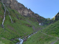
A journey through water and stone! The water of the four waterfalls along the route and that of the two Laouchets lakes. The stone of the Désert de Platé, at the foot of which the two lakes lie.

Details

3123200
Creation:
Last update:
Last review:
  • Walking
    Activity: Walking
  • ↔
    Distance: 10.02 mi
  • ◔
    Average duration: 7h 40 
  • ▲
    Difficulty: Difficult

  • ⚐
    Back to start: Yes
  • ↗
    Ascent: + 3,481 ft
  • ↘
    Descent: - 3,481 ft

  • ▲
    Highest point: 7,175 ft
  • ▼
    Lowest point: 3,855 ft

Description of the walk

Park in the Lignon car park at the end of the road.

(S/E) Take the path opposite, which follows both theGR® 5 and 96 (red and white markings). You’ll reach the junction where theseGR® routes split, near the first two waterfalls, the Sauffaz and the Pleureuse.

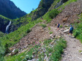
(1) Leave theGR®5on your left and continue straight ahead on theGR®96. Follow the Torrent de Sales, initially along its right bank. Cross it via the bridge at the hamlet known as Le Clos. Continue along its left bank until you reach the Pas de Sales, which offers a superb view of thethird waterfall, the Sales waterfall.

(2) Continue the climb southwards. Pass thefourth waterfall, the Trainant waterfall. Shortly afterwards, a relatively flat section leads to the Refuge de Sales.

(3) Stay on theGR®96, leaving the path to the Combe des Foges on your right, and reach the Y-junction with the path leading to the Brèche du Dérochoir.

(4) Keep to the right again on theGR®, cross the Grand Pré and come to another junction, where a path leads to the Passage du Dérochoir.

(5) Ignore this route and turn 90° to the right onto the GR®. Head up to a ridge overlooking the lakes.

(6) Leave theGR® here, turn right and head downhill following the view to reach the two lakes, known locally as the Laouchets.

(7) Follow the same route as on the way out to return to the starting car park, the Lignon car park (S/E).

Waypoints

  1. S/E : mi 0 - alt. 3,855 ft - Le Lignon car park
  2. 1 : mi 0.78 - alt. 4,751 ft - GR junction - Cascades de la Pleureuse et de la Sauffaz
  3. 2 : mi 1.68 - alt. 5,331 ft - Pas de Sales
  4. 3 : mi 2.63 - alt. 6,135 ft - Refuge de Sales
  5. 4 : mi 3.29 - alt. 6,273 ft - Brèche crossroads
  6. 5 : mi 3.83 - alt. 6,604 ft - Dérochoir crossroads
  7. 6 : mi 4.6 - alt. 7,175 ft - Ridge
  8. 7 : mi 5.01 - alt. 7,014 ft - Les Laouchets
  9. S/E : mi 10.02 - alt. 3,855 ft - Le Lignon car park

Notes

(3) Sales Mountain Hut, water point.

Worth a visit

Between (1) and (3): The four waterfalls.
(3) The Sales Refuge makes for an interesting stop on the way there, but especially on the way back.
(7) The lakes, offering a superb view of the rocky expanse of the Désert de Platé.

Always be cautious and plan ahead when you're outdoors. Visorando and the author of this route cannot be held responsible for any accidents occurring on this route.

The GR® and PR® markings are the intellectual property of the Fédération Française de Randonnée Pédestre.

Reviews and comments

4.5 / 5
Based on 2 reviews

Reliability of the description
5 / 5
Ease of following the route
3.5 / 5
Route interest
5 / 5
Les2FL
Les2FL

Overall rating : 5 / 5

Date of your route : Aug 26, 2026
Reliability of the description : ★★★★★ Very good
Ease of following the route : ★★★★★ Very good
Route interest : ★★★★★ Very good
Very busy route : Yes

A superb walk, the difficulty of which lies in the distance and the elevation gain; the path itself presents no technical challenges. The final climb after Grand Pré is a bit tough on the legs, but carrying on past the Sales refuge and on to the lakes is definitely worth it

Like all hikes in the area, the path can get very busy in summer, but by setting off early in the cool of the morning, we were able to tackle most of the climb almost on our own.
You pass through landscapes that are truly varied but all magnificent. We spotted ibex and marmots on our climb up to the Pas de Salles.
Thank you!

Machine-translated

bernardino
bernardino ★

Hello, and many thanks for this distance measurement. Unfortunately, heart rate monitors, pedometers, GPS devices and apps often give very different readings. And that’s the case here. The suggested route was created using the app. To check its accuracy, I plotted a route between various points on the road, the distance between which in kilometres is shown on the map. All you need to do is zoom out to see this distance. And what did I find? Well, the same figure. So, based on this measurement, the distances given for this route via the app are correct.
Enjoy exploring the site.

Machine-translated

Alain Pr
Alain Pr

Overall rating : 4 / 5

Date of your route : Aug 19, 2020
Reliability of the description : ★★★★★ Very good
Ease of following the route : ★★☆☆☆ Disappointing
Route interest : ★★★★★ Very good
Very busy route : Yes

Having completed this run – with a significant difference in distance between the route description and my Garmin heart rate monitor – we covered 24 km following the route described, rather than the 16 km stated; the elevation gain is just over 1,020+.

Machine-translated

Other walks in the area

For more walks, use our search engine .

The GPS track and description are the property of this route's author. Please do not copy them without permission.