Étang des Deux Frères via the footpaths and the GR®46

A walk mainly along footpaths, guaranteeing a complete immersion in nature.
Passes by the Étang des Deux Frères and two other nearby historic sites for the more curious.

Details

39235146
Creation:
Last update:
Last review:
  • Walking
    Activity: Walking
  • ↔
    Distance: 6.66 mi
  • ◔
    Average duration: 3h 05 
  • ▲
    Difficulty: Moderate

  • ⚐
    Back to start: Yes
  • ↗
    Ascent: + 36 ft
  • ↘
    Descent: - 36 ft

  • ▲
    Highest point: 564 ft
  • ▼
    Lowest point: 505 ft

Description of the walk

Start at the car park (first entrance to the forest).

(S/E) Take the Route Forestière de Louis XIII to the first junction.

(1) Turn right towards the south onto the Allée de Brocart until you reach the Route Forestière de Lourouer.

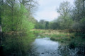
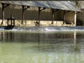
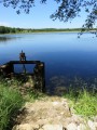
(2) Turn left towards the east onto the Allée des Deux Frères and continue to the pond of the same name.

(3) Pass the ruins of Grammont Abbey and join the Allée de l’Oratoire (several paths lead there); continue along this path, crossing the Route Forestière de l’Abbaye until you reach the Route Forestière de Berthommiers

(4) When you reach this road, follow it leftwards for 100 metres to join the Route Forestière de la Bernaise on your right. At the end, turn left to join theGR®46.

(5) Turn left onto the Route Forestière du Maine, which forms part ofthe GR®46, and continue until you reach the Route Forestière de Berthommiers. Turn right to reach Lourouer les Bois.

(6) At the Maison Forestière in Lourouer-les-Bois, take the path on the right onto the Red Cross Route Forestière and follow it down to the D67.

(7) Follow the road to the left towards the roundabout and turn left to return to (S/E).

Waypoints

  1. S/E : mi 0 - alt. 528 ft - Car park (first entrance to the forest)
  2. 1 : mi 0.53 - alt. 528 ft - Allée de Brocart
  3. 2 : mi 1.06 - alt. 538 ft - Allée des Deux Frères
  4. 3 : mi 2.15 - alt. 518 ft - Pond - Etang des Deux Frères
  5. 4 : mi 2.88 - alt. 515 ft - Route Forestière de la Bernaise
  6. 5 : mi 3.88 - alt. 531 ft - Route Forestière du Maine
  7. 6 : mi 5.27 - alt. 558 ft - Lourouer-les-Bois Forest House
  8. 7 : mi 6.35 - alt. 522 ft - D67
  9. S/E : mi 6.66 - alt. 528 ft - Car park (first access point to the forest)

Notes

This walk requires sturdy footwear, particularly towards the end of the Route Forestière de la Bernaise.

Worth a visit

Ruins of Château de la Motte (information available on the Allée du Riau de la Motte).
Ruins of Grammont Abbey (barely visible and no historical information).
Ruins of the Château du Maine (near theGR®46).

Always be cautious and plan ahead when you're outdoors. Visorando and the author of this route cannot be held responsible for any accidents occurring on this route.

The GR® and PR® markings are the intellectual property of the Fédération Française de Randonnée Pédestre.

Reviews and comments

4.7 / 5
Based on 2 reviews

Reliability of the description
5 / 5
Ease of following the route
5 / 5
Route interest
4 / 5
phil5mvb
phil5mvb
• Edited:

Overall rating : 4.7 / 5

Date of your route : Apr 13, 2026
Reliability of the description : ★★★★★ Very good
Ease of following the route : ★★★★★ Very good
Route interest : ★★★★☆ Good
Very busy route : No

A route with no particular difficulties.
A pleasant walk through the Chateauroux forest.

Machine-translated

Mic's
Mic's

Thank you for your feedback.
It’s true that at this time of year, and with the recent heavy rain, the path may be flooded.
Wishing you some lovely walks.
Mic's

Machine-translated

vanpraet
vanpraet

Overall rating : 4.7 / 5

Date of your route : Mar 11, 2024
Reliability of the description : ★★★★★ Very good
Ease of following the route : ★★★★★ Very good
Route interest : ★★★★☆ Good
Very busy route : No

A very pleasant walk; it was lovely to discover this pond. An interesting route through the forest, although there are a few sections that are difficult to navigate in wet weather.

Machine-translated

Other walks in the area

For more walks, use our search engine .

The GPS track and description are the property of this route's author. Please do not copy them without permission.