Discovering Terre-de-Bas

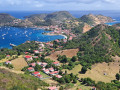
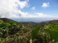
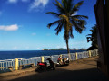
A walking route that will allow you to explore the natural environment of Terre-de-Bas: the dry forest along the coastline (watch out for manchineel trees), and the pools a little further inland with small tortoises. You’ll encounter a variety of landscapes along the way: a view of Le Pâté and a lovely view of Terre-de-Haut.

Details

n°539730
Creation:
Last update:
Last review:
  • Walking
    Activity: Walking
  • ↔
    Distance: 4.52 mi
  • ◔
    Average duration: 3h 00 
  • ▲
    Difficulty: Moderate

  • ⚐
    Back to start: Yes
  • ↗
    Ascent: + 1,086 ft
  • ↘
    Descent: - 1,083 ft

  • ▲
    Highest point: 774 ft
  • ▼
    Lowest point: 3 ft

Photos

Description of the walk

(S/E) From the jetty, follow the road leading to the village. Pass two junctions on the left to reach Grande Anse beach. Walk along the beach and continue straight ahead. You will reach a crossroads at the edge of the beach.

(1) Carry on along Rue de la Plage. At the end of the tarmac section, follow the path marked in yellow (watch out for manchineel trees; see the practical information). The path is obvious, the only one, and well marked once you reach the stony area. Enjoy the various views of the sea and Le Pâté, a small islet offshore. In the distance, you can see Basse-Terre.

(2) Go through the gate, which is actually a barrier for goats and other livestock. The path continues on the other side. Shortly afterwards, the path moves away from the coast and begins to climb. The forest thins out. Cross the clearings, still following the path.

(3) Go over the low wall with wooden barriers; the path continues to climb, sometimes over scree. The forest changes and becomes denser. Carry on climbing.

(4) You’ll reach a pond on slightly flatter ground. Shortly afterwards, a blue-marked path joins the trail; carry on straight ahead and you’ll reach another junction, this time with a red-marked path.

(5) Turn left to follow it, passing more pools along the way. The path begins to descend in wide bends. You’ll reach a road; continue downhill as straight as possible, sometimes on the road and sometimes on paths linking the roads.

(6) Finish the descent along the road leading to Grande Anse beach.

(1) Once at the beach, turn right to rejoin the road heading towards the jetty (S/E).

Waypoints

  1. S/E : mi 0 - alt. 10 ft - Jetty
  2. 1 : mi 0.7 - alt. 7 ft - Beach junction
  3. 2 : mi 1.53 - alt. 39 ft - Gate in a fence
  4. 3 : mi 1.99 - alt. 266 ft - Low wall
  5. 4 : mi 2.69 - alt. 761 ft - Pond
  6. 5 : mi 2.78 - alt. 768 ft - Junction/Red markings
  7. 6 : mi 3.64 - alt. 135 ft - Route to Grande Anse beach
  8. S/E : mi 4.52 - alt. 10 ft - Jetty

Notes

Warning: along the path you will come across manchineel trees (which resemble apple trees, as do their fruits); every part of this tree is poisonous, so do not seek shelter beneath it if it rains.

N.B. From (2), the route shown in purple on the IGN map is incorrect: stick to the route and description provided for the walk.

There are non-venomous grass snakes and tortoises in the ponds.

Wear suitable footwear, as it is often very hot.

Reviews and comments

4.3 / 5
Based on 2 reviews

Reliability of the description
4.5 / 5
Ease of following the route
4.5 / 5
Route interest
4 / 5
User 4576365

Overall rating : 4 / 5

Date of your route : Jun 15, 2026
Reliability of the description : ★★★★☆ Good
Ease of following the route : ★★★★☆ Good
Route interest : ★★★★☆ Good
Very busy route : No


A pleasant walk. Not too long, with lovely views of the sea and the Saintes archipelago.

Machine-translated

Janailhac
Janailhac

Overall rating : 4.7 / 5

Date of your route : Dec 27, 2019
Reliability of the description : ★★★★★ Very good
Ease of following the route : ★★★★★ Very good
Route interest : ★★★★☆ Good

The walk is more enjoyable when done clockwise rather than anti-clockwise.
At point 5, if you want to extend the walk in an interesting way, you can take the section of path that leads to the southern road and head down towards the village of Petites-Anses (not shown on the map).

Machine-translated

Other walks in the area

For more walks, use our search engine .

The GPS track and description are the property of this route's author. Please do not copy them without permission.