Country:
 City:
City:


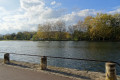
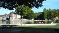
Start at the car park near the lock (restaurant housed in a former lock keeper’s cottage).
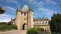
(S/E) Follow the footpaths (marked in red and white onthe GR® 213) towards the Porte de Sens. This gate has been a listed historic monument since 1882. Indeed, the town has managed to preserve the remains of its 12th-century fortified walls. Continuing along the route as far as the secondary school, you’ll also come across, on the right, the remains of the “Tour du Sorcier”, on which an early 19th-century dwelling is built.
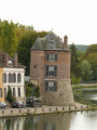
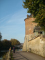
Before turning left into Rue de la Cornillate, take a look to your right: you’ll see the “Grosse Tour”, a royal keep built by Philip Augustus around 1210. Continue along Rue de la Grosse Pierre, keeping to the left.
(1) Turn right onto Route de Dixmont (D15). Continue in this direction until you reach the bridge. Pass under the D606 main road, then head up the hill on the right.
(2) Turn left onto the grassy path leading up to the Bois de Saint-Martin (marked with yellow and white-and-redGR® signs, either together or alternately). Follow the path to the end. At the top, as you emerge from the woods, take the path on your left for about fifty metres.
(3) Cross the road and continue straight ahead along the Route des Giltons. On reaching the hamlet, take the first street on the right (Rue Lemerle), then continue downhill along the first path on the right. Carry on until you reach the edge of the woods and take the stony path on the right for a few metres before heading uphill to the left along the path at the edge of the woods.
(4) At the junction, turn right towards the hamlet of Les Thénots. Then carry on straight ahead (tarmac road) towards La Millerie. Continue straight ahead (yellow markings).
(5) At Valprofonde, turn right twice in quick succession to cross the Ru Galant towards the chapel. Cut across the D232 and take the path opposite (Chemin de Château Feuillé). A few metres further up, at the Fork in the road, head up to the right. Cross the woodland.
(6) As you emerge from the woodland, turn left and carry on straight ahead along the lovely avenue lined with trees. Pass in front of the gates of Château de Palteau. Cross the junction with the D122 and follow it to the sign marking the hamlet’s exit a little further down (beware of two conflicting yellow markings).
(7) Take the grassy path to the right of the sign. Follow it for over a kilometre, then head downhill to the left towards Armeau along the first path after the edge of the woods. Once you reach the RD122, a few metres further down, take the street on the right (Rue de Bellevue). Follow it for a few hundred metres and turn right onto the grassy verge until you reach the junction.
(8) Before the Chemin de Larris, head uphill to the right (EDF meter box). Further up, at the Fork in the road (elevation 136), continue to the right. Reach Beaudemont via the Chemin de la Treille. At the road running through Beaudemont, turn left then right to join the Ruelle du Coq. At the end of this lane, turn left, then right, and continue to the Route de Chantereine. Cross it and continue opposite, along the Rue de Chantereine.
(9) Turn left onto a grassy track and, at the end of it, turn right.
(10) Turn right, then immediately left. Continue along a grassy path that alternates between open and wooded areas until you reach a path running perpendicular to it; head down this path to the left. Pass in front of a reservoir.
(11) Turn left onto the path that runs alongside the bushes.
(12) At the junction of the paths, head down to the right. Cross the road and continue straight ahead. Turn right and go down the steps. Head left, walking alongside the stadium (Rue du 11 novembre 1918). Continue to the right and follow Rue des Fossés.
Where it ends at Avenue du Général de Gaulle, cross to the opposite side, turn right and then head down to the left onto the promenade. When you reach the banks of the Yonne, head down the towpath to the right. Go under the bridge and continue straight on to return to the starting point (S/E).



 Tourist office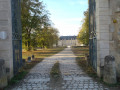

 Easy
Easy 
 Visorando Member