Country:
 City:
City:


The starting point is at the car park near the lock.
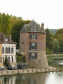
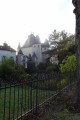
(S/E) Immediately opposite, take the Boulevard Marceau promenade (red and white signposts). Cross Rue Carnot (the main street) and continue straight ahead along Boulevard Victor Hugo. As you walk, admire the Grosse Tour on your right, as well as the Chateaubriand secondary school a little further on to the left. Continue along these Villeneuve promenades (blue signposts).
(1) Cross Rue de Valprofonde and carry straight on along Boulevard Gambetta. Pass Rue du Puits d’Amour and continue along Rue du Faubourg de l’Espérance, then onto Route de Beaudemont (the road, not Rue de Beaudemont, which is on the right). At the end of this road, turn left. Pass under the bridge over the D606.
(2) Go up the stairs on the right. Take the path at the top of the steps, continue for about 150 metres and follow the second path on the left, which leads onto Route de Beaudemont. Cross this road to continue along the path directly opposite. A section with a moderate gradient begins here. About 250 metres further up, head slightly to the right (blue markings) to reach the Chemin de la Voie Creuse.
(3) Then head up to the left. After about 80 metres, turn left (yellow markings); walk a little way to get a clear view of the path. Continue for about 800 metres, ignoring any side paths.
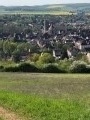
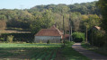
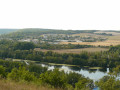
(4) Turn left, then head down this path. Enjoy the lovely views of the countryside around Villeneuve-sur-Yonne. After passing the reservoir, take the path on the left about 30 metres further down, which will gradually lead you back towards the town. Continue for about 500 metres to reach a cross-path.
(5) Head down to the right to cross the Route de Beaudemont once more. Join the outbound route by turning right.
(2) Go down the stairs (be careful, as some steps are damaged). Cross the bridge and carry on straight ahead to continue along Rue du 11 Novembre. Opposite the cemetery, turn right into Rue des Fossés. You’ll come out onto Avenue Charles de Gaulle. Turn left and leave this avenue by taking the first right (Rue du Port).
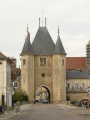
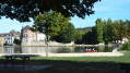
(6) Return to the River Yonne via Quai du Commerce. Turn right and keep the river on your left until you return. Pass the Bonneville Tower, then a little further on the Rousson Tower, before returning to the lock car park (S/E).

 Tourist office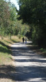


 Moderate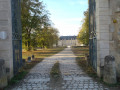
 Visorando Member