Country:
 City:
City:


Car park near the lock (restaurant housed in a former lock keeper’s cottage).
(S/E) Follow the walking trails (marked in red and white onthe GR® 213) towards the Porte de Sens. This gate has been listed as a Historic Monument since 1882. Indeed, the town has successfully preserved the remains of its 12th-century fortified walls. Continuing along the route as far as the secondary school, you will also come across, on the right, the remains of the “Tour du Sorcier” (Wizard’s Tower), on top of which stands a house dating from the early 19th century.
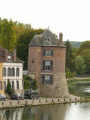
(1) Before turning left onto Rue de la Cornillate, take a look to the right: you’ll see the “Grosse Tour”, a royal keep built by Philip Augustus around 1210. Continue along Rue de la Grosse Pierre, keeping to the left. Turn right onto Route de Dixmont (D15). Carry on in this direction until you reach the bridge. Pass under the D606 main road.
(2) Just after the bridge, turn right onto the Chemin de la Cytrière. After a few hundred metres, turn left onto a grassy path leading up to the Bois de Saint-Martin. This hill overlooks the town to the north-east and rises to 170 metres. The people of Villeneuve have kept up the tradition of visiting this hillside every Easter Monday to take part in the ‘Roulée’ – a race with hard-boiled, coloured eggs.
(3) Where the path splits in two, turn left onto the grassy path (yellow markings and white and red GR® markings) and follow it to its end, which coincides with the end of the white and red markings. Then follow the yellow markings. At the crossroads, turn left onto the dirt track and follow it to the next junction.
(4) At the crossroads, take the tarmac road on the left (Chemin de Flandres). On the way, you’ll pass through the hamlet of Champ du Guêt: this high vantage point was once an observation post on the plateau, overlooking the Yonne valley. Continue along the road to the hamlet of Flandres. Walk through the hamlet.
(5) Take the stony track on the left (Chemin de la Tramée), which leads to the hamlet of Talouan. When you reach the centre of the hamlet, carry on straight ahead along the D5 (Route des Bordes) towards the exit of the hamlet. As you pass through, cross the Rû Saint-Ange and continue straight on. The road turns sharply to the right.
(6) At the bend, take the grassy track straight ahead, which climbs steeply northwards. When you reach the top, at a reservoir, carry on straight ahead. At the next Fork in the road, a few hundred metres further on, turn right towards the hamlet of Vaufoin.
(7) You’ll come to a tarmac road (with a pond on the right). Follow it to the left for about fifty metres, then turn right (Chemin des Courtaudes). Leave the hamlet and stay on the tarmac road which, after a few hundred metres, bends to the left, then joins the Route de Beaujard at La Grange au Doyen. The yellow markings have disappeared.
(8) At the bend, turn left onto the track and continue straight on until you reach the edge of the woods. Do not take the first track on the left but carry on until you reach a junction of tracks, about a hundred metres further on.
(9) At the crossroads, take the road to the right for a few hundred metres, then turn left onto a grassy track. Follow it to the end, as far as the Cochepie underground aqueduct, which can be recognised by its white-painted wooden posts. The springs of the Cochepie Valley have been channelled and are carried northwards via an underground aqueduct; from this point, you walk alongside its structures.
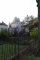
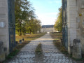
(10) Turn left whilst walking along the edge of the woodland. Pass over the underground aqueduct (still marked by white-painted wooden stakes) to reach a tarmac road at a corner of the boundary wall of the Château de Passy (private property): This 17th-century château, built by the Bishop of Nevers, is now owned by the Caisse des Écoles of Paris’s 13th arrondissement and houses an archaeological research centre. Follow the castle wall to the next corner (whilst you’re at it, take a look at the castle) then turn left onto the Route de Beaujard. Leave the village, passing the last house and an underground reservoir on the right.
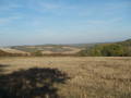
(11) A few metres further on, after entering the woods, take the first path leading uphill to the right towards the hamlet of Les Beauregards. You’ll come across yellow markings again. You’ll soon emerge from the woods. Cross the Cochepie underground aqueduct once more (white-painted wooden posts), then take a path on the left. Cross the aqueduct again and continue uphill. Turn round halfway up the slope to admire the view.
(12) After the cluster of oak trees lining the path (marker on a tree), at the Fork in the road, turn right for a few metres. Turn left immediately. You’ll reach the aqueduct (white posts) and follow it for about a hundred metres.
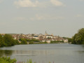
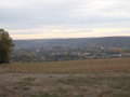
(13) Then take the first path on the right. You’ll emerge above Villeneuve-sur-Yonne (lovely view) and then, at the ridge, head down into the valley. At the high-voltage pylon, carry straight on to the property below, ignoring the paths to the right and left.
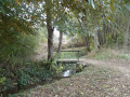
(14) Turn left. Follow the path alongside a wall; it leads to the Chemin des Cannes. Turn right onto this path to reach the Rû Saint-Ange. The wide path turns into a track that runs alongside the stream until you reach the footbridge, which you cross. Continue along the Chemin de Cochepie until you reach the D15 (Route de Dixmont).
(15) Follow it to the right towards Villeneuve-sur-Yonne. When you reach the bridge, follow the route you took on the way out in the opposite direction (white-and-red markings) to return to the starting point: turn left onto Rue de la Grosse-Pierre, then right onto Rue de la Cornillate, and finally right again to head down Boulevard Victor Hugo to the car park on the banks of the Yonne. (S/E)


 Tourist office
 Easy
Easy 
 Visorando Member