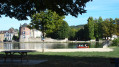
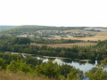
Around the carp fishing lake

This pleasant route features a diverse range of flora and fauna. It is a real paradise for anglers (especially carp anglers, including those who fish at night). The path skirting the lake is also dotted with fitness trail equipment.

Details

n°1429773
Creation:
Last update:
Last review:
  • Walking
    Activity: Walking
  • ↔
    Distance: 3.00 mi
  • ◔
    Average duration: 1h 25 
  • ▲
    Difficulty: Easy

  • ⚐
    Back to start: Yes
  • ↗
    Ascent: + 10 ft
  • ↘
    Descent: - 10 ft

  • ▲
    Highest point: 243 ft
  • ▼
    Lowest point: 226 ft
  • ⚐ Country: France
  • ⚐ City: Villeneuve-sur-Yonne (89500)
  • ⚑
    Start/End: N 48.085981° / E 3.292559°
  • Accessible from the train station Gare de Villeneuve-sur-Yonne.
  • Hour-by-hour weather

Photos

Description of the walk

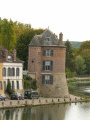
The starting point is at Lock No. 6 in Villeneuve-sur-Yonne, very close by in the former waterworks building, now converted into a restaurant (Au Vieux Tilleul).

(S/E) Take the towpath on the right bank of the Yonne, continuing straight on (the river will be on your left). At the junction with the path leading to the sewage treatment works, continue straight on.

(1) At the next junction, take the path branching off to the right (under the high-voltage power lines), following the lake on your left, which is visible in places. The path skirts the lake to the right, running parallel to the RD606.

(2) A few hundred metres further on, at the Fork in the road, take the path on the left which continues to run alongside the lake. Follow this path as it turns to the right, whilst still running alongside the lake.

(3) The path turns left, then shortly afterwards turns left again, whilst remaining alongside the same lake.

(4) At the next junction, turn left onto the towpath, which runs between the river on your right and the lake on your left. Continue straight on, passing the leisure centre (on your left).

(1) Follow the same route you took on the way there in the opposite direction until you reach the starting point (S/E).

Waypoints

  1. S/E : mi 0 - alt. 233 ft - Lock No. 6 at Villeneuve-sur-Yonne
  2. 1 : mi 0.68 - alt. 230 ft - High-voltage power line
  3. 2 : mi 1.24 - alt. 236 ft - Junction
  4. 3 : mi 1.59 - alt. 230 ft - Turn left at the junction
  5. 4 : mi 1.91 - alt. 230 ft - Banks of the Yonne
  6. S/E : mi 3 - alt. 233 ft - Lock No. 6 at Villeneuve-sur-Yonne

Notes

A flat route, with no difficulty at all, alternating between shaded and sunny sections depending on the time of day.

Worth a visit

Reviews and comments

4.7 / 5
Based on 1 review

Reliability of the description
5 / 5
Ease of following the route
5 / 5
Route interest
4 / 5
J.Ph.G
J.Ph.G

Overall rating : 4.7 / 5

Date of your route : May 03, 2024
Reliability of the description : ★★★★★ Very good
Ease of following the route : ★★★★★ Very good
Route interest : ★★★★☆ Good
Very busy route : Yes

A really lovely walk – expect to come across quite a few anglers.

Machine-translated

Trognonnette
Trognonnette

Thank you very much, Élodie, for your reply and for the change you made! That’s very kind of you!
Yes, yes, we really enjoyed the walk we went on, thank you very much.

Thanks again, and all the best!

Machine-translated

OT Sens
OT Sens ★

Hello Trognonette,
Thank you for letting us know about the starting point for this walk! We’ve updated the walk description this morning to make the starting point easier to find!
We hope you had a lovely walk in Villeneuve-sur-Yonne!
Elodie from the Sens and Sénonais Tourist Office

Machine-translated

Trognonnette
Trognonnette

We had a bit of trouble figuring out where to go to find the sixth lock!...
In the end, we went for a stroll in Villeneuve-sur-Yonne along the banks of the Yonne... it’s a lovely spot.

Machine-translated

Other walks in the area

For more walks, use our search engine .

The GPS track and description are the property of this route's author. Please do not copy them without permission.