Country:
 City:
City:


Throughout the first part of the route, from the starting point to (6), follow the red and white markings ofthe GR®213.
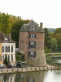
(S/E) From the car park in front of the Maison de l’Eau (now converted into a restaurant), walk upstream along the River Yonne via Avenue Roland Bonnion and then Quai Bretoche, until you reach the restaurant La Lucarne aux Chouettes. Take the staircase directly opposite you on the left to reach the bridge.
(1) Turn right to cross the river and then continue straight on along Faubourg Saint-Laurent. At the junction, cross over to take the underpass opposite, which goes under the railway line. Then turn right, then immediately left to follow a narrow, fairly steep path that winds its way through the gardens.
(2) When you reach the top, turn left. After a few hundred metres, turn right onto a wide path that leads uphill. Pass under two medium-voltage power lines. You’ll come to a tarmac road serving a few detached houses (Chemin des Quarts Froids). Continue straight on along this road until the next junction (wrought-iron cross, high-voltage power line). Keep going in the same direction for about a hundred metres.
(3) Turn left onto Rue Saint-Vincent and walk for about 200 metres along this road. Then take a narrow path that appears on the right (marker post with aGR® sign). This path descends quite steeply through thorny bushes until it reaches a road at the bottom of the slope. Turn right onto this road, then at the next bend, continue along the dirt track opposite. Cross the woodland and reach the RD72.
(4) Cross the RD72 and follow the path opposite which crosses the Thénard estate. Stay on this path (GR®213, red and white markings), continuing in the same direction without paying attention to the various paths, large and small, that you come across.
(5) At the bottom, at the metal gate, take the wide path on the right for a few dozen metres to reach a second wooden forest gate, before continuing towards the Fontaine Rouge site. A short detour to the left is recommended to explore the very pretty site of the headwaters of the Ru de Bourienne, which, according to legend, sprang from beneath King Saint Louis’s lance. Retrace your steps back to the gate. Turn left and then continue straight on for nearly 2 km to reach the “Fontaine Rouge” site.
From this point until you return to (2), follow the yellow and redGRP® markings.
(6) Turn slightly to the right onto the stony path leading up to the Bois du Marteau. When the path begins to descend, head up to the right along a wide path. At the reservoir, turn right. On reaching the ridge, continue to the road.
(7) Head downhill to the left; cross the RD72 to take the path opposite. After a few steps (less than 100 metres), turn right towards the “Montagne de Bussy”.
(8) Just before the ridge, turn left towards the houses. After a few hundred metres along this path, followed by a section of tarmac road (Chemin des Boulins), you’ll come out at a junction with a road. Take this road to the left for less than 500 metres.
(9) Then turn left onto a path that appears just after a pond and a bus shelter (Chemin des Marmions). After passing under the power line, head down to the right onto the grassy path. After a few hundred metres, turn right, then immediately head down to the left.
(10) Just before reaching a clearly marked crossroads, turn right, walking uphill past an orchard and then through scrub. At the next crossroads, turn left and head downhill towards the houses. At the cemetery, walk uphill to the right along Avenue Georges Bolnat until it ends. Take a small path on the left (marked by a stone marker) which descends gently across a lawn before joining Rue des Renverts at the bottom. Follow the pavement to the right for a few hundred metres. Near a fire hydrant, opposite Rue des Mûriers, head up to the right along a path that runs alongside some gardens. Look out for the start of the narrow path on the left – the one you took on the way there – which leads down between two properties.
(2). Take this path in the opposite direction, then go under the railway line and across the bridge.
(1) Go down from the bridge via the steps on the left, then walk along the banks of the Yonne to return to the starting point (S/E).



 Tourist office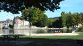
 Easy
Easy 
 Visorando Member