Pointe de la Bailletaz via the Col de la Bailletaz

This hike, which is not particularly difficult apart from its final section, is an extension of the route to the Col de la Bailletaz from the Saut Dam. It takes you up to a 3,000-metre peak via the Grande Sassière Nature Reserve before you reach a more high-mountain environment from the Col de la Bailletaz (2,852 m). I have therefore included the description of the first four points up to the Col de la Bailletaz. My addition concerns the route to the summit of the Pointe de la Bailletaz (3,071 m) via a more rugged path.

Details

n°108361190
Creation:
Last update:
Last review:
–
  • Walking
    Activity: Walking
  • ↔
    Distance: 9.20 mi
  • ◔
    Average duration: 6h 30 
  • ▲
    Difficulty: Difficult

  • ⚐
    Back to start: Yes
  • ↗
    Ascent: + 2,575 ft
  • ↘
    Descent: - 2,575 ft

  • ▲
    Highest point: 10,052 ft
  • ▼
    Lowest point: 7,454 ft

Description of the walk

From Bourg-Saint-Maurice, head towards Val d’Isère (D902). At Villaret du Nial, turn left towards La Sassière. Drive through Villaret du Nial and continue to the Barrage du Saut. Park in the car park by Lac du Saut.

(S/E) Take the track to the left of Lac du Saut towards Lac de la Sassière. Pass the Chalet du Santel on your left, continue along the track and head for the Lac de la Sassière dam.

(1) Turn right and cross the dam. Just after the dam, turn left towards the Col de la Baillettaz.

(2) Ignore a path on the right and carry on southwards.

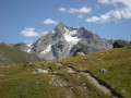
(3) At the next junction, turn left onto the path towards the pass. Pass at the foot of the striking Pointe de Picheru and head across the valley with Lac de la Sassière below on your left.

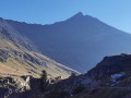
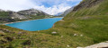
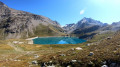
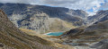
(4) Climb a few hairpin bends and pass above Lac Santel. You will then reach the Col de la Bailletaz (magnificent views; note Lac de la Bailletaz nestled 100 m below).

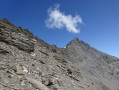
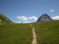
(5) Then turn right towards the west onto a faintly marked path, cross a few grassy knolls and reach the foot of a rocky outcrop blocking access to the summit.

(6) Go round this rocky outcrop by taking a faint path to the left, crossing a scree slope that is a little exposed but not insurmountable – though you’ll still need to remain vigilant. At the end of the scree slope, look out for the path branching off to the right to climb the final few dozen metres to the summit

(7)Return along the same route in the opposite direction as far as the junction near the dam.

(2) Take the path on the left. Follow the River Sassière. Further on, pass the Chalet de la Sassière on your right. Follow the southern shore of Lac du Saut and reach the road at the hamlet of Le Saut, now in ruins. Turn right onto this road and head back to the car park (S/E).

Waypoints

  1. S/E : mi 0 - alt. 7,477 ft - Car park at the Barrage du - Lac du Saut
  2. 1 : mi 2.1 - alt. 8,071 ft - Dam embankment - Lac de la Sassière
  3. 2 : mi 2.48 - alt. 8,117 ft - Common junction (out and back) - Lac de la Sassière
  4. 3 : mi 2.62 - alt. 8,179 ft - Common junction (out and back)
  5. 4 : mi 3.32 - alt. 8,576 ft - Change of direction
  6. 5 : mi 4.39 - alt. 9,377 ft - Col de la Bailletaz
  7. 6 : mi 4.65 - alt. 9,626 ft - Rocky outcrop
  8. 7 : mi 4.85 - alt. 10,020 ft - Pointe de la Bailletaz
  9. S/E : mi 9.2 - alt. 7,477 ft - Car park at the Barrage du - Lac du Saut

Notes

Please note: the environment you will be passing through on this walk is fragile. Take care with the flora (it is forbidden to pick edelweiss) and do not disturb the local wildlife. Take your rubbish home with you and pick up any you find.
Make sure you bring plenty of water.

This route passes through a protected area, which may be subject to special regulations:

Worth a visit

From (7), you can head south-east to visit Lac du Plan du Cheval.

Other walks in the area

For more walks, use our search engine .

The GPS track and description are the property of this route's author. Please do not copy them without permission.