From Seelbach to HohenGeroldseck via Lützelhardt

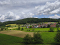
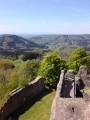
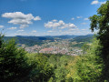
A circular walk to visit Geroldseck and the Lützelhardt ruins, half through woodland and half across open countryside.

Details

n°42124410
Creation:
Last update:
Last review:
  • Walking
    Activity: Walking
  • ↔
    Distance: 8.18 mi
  • ◔
    Average duration: 5h 05 
  • ▲
    Difficulty: Moderate

  • ⚐
    Back to start: Yes
  • ↗
    Ascent: + 1,483 ft
  • ↘
    Descent: - 1,460 ft

  • ▲
    Highest point: 1,696 ft
  • ▼
    Lowest point: 807 ft

Description of the walk

Park in the car park at Seelbach cemetery.

(S/E) Take the road leading up towards the forest and carry on straight ahead at all junctions: this is the steepest part of the walk. You’ll reach the Lützelhardt ruins.

(1) Follow the Yellow Diamond markings and head south-east. You’ll reach the junction with the Lützelhardweg.

(2) Carry on straight ahead along the Geroldsecker Qualitätsweg. Do the same at the first junction you come to.

(3) At the second junction, turn left onto Kaltetnonis Wald and follow the signs for “Burg Hohengeroldseck”.

(4) Turn left and follow the Geroldsecker Qualitätsweg.

(5) Look out for the path on your left, which you’ll take on the way back, and keep to the right.

(6) Cross the very busy road carefully at the Schönberg Pass car park and rejoin the path opposite. Keep to the right at the three-way junction, pass the café and the farm to reach the BurgerPfad, a footpath leading up to Geroldseck: there are activities for children along the way.

(7) Turn left to follow the Alte Landstrasse through the meadows. Then continue along a series of wide hairpin bends to the ruins of Burg Hohengeroldseck.

(8) Turn round and retrace your steps to the road.

(6) Carry on straight ahead.

(5) Keep to the right to follow the path you took on the way there. Carry on until you reach a three-way junction at Eisenhof.

(9) Turn left onto the Alte Landstrasse, which climbs, and carry on to Seelbach.

(10) Once you’ve entered Seelbach, take the first left (Talblick) and carry on straight ahead along the road, which will lead you to the cemetery and the car park (S/E).
Waypoints

  1. S/E : mi 0 - alt. 827 ft - Seelbach cemetery car park
  2. 1 : mi 0.67 - alt. 1,476 ft - Lützelhardt Ruins
  3. 2 : mi 0.99 - alt. 1,345 ft - Junction with Lützelhardweg
  4. 3 : mi 1.54 - alt. 1,516 ft - Junction with Kaltetnonis Wald
  5. 4 : mi 2.56 - alt. 1,529 ft - Junction with the Kallenwald tower
  6. 5 : mi 3.82 - alt. 1,178 ft - Junction for both outbound and return routes
  7. 6 : mi 4 - alt. 1,191 ft - Schönberg Pass car park
  8. 7 : mi 4.46 - alt. 1,378 ft - Burgerpfad
  9. 8 : mi 4.9 - alt. 1,696 ft - Ruins of Hohengeroldseck Castle
  10. 9 : mi 6.95 - alt. 850 ft - Eisenhof
  11. 10 : mi 7.77 - alt. 820 ft - Entrance to Seelbach
  12. S/E : mi 8.18 - alt. 827 ft - Seelbach cemetery car park

Worth a visit

Reviews and comments

5 / 5
Based on 1 review

Reliability of the description
5 / 5
Ease of following the route
5 / 5
Route interest
5 / 5
Willems Grâce-Hollogne

Overall rating : 5 / 5

Date of your route : Jun 07, 2024
Reliability of the description : ★★★★★ Very good
Ease of following the route : ★★★★★ Very good
Route interest : ★★★★★ Very good
Very busy route : No

A very nice walk, also interesting because of the two castle ruins. There were hardly any hikers, probably because I set off so early in the morning.

Machine-translated

Other walks in the area

For more walks, use our search engine .

The GPS track and description are the property of this route's author. Please do not copy them without permission.