From Santa Elena to Hoz de Jaca

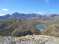
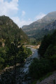
A lovely walk where you’ll follow the River Gállego along a path that is sometimes narrow but always safe, with small bridges and/or short sections with cables. This path will take you to Hoz de Jaca, where you can enjoy a stunning view of the Bübal Reservoir. It’s also a historic trail where you’ll find many defensive structures from the Linea P: see details in the ‘Places to see’ section.

Details

n°48716068
Creation:
Last update:
Last review:
  • Walking
    Activity: Walking
  • ↔
    Distance: 7.39 mi
  • ◔
    Average duration: 5h 05 
  • ▲
    Difficulty: Moderate

  • ⚐
    Back to start: Yes
  • ↗
    Ascent: + 1,972 ft
  • ↘
    Descent: - 1,988 ft

  • ▲
    Highest point: 4,150 ft
  • ▼
    Lowest point: 3,173 ft

Photos

Description of the walk

The starting point is at the Santa Elena Bridge. Leave the A-136 at the ‘Dolmen de Santa Elena’ sign and park just before the bridge. Another, smaller car park is available, about 200 metres further up, at the hairpin bend to the right.

(S/E) Continue along the road to the second car park.

(1) Turn right to follow the path which runs alongside the first defensive line of the Linea P and leads to the Santa Elena bunker.

(2) Turn back.

(1) Turn right to start the route that follows thePR®-HU 78.

(3) Pass an alternative route to this path on your right (which also leads to Hoz de Jaca), but with a steeper gradient. A few minutes later, you’ll emerge from the forest and head back down towards the river.

(4) Pass the Tibetan bridge on your left. A little further on, you’ll find a small pebble beach where you can dip your feet… or more. Continue along the path.

(5) From this point, the slope becomes steeper. Watch out for the gully forming on your right after you’ve crossed an iron bridge and a step secured by a cable. The path then continues gently downhill and joins the tarmac road leading to the dam. Follow it for a few dozen metres.

(6) Take the path on the right and join a track suitable for vehicles.

(7) You can follow it down to the dam: a lovely photo opportunity if the reservoir is full. Otherwise, continue to the right along the track.

(8) Pass the end of the zip line (see ‘Places to see’) before leaving the forest. Continue along the path which crosses the Barranco del Plantio and leads to a junction.

(9) Pass a path on your left, then, once you’ve left the forest, pass the path signposted “Mirador de Cenisarruebo” on your right and you’ll come out onto a narrow road.

(10) Follow it towards the centre of Hoz de Jaca (Avenida del Mirador). Carry on straight ahead to reach the starting point of the zip line and the Mirador de Peña Blanca.

(11) Turn round and retrace your steps along the ascent route, in the opposite direction, until you reach the track below the dam.

(6) Ignore the alternative route suggested by some websites, which crosses the river to the right (see ‘Practical information’ section). Keep to the left, following the route in the opposite direction to the outward journey, and return to the starting car park (S/E).

Waypoints

  1. S/E : mi 0 - alt. 3,196 ft - Car park at the Santa Elena bridge
  2. 1 : mi 0.16 - alt. 3,268 ft - Second car park, path junction
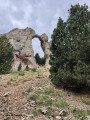
  3. 2 : mi 0.22 - alt. 3,235 ft - Santa Elena bunker
  4. 3 : mi 0.95 - alt. 3,314 ft - Junction with alternative path
  5. 4 : mi 1.13 - alt. 3,238 ft - Tibetan bridge
  6. 5 : mi 1.31 - alt. 3,337 ft - Start of the crevasse
  7. 6 : mi 1.93 - alt. 3,343 ft - Resume the path to the right
  8. 7 : mi 2.23 - alt. 3,632 ft - Vehicle-accessible track, descent possible
  9. 8 : mi 2.42 - alt. 3,691 ft - Arrival via zip line
  10. 9 : mi 2.98 - alt. 3,940 ft - Exit from the forest
  11. 10 : mi 3.26 - alt. 4,039 ft - Route
  12. 11 : mi 3.76 - alt. 4,068 ft - Viewpoint
  13. S/E : mi 7.39 - alt. 3,196 ft - Car park at the Santa Elena bridge

Notes

(4) Tibetan bridge: some online guides suggest crossing the river at point (6), but you would then have to cross it again via the Tibetan bridge on the way down… and without a harness or carabiners, that’s impossible!

Worth a visit

The Linea P (Pyrenean Defence Organisation) was built by Franco’s army between 1939 and 1953 in the utmost secrecy to protect Spain from an invasion across its Pyrenean border by the Allies, the Germans or Republican resistance fighters during and after the Second World War.

Tirolina del Valle de Tena: if it’s open, you can speed up your return journey using the 1 km-long zip line

Santa Elena Dolmens: further down (visible on the IGN map), two modest dolmens (1.5 metres high) dating back 5,000 years

Always be cautious and plan ahead when you're outdoors. Visorando and the author of this route cannot be held responsible for any accidents occurring on this route.

The GR® and PR® markings are the intellectual property of the Fédération Française de Randonnée Pédestre.

Reviews and comments

5 / 5
Based on 1 review

Reliability of the description
5 / 5
Ease of following the route
5 / 5
Route interest
5 / 5
Villadosia
Villadosia

Overall rating : 5 / 5

Date of your route : Oct 01, 2026
Reliability of the description : ★★★★★ Very good
Ease of following the route : ★★★★★ Very good
Route interest : ★★★★★ Very good
Very busy route : No

Route completed on 30 September, under overcast skies. It’s a lovely route with historical interest, following the riverbank and passing several truly unique spots: the dam, the zip line, the viewing point…
Reading the description and studying the map, I never once expected to find myself more than 100 metres above the abyss! To the left, the start of the zip line… not bad. To the right… the ‘columpio’, a swing suspended 150 metres above the lake.
Well, on 30 September everything was closed, even three-quarters of the houses in Hoz.
The remains of the fortifications are also interesting. They take us back to those years of Franco’s Spain… Not so long ago.

Machine-translated

Other walks in the area

For more walks, use our search engine .

The GPS track and description are the property of this route's author. Please do not copy them without permission.