From Saint-Valéry-en-Caux to Veules-les-Roses via the GR®21

The morning of the5th stage between the port city and one of the most beautiful villages in France.

This walk is part of a multi-day hike: Du Havre au Tréport par le GR®21

Details

23088789
Creation:
Last update:
Last review:
  • Walking
    Activity: Walking
  • ↔
    Distance: 5.45 mi
  • ◔
    Average duration: 2h 45 
  • ▲
    Difficulty: Moderate

  • ⚐
    Back to start: No
  • ↗
    Ascent: + 262 ft
  • ↘
    Descent: - 240 ft

  • ▲
    Highest point: 262 ft
  • ▼
    Lowest point: -7 ft
  • ⚐ Country: France
  • ⚐ City: Saint-Valery-en-Caux (76460)
  • ⚑
    Start: N 49.86912° / E 0.712078°
  • ⚑
    End: N 49.87677° / E 0.797516°
  • ❏
    IGN map(s): Ref. 1809OT, 1909OT
  • Hour-by-hour weather

Photos

Description of the walk

(S) Set off from the bridge, following the Quai d’Amont to the seafront. Follow it all the way past the casino. At the end, cross the car park along the cliff.

(1) Turn left at a 180° angle onto the steps leading to the top of the cliff. Continue to the right, passing the memorial to Costes and Bellonte’s 1933 transatlantic flight. Carry on along the level path until you reach a Fork in the road.

(2) Turn left, then left again at the next junction. Keep left again at the Fork in the road, walking alongside large fields on your left.

(3) Near some houses, keep turning left onto a farm track flanked by fields. After about 2 km, continue along the track as it bends to the right. Pass close to a wind turbine.

(4) Just before the RD925, turn left onto the service track for the row of wind turbines. Follow it to the end and continue along the edge of the field for 250 m until you reach the junction.

(5) Head slightly to the left onto the road for 600 m.

(6) Turn left onto the track which heads across the field, then bends to the right.

(7) At a fork in the road, carry on straight ahead.

(8) At the junction with the road, turn left towards the car park, which you’ll leave on your left.

(9) Turn left towards the sewage treatment works. Walk past the viewing point at the top of the cliff. Head down the path through the woodland to the seafront (E).

Waypoints

  1. S : mi 0 - alt. 23 ft - Saint-Valéry-en-Caux
  2. 1 : mi 0.44 - alt. 30 ft - Staircase
  3. 2 : mi 0.68 - alt. 151 ft - Fork
  4. 3 : mi 1.38 - alt. 220 ft - Escot
  5. 4 : mi 2.81 - alt. 262 ft - D925 road
  6. 5 : mi 3.53 - alt. 240 ft - Manneville Track
  7. 6 : mi 3.85 - alt. 233 ft - Path through the fields
  8. 7 : mi 4.7 - alt. 207 ft - Fork
  9. 8 : mi 4.99 - alt. 177 ft - Towards the car park
  10. 9 : mi 5.22 - alt. 144 ft - Wastewater treatment plant
  11. E : mi 5.45 - alt. 33 ft - Veules-les-Roses

Notes

GR®21, marked in the usual red and white.
I didn’t see any point in following theGR® between (4) and (5), so I took a shortcut by following the wind turbine service track running parallel to the RD925, then following the tractor tracks through the middle of the potato field. Depending on the season and the crop, this 250-metre crossing of the field may be more difficult.

Worth a visit

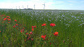
Flax fields in bloom in June.
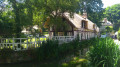
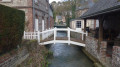
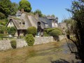
(E) Veules-les-Roses, a charming seaside village

Always be cautious and plan ahead when you're outdoors. Visorando and the author of this route cannot be held responsible for any accidents occurring on this route.

The GR® and PR® markings are the intellectual property of the Fédération Française de Randonnée Pédestre.

Reviews and comments

3.7 / 5
Based on 4 reviews

Reliability of the description
4.3 / 5
Ease of following the route
4.5 / 5
Route interest
2.3 / 5
Cathyglou
Cathyglou

Overall rating : 3.7 / 5

Date of your route : Apr 21, 2025
Reliability of the description : ★★★★☆ Good
Ease of following the route : ★★★★★ Very good
Route interest : ★★☆☆☆ Disappointing
Very busy route : No

Hello,
I’d been warned by your description, the Tourist Office’s advice and your own comments
The cliffs are crumbling, so the sea is a long way off. But the colours are stunning – the sea, the clouds, the rapeseed fields and the green of a few copses…
Then, as expected, there’s a detour that runs alongside the wind turbines, before veering away from the agri-voltaic field, and you end up walking along the road (which is quiet but tarmac).
Arriving in Veules offers a stunning 180° view, and the walk through the little wood is lovely…
A lovely sunny day in Veules…
The tourist office had indicated a bus at 5.50 pm (Easter Sunday)... At 6.15 pm, I hitchhiked

Machine-translated

Olishkaya
Olishkaya

Overall rating : 3.7 / 5

Date of your route : May 20, 2024
Reliability of the description : ★★★★★ Very good
Ease of following the route : ★★★★★ Very good
Route interest : ★☆☆☆☆ Very disappointing
Very busy route : No

With absolutely no view of the coast, this section is of no interest whatsoever. Worse still, a large part of the route runs alongside a very busy road and wind turbines. Frankly, it’s best to give it a miss. Veules-les-Roses and Valéry-en-Caux – which are unmissable – can be visited separately. Finally, please note that if you wish to travel to one of the towns by coach after this route (line 514), be very wary of the transport operator, Nomad, as there is no reliable information on their website. In this instance, there was no mention anywhere that the coaches were simply cancelled on the days we were there. Check with the tourist information offices beforehand – they’re far more helpful. For your information, a taxi costs around €30; there’s no Uber in the area.

Machine-translated

petites jambes
petites jambes

Overall rating : 4 / 5

Date of your route : Apr 20, 2023
Reliability of the description : ★★★★☆ Good
Ease of following the route : ★★★★☆ Good
Route interest : ★★★★☆ Good
Very busy route : No

The route runs solely through Veules-les-Roses and Manneville-es-Plains to form a circular route (around 12 km). On the way back, 500 metres after the junction of the D925 and D68 – where you need to turn left onto a dirt track – there are no (longer) GR 21 markings.

Machine-translated

Other walks in the area

For more walks, use our search engine .

The GPS track and description are the property of this route's author. Please do not copy them without permission.