Country:
 City:
City:


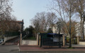
Start from Place du Général de Gaulle, right in front of the town hall.
Three waymarkers to look out for
(S/E) Head towards the town hall, then turn left down Rue Boucicaut, following the edge of Square Georges Pompidou. At the end of the square, turn right to cross Rue Jean Jaurès, then turn left until you reach thefirst junction.
Please note: contrary to what is shown on the map, these final few metres are on Rue Boucicaut and not Rue Jean Jaurès – the latter only begins at the far end of the square
(1) Turn right and follow Rue Antoine Petit along the right-hand pavement. Walk past the municipal health centre. Cross Boulevard de la République on the right-hand side, then cross Avenue Jean Moulin (an extension of Rue Antoine Petit) at the traffic lights.
Then turn left onto Rue Robert Marchand. Cross the green corridor and follow Rue René Isidore as far as Avenue Lombart. Walk up the avenue on the left and, after a few metres, you’ll come to a historic marker.
Three markers to find
(2) Turn round, walk down Avenue Lombart and take the bridge over the RER line. Then take thesecond right onto Rue Gentil Bernard. Cross Rue du Maréchal Gallieni on your left. At the next junction, turn right to find a historical marker at Fontenay-aux-Roses RER station.
(3) Turn round and follow Rue Jean-Noël Pelnard. After about 150 m, leave the street and take the Coulée Verte, which runs parallel to it. You’ll arrive at Avenue Paul Langevin.
Two markers to look for
Follow this avenue to the left, staying on the left-hand pavement; cross Avenue Lombard (at the traffic lights) and continue straight on along Avenue Jean Perrin. Pass under the RER line and walk alongside the Cité des Blagis. You’ll come to a large junction with, on the left, a brick church marking thesecond marker on this section.
Three markers to find
(4) Then take thefirst left, into Avenue Gabriel Péri. When the slope gets steeper and the road curves to the right, carry on straight ahead up Rue Rémy Laurent. Further on, you’ll come to Avenue Gabriel Péri on your right; follow it uphill.
At the junction, take Avenue Lombart, which continues from there. Follow the avenue up to the traffic lights, at the edge of the Coulée Verte. N.B. To find thethird marker, it’s probably best, when you reach Avenue Lombart, to look to your left at the large building opposite and cross to the other side of the road.
Two waymarkers to find
(5) Turn right onto Rue des Bénards. At the Fork in the road, after about fifty metres, take the left-hand branch, which is the continuation of Rue des Bénards. Then take thefirst left, Rue Léon Blum, which soon bends to the right. At the end, turn left. At the traffic lights, cross Rue Marx-Dormoy and take Rue Georges Bailly opposite.
A few tens of metres further on, take a pedestrian crossing on the right and follow it to the end, where it meets the Allée des Lilas. Turn left onto this lane, then right onto the Allée des Glycines. About 100 metres further on, take thefirst pedestrian crossing on the right and return to Rue Marx-Dormoy.
Then follow the avenue to the left until you reach a major junction where there should be a marker (not present at the end of October 2020 due to roadworks). Take thefirst left onto Rue du Moulin Blanchard.
Cross Rue Blanchard and climb the steps up to a clearly visible hillock. The steps cross a spiral path at two landings. Once at the top, walk down the spiral path (or turn back to thefirst landing, then turn right onto the path to find yourself on the other side at the top of a few steps). Go down the steps on the left to reach the Coulée Verte.
See Variation 1 to avoid climbing the hill.
A marker to look for
(6) Follow the Coulée Verte to the left and pass under Rue Blanchard, continuing straight on. You’ll come out onto Rue Georges Bailly; follow it to the right until you reach Avenue Jeanne et Maurice Dolivet (traffic lights). Follow the avenue to the left, on the right-hand pavement.
(7) Take thefirst lane on the right to reach the cemetery entrance (look carefully… boundary stone). Turn round to return to Avenue Jeanne et Maurice Dolivet.
(7) Follow the avenue to the right as far as Parc Sainte Barbe, and enter via the entrance opposite the petrol station. Cross the park via a path that branches off to the left, leading onto a track between a children’s playground and a sports hall currently under renovation until 2022 (you can also go straight on from the entrance, as the playground and sports hall are clearly visible). Exit the park onto the Coulée Verte and walk alongside a football pitch for a few metres.
Two landmarks to look for
(8) Take thefirst path on the right. Shortly afterwards, walk alongside the Fontenay media library. Join Rue Boucicaut and follow it to the right.
(1) Atthe first set of traffic lights, cross Avenue Jeanne et Maurice Dolivet and follow it to the right for a few dozen metres, then head up to the left towards Place du Général De Gaulle, either via Ruelle de la Demie-Lune (pedestrian crossing) or through a small public garden running alongside the alley; this has recently been opened and is not shown on the map as of November 2020) (S/E).


 Visorando Member

 Moderate
 Difficult